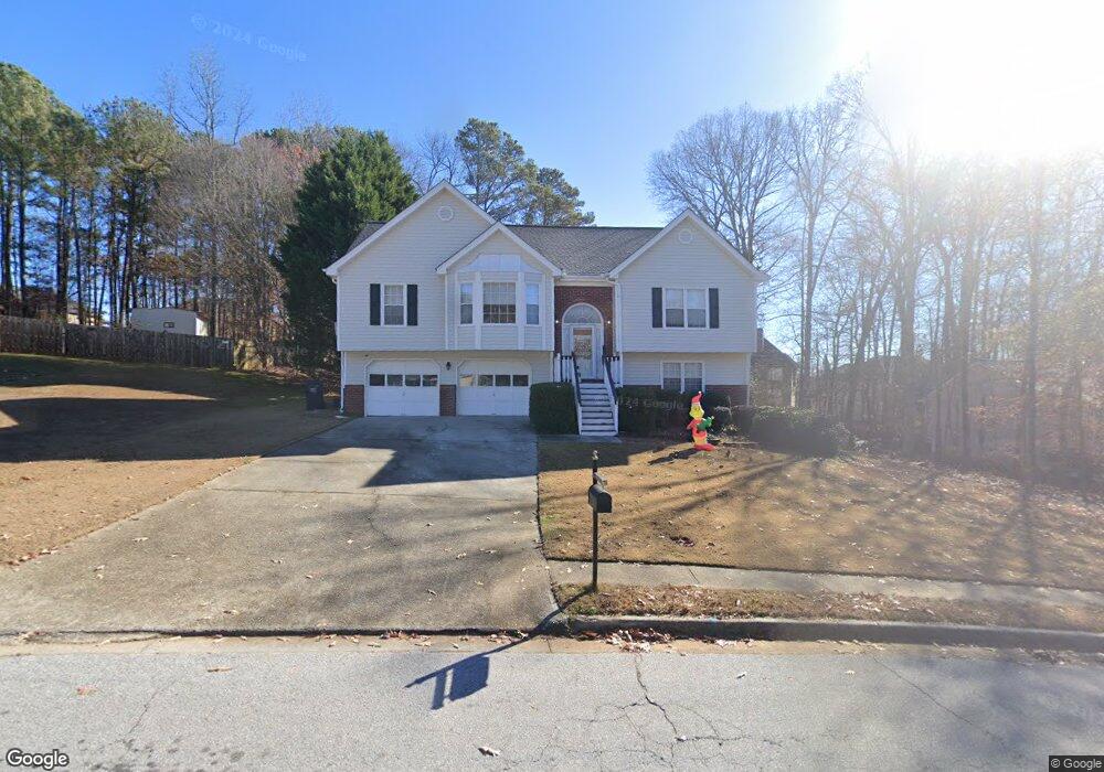
2705 Fort Daniels Dr Dacula, GA 30019
Estimated Value: $386,000 - $409,000
3
Beds
2
Baths
1,584
Sq Ft
$251/Sq Ft
Est. Value
About This Home
This home is located at 2705 Fort Daniels Dr, Dacula, GA 30019 and is currently estimated at $397,327, approximately $250 per square foot. 2705 Fort Daniels Dr is a home located in Gwinnett County with nearby schools including Fort Daniel Elementary School, Frank N. Osborne Middle School, and Mill Creek High School.
Ownership History
Date
Name
Owned For
Owner Type
Purchase Details
Closed on
Jul 2, 2021
Sold by
Akins Timothy E
Bought by
Lowe Michael P
Current Estimated Value
Home Financials for this Owner
Home Financials are based on the most recent Mortgage that was taken out on this home.
Original Mortgage
$299,475
Outstanding Balance
$270,546
Interest Rate
2.9%
Mortgage Type
FHA
Estimated Equity
$126,781
Purchase Details
Closed on
Apr 6, 2010
Sold by
Federal Home Loan Mortgage Corporation
Bought by
Akins Timothy E and Akins Mary L
Purchase Details
Closed on
Dec 1, 2009
Sold by
Chase Hm Fin Llc
Bought by
Federal Home Loan Mortgage Corporation
Purchase Details
Closed on
Oct 13, 1995
Sold by
Dms Bldrs Inc
Bought by
Akins Timothy E Mary L
Create a Home Valuation Report for This Property
The Home Valuation Report is an in-depth analysis detailing your home's value as well as a comparison with similar homes in the area
Home Values in the Area
Average Home Value in this Area
Purchase History
| Date | Buyer | Sale Price | Title Company |
|---|---|---|---|
| Lowe Michael P | $305,000 | -- | |
| Akins Timothy E | -- | -- | |
| Federal Home Loan Mortgage Corporation | -- | -- | |
| Chase Hm Fin Llc | $85,063 | -- | |
| Akins Timothy E Mary L | $120,300 | -- |
Source: Public Records
Mortgage History
| Date | Status | Borrower | Loan Amount |
|---|---|---|---|
| Open | Lowe Michael P | $299,475 | |
| Closed | Akins Timothy E Mary L | $0 |
Source: Public Records
Tax History Compared to Growth
Tax History
| Year | Tax Paid | Tax Assessment Tax Assessment Total Assessment is a certain percentage of the fair market value that is determined by local assessors to be the total taxable value of land and additions on the property. | Land | Improvement |
|---|---|---|---|---|
| 2025 | $5,627 | $162,080 | $36,080 | $126,000 |
| 2024 | $5,768 | $151,600 | $29,600 | $122,000 |
| 2023 | $5,768 | $144,960 | $29,600 | $115,360 |
| 2022 | $4,686 | $122,000 | $24,800 | $97,200 |
| 2021 | $3,298 | $101,040 | $18,640 | $82,400 |
| 2020 | $3,009 | $86,640 | $17,120 | $69,520 |
| 2019 | $2,919 | $86,640 | $17,120 | $69,520 |
| 2018 | $2,743 | $78,520 | $15,600 | $62,920 |
| 2016 | $2,764 | $69,040 | $12,400 | $56,640 |
| 2015 | $2,565 | $62,640 | $10,400 | $52,240 |
| 2014 | $2,342 | $56,040 | $10,400 | $45,640 |
Source: Public Records
Map
Nearby Homes
- 1827 Scouts Walk
- 2706 Captain Ct
- 2765 Daniel Park Run Unit 3
- 1618 Rocky Knoll Ln
- 1603 Fort Perry Way
- 2674 Rocky Knoll Ct
- 2687 High Creek Run
- 1521 Rocky Knoll Ln
- 2915 Dacula Oaks Dr Unit 1
- 2717 High Creek Run Unit 1
- 1615 Burnt Oak Way
- 2425 Fort Daniels Dr Unit 3A
- 2431 Lance Ridge Way
- 2747 High Creek Run
- 2628 Adair Trail
- 2955 Windsong Park Ln Unit 1
- 2585 Braselton Hwy
- 2715 Fort Daniels Dr
- 1835 Captain Walk Unit 3
- 2715 Ft Daniels Dr Unit Bsmnt
- 2715 Ft Daniels Dr
- 2695 Fort Daniels Dr
- 1825 Captain Walk Unit 3
- 2720 Fort Daniels Dr Unit 1
- 2700 Fort Daniels Dr
- 1845 Captain Walk Unit 3
- 2776 Captain Ct Unit 3
- 2725 Fort Daniels Dr
- 2766 Captain Ct
- 1740 Katrina -Jo Ann Cir Unit I
- 2756 Captain Ct Unit 259
- 2756 Captain Ct Unit 3
- 2786 Captain Ct
- 2685 Fort Daniels Dr NE
- 1840 Captain Walk
- 1730 Katrina -Jo Ann Cir
- 2670 Fort Daniels Dr Unit 2