Estimated Value: $326,414 - $371,000
3
Beds
2
Baths
1,542
Sq Ft
$229/Sq Ft
Est. Value
About This Home
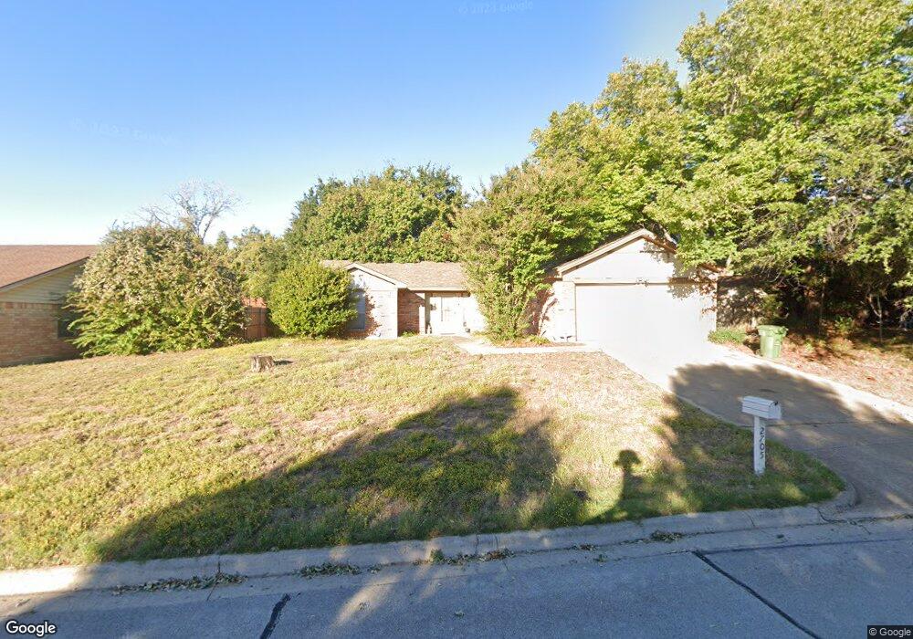
This home is located at 2705 Springbrooke Dr, Hurst, TX 76054 and is currently estimated at $353,604, approximately $229 per square foot. 2705 Springbrooke Dr is a home located in Tarrant County with nearby schools including W.A. Porter Elementary School, Smithfield Middle School, and Birdville High School.
Ownership History
Date
Name
Owned For
Owner Type
Purchase Details
Closed on
Nov 29, 1999
Sold by
Bennett Clara W
Bought by
Roon Debbie A
Current Estimated Value
Home Financials for this Owner
Home Financials are based on the most recent Mortgage that was taken out on this home.
Original Mortgage
$79,800
Outstanding Balance
$25,113
Interest Rate
7.93%
Estimated Equity
$328,491
Purchase Details
Closed on
Mar 21, 1996
Sold by
Va
Bought by
Bennett John R and Bennett Clara W
Home Financials for this Owner
Home Financials are based on the most recent Mortgage that was taken out on this home.
Original Mortgage
$92,000
Interest Rate
7%
Mortgage Type
Seller Take Back
Purchase Details
Closed on
Sep 5, 1995
Sold by
Citicorp Mtg Inc
Bought by
Va
Create a Home Valuation Report for This Property
The Home Valuation Report is an in-depth analysis detailing your home's value as well as a comparison with similar homes in the area
Home Values in the Area
Average Home Value in this Area
Purchase History
| Date | Buyer | Sale Price | Title Company |
|---|---|---|---|
| Roon Debbie A | -- | Ticor Land Title Company | |
| Bennett John R | -- | -- | |
| Va | -- | -- | |
| Citicorp Mtg Inc | $62,174 | -- |
Source: Public Records
Mortgage History
| Date | Status | Borrower | Loan Amount |
|---|---|---|---|
| Open | Roon Debbie A | $79,800 | |
| Previous Owner | Bennett John R | $92,000 |
Source: Public Records
Tax History
| Year | Tax Paid | Tax Assessment Tax Assessment Total Assessment is a certain percentage of the fair market value that is determined by local assessors to be the total taxable value of land and additions on the property. | Land | Improvement |
|---|---|---|---|---|
| 2025 | $6,869 | $302,354 | $60,000 | $242,354 |
| 2024 | $6,869 | $302,354 | $60,000 | $242,354 |
| 2023 | $6,812 | $298,065 | $60,000 | $238,065 |
| 2022 | $6,208 | $251,088 | $40,000 | $211,088 |
| 2021 | $5,902 | $227,518 | $40,000 | $187,518 |
| 2020 | $5,011 | $194,988 | $40,000 | $154,988 |
| 2019 | $5,194 | $197,614 | $40,000 | $157,614 |
| 2018 | $4,740 | $180,335 | $40,000 | $140,335 |
| 2017 | $4,801 | $179,932 | $40,000 | $139,932 |
| 2016 | $4,159 | $155,863 | $35,000 | $120,863 |
| 2015 | $3,468 | $129,300 | $20,000 | $109,300 |
| 2014 | $3,468 | $129,300 | $20,000 | $109,300 |
Source: Public Records
Map
Nearby Homes
- 736 Springhill Dr
- 712 Springhill Dr
- 753 Toni Dr
- 6400 Rogers Dr
- 6350 Rogers Dr
- 6505 Parkway Ave
- 9120 Nob Hill Dr
- 2925 Ridgewood Dr
- 8920 Martin Dr
- 6704 Nob Hill Ct
- 6708 Nob Hill Ct
- 6448 Hawks Ridge Dr
- 6625 Crane Rd
- 6812 Switchback Trail
- 2620 Brookridge Dr
- 6432 Brynwyck Ln
- 2244 Hurstview Dr
- 2221 Farrington Ln
- 6513 Paula Ct
- 2157 Lookout Ct
- 2709 Springbrooke Dr
- 2701 Springbrooke Dr
- 2713 Springbrooke Dr
- 2708 Springbrooke Dr
- 2704 Springbrooke Dr
- 2712 Springbrooke Dr
- 2717 Springbrooke Dr
- 2700 Springbrooke Dr
- 2716 Springbrooke Dr
- 2713 Prestondale Dr
- 2709 Prestondale Dr
- 6500 Precinct Line Rd
- 2721 Prestondale Dr
- 2705 Prestondale Dr
- 6516 Precinct Line Rd
- 736 Regency Dr
- 740 Regency Dr
- 732 Regency Dr
- 2701 Prestondale Dr
- 744 Regency Dr
Your Personal Tour Guide
Ask me questions while you tour the home.