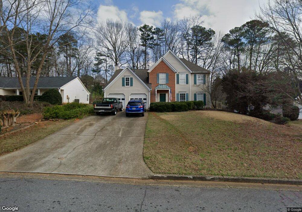
2705 Woodbine Hill Way Unit 1 Norcross, GA 30071
Estimated Value: $394,000 - $476,000
4
Beds
3
Baths
2,278
Sq Ft
$192/Sq Ft
Est. Value
About This Home
This home is located at 2705 Woodbine Hill Way Unit 1, Norcross, GA 30071 and is currently estimated at $436,503, approximately $191 per square foot. 2705 Woodbine Hill Way Unit 1 is a home located in Gwinnett County with nearby schools including Charles Brant Chesney Elementary School, Duluth Middle School, and Duluth High School.
Ownership History
Date
Name
Owned For
Owner Type
Purchase Details
Closed on
Jan 19, 2017
Sold by
Brown Robert Stoldt
Bought by
Brown Robert Stoldt and Brown Martha Christine
Current Estimated Value
Purchase Details
Closed on
Jun 25, 1998
Sold by
Ingram K Douglas and Ingram Barbara H
Bought by
Brown Robert S
Home Financials for this Owner
Home Financials are based on the most recent Mortgage that was taken out on this home.
Original Mortgage
$127,350
Interest Rate
7.04%
Mortgage Type
New Conventional
Purchase Details
Closed on
Jun 14, 1995
Sold by
Cherokee Homes
Bought by
Hogan Ingram K and Hogan Barbara A
Purchase Details
Closed on
Nov 4, 1994
Sold by
Allen City Inv Inc
Bought by
Cherokee Homes Inc
Create a Home Valuation Report for This Property
The Home Valuation Report is an in-depth analysis detailing your home's value as well as a comparison with similar homes in the area
Home Values in the Area
Average Home Value in this Area
Purchase History
| Date | Buyer | Sale Price | Title Company |
|---|---|---|---|
| Brown Robert Stoldt | -- | -- | |
| Brown Robert S | $141,500 | -- | |
| Hogan Ingram K | $131,600 | -- | |
| Cherokee Homes Inc | $137,500 | -- |
Source: Public Records
Mortgage History
| Date | Status | Borrower | Loan Amount |
|---|---|---|---|
| Previous Owner | Brown Robert S | $127,350 | |
| Closed | Hogan Ingram K | $0 |
Source: Public Records
Tax History Compared to Growth
Tax History
| Year | Tax Paid | Tax Assessment Tax Assessment Total Assessment is a certain percentage of the fair market value that is determined by local assessors to be the total taxable value of land and additions on the property. | Land | Improvement |
|---|---|---|---|---|
| 2025 | $1,029 | $186,160 | $29,920 | $156,240 |
| 2024 | $1,027 | $155,600 | $28,000 | $127,600 |
| 2023 | $1,027 | $155,600 | $28,000 | $127,600 |
| 2022 | $988 | $139,480 | $26,000 | $113,480 |
| 2021 | $975 | $107,360 | $20,000 | $87,360 |
| 2020 | $973 | $107,360 | $20,000 | $87,360 |
| 2019 | $901 | $96,680 | $18,000 | $78,680 |
| 2018 | $883 | $90,840 | $16,000 | $74,840 |
| 2016 | $923 | $69,760 | $13,600 | $56,160 |
| 2015 | $934 | $64,000 | $13,600 | $50,400 |
| 2014 | $942 | $64,000 | $13,600 | $50,400 |
Source: Public Records
Map
Nearby Homes
- 4368 Buckingham Place
- 4328 Buckingham Place
- 4302 Inverness Rd
- 2865 Landington Way
- 2896 Landington Way
- 4569 Iroquois Trail
- 4245 Almanor Cir
- 3991 Centennial Trail
- 2688 Cranston Ln
- 4196 Buford Hwy
- 4136 Buford Hwy
- 2730 Shelter Cove NW
- 2606 Gravitt Rd Unit 2
- 4777 Overlook View Ct
- 3969 Leeward Ct Unit 4
- 4300 Wildridge Dr
- 4172 Howell Park Rd
- 3980 Howell Park Rd
- 2250 Berkeley Creek Ct Unit 2
- 2725 Woodbine Hill Way Unit 1
- 2735 Woodbine Hill Way
- 2710 Woodbine Hill Way Unit 1
- 2695 Woodbine Hill Way
- 2720 Woodbine Hill Way Unit 1
- 2700 Woodbine Hill Way Unit 19
- 2700 Woodbine Hill Way Unit 2
- 2685 Woodbine Hill Way
- 2685 Woodbine Hill Way Unit 2
- 2745 Woodbine Hill Way
- 2730 Blarney Way Unit 65
- 2730 Blarney Way
- 2730 Woodbine Hill Way Unit 1
- 2690 Woodbine Hill Way
- 2740 Blarney Way
- 2720 Blarney Way
- 2750 Blarney Way
- 2675 Woodbine Hill Way
- 2680 Woodbine Hill Way Unit 2
- 2710 Blarney Way