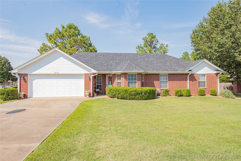
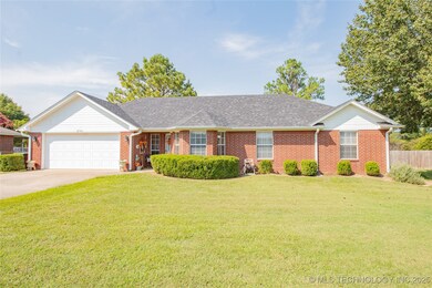
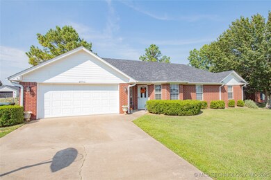
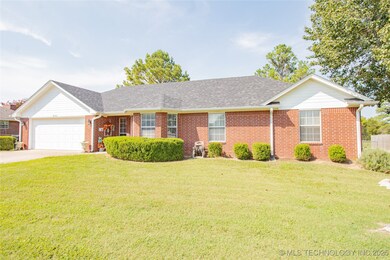
2706 Forrest Cir Durant, OK 74701
Estimated payment $1,299/month
Highlights
- No HOA
- Cul-De-Sac
- Brick Veneer
- Covered Patio or Porch
- 2 Car Attached Garage
- Handicap Accessible
About This Home
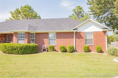
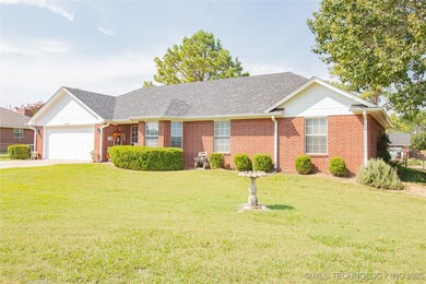
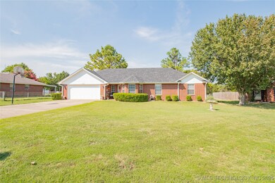
Located on a quiet cul-de-sac in one of Durant’s desirable neighborhoods, this 3-bedroom, 2-bath home offers both comfort and convenience just a short drive from Washington Avenue. Inside, a spacious living room anchors the layout and flows into a bright dining area and a functional kitchen with a peninsula for casual seating. Flooring is a mix of carpet, vinyl, and tile, providing practical finishes throughout the home. The main hall leads to two guest bedrooms with a full bath, while the master suite includes its own private bath for added convenience. Set on a larger lot, the property features a fenced backyard with a cozy covered patio—perfect for outdoor relaxation. A newer roof, additional attic insulation installed by OGE, and an attached two-car garage with storage and workspace add value to this well-kept home. With its inviting front elevation and established neighborhood setting, this home is a solid choice for buyers seeking comfort, function, and location.
Home Details
Home Type
- Single Family
Est. Annual Taxes
- $1,104
Year Built
- Built in 1996
Lot Details
- 0.25 Acre Lot
- Cul-De-Sac
- South Facing Home
- Chain Link Fence
Parking
- 2 Car Attached Garage
- Parking Storage or Cabinetry
- Workshop in Garage
Home Design
- Brick Veneer
- Slab Foundation
- Wood Frame Construction
- Fiberglass Roof
- Wood Siding
- Asphalt
Interior Spaces
- 1,548 Sq Ft Home
- 1-Story Property
- Ceiling Fan
- Aluminum Window Frames
- Fire and Smoke Detector
- Washer Hookup
Kitchen
- Oven
- Stove
- Range
- Microwave
- Plumbed For Ice Maker
- Dishwasher
- Laminate Countertops
Flooring
- Carpet
- Tile
- Vinyl
Bedrooms and Bathrooms
- 3 Bedrooms
- 2 Full Bathrooms
Accessible Home Design
- Handicap Accessible
- Accessible Entrance
Schools
- Silo Elementary School
- Silo High School
Utilities
- Zoned Heating and Cooling
- Programmable Thermostat
- Electric Water Heater
- Phone Available
- Cable TV Available
Additional Features
- Energy-Efficient Insulation
- Covered Patio or Porch
Community Details
- No Home Owners Association
- Ridgemont Estates I Subdivision
Map
Home Values in the Area
Average Home Value in this Area
Tax History
| Year | Tax Paid | Tax Assessment Tax Assessment Total Assessment is a certain percentage of the fair market value that is determined by local assessors to be the total taxable value of land and additions on the property. | Land | Improvement |
|---|---|---|---|---|
| 2025 | $1,153 | $14,469 | $1,162 | $13,307 |
| 2024 | $1,104 | $14,047 | $1,162 | $12,885 |
| 2023 | $1,104 | $13,638 | $1,162 | $12,476 |
| 2022 | $1,070 | $13,638 | $1,162 | $12,476 |
| 2021 | $1,044 | $13,638 | $1,162 | $12,476 |
| 2020 | $1,049 | $13,638 | $1,162 | $12,476 |
| 2019 | $1,039 | $13,317 | $1,162 | $12,155 |
| 2018 | $1,010 | $12,929 | $1,162 | $11,767 |
| 2017 | $851 | $12,553 | $1,162 | $11,391 |
| 2016 | $880 | $12,954 | $1,419 | $11,535 |
| 2015 | $853 | $12,585 | $1,650 | $10,935 |
| 2014 | $853 | $12,585 | $1,650 | $10,935 |
Property History
| Date | Event | Price | List to Sale | Price per Sq Ft |
|---|---|---|---|---|
| 09/24/2025 09/24/25 | Pending | -- | -- | -- |
| 09/10/2025 09/10/25 | For Sale | $229,000 | -- | $148 / Sq Ft |
Purchase History
| Date | Type | Sale Price | Title Company |
|---|---|---|---|
| Warranty Deed | $139,000 | None Available | |
| Warranty Deed | $69,000 | -- | |
| Warranty Deed | $6,000 | -- | |
| Warranty Deed | $6,000 | -- |
Source: MLS Technology
MLS Number: 2538974
APN: A235-00-001-005-0-000-00
Disclaimer: Certain information contained herein is derived from information provided by parties other than Homes.com. All information provided is deemed reliable, but is not guaranteed to be accurate and should be independently verified.
![]() IDX information is provided exclusively for personal, non-commercial use, and may not be used for any purpose other than to identify prospective properties consumers may be interested in purchasing.
IDX information is provided exclusively for personal, non-commercial use, and may not be used for any purpose other than to identify prospective properties consumers may be interested in purchasing.
Information is deemed reliable but not guaranteed.
- 2606 Christy Ln
- 3039 Kande Ln
- 3241 Seabiscuit
- 3257 Seabiscuit
- 3240 Seabiscuit
- 3248 Seabiscuit
- 3424 Little John Dr
- 3308 Seabiscuit
- 00031 Ed F Davis Rd
- 00 Ed F Davis Rd
- 00030 Ed F Davis Rd
- 3400 Lazy Ln
- 3715 Lionel Ln
- 3127 Secretariat St
- 3508 Carriage Point Dr
- 3617 Rock Bluff Dr
- 1973 Marie Dr
- 001 N Washington Ave
- 00 Larkspur Ln
- 0 Gershwin Dr
