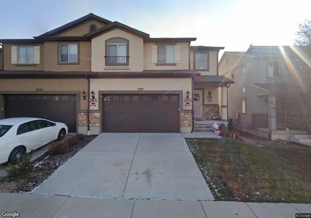
2707 W Maple Dr Lehi, UT 84043
Thanksgiving NeighborhoodEstimated Value: $450,000 - $477,000
3
Beds
4
Baths
2,404
Sq Ft
$192/Sq Ft
Est. Value
About This Home
This home is located at 2707 W Maple Dr, Lehi, UT 84043 and is currently estimated at $461,103, approximately $191 per square foot. 2707 W Maple Dr is a home located in Utah County with nearby schools including Liberty Hills Elementary School, Skyridge High School, and Ascent Academies of Utah - Lehi Campus.
Ownership History
Date
Name
Owned For
Owner Type
Purchase Details
Closed on
Sep 9, 2015
Sold by
Morrow David L and Morrow Mary F
Bought by
Morrow David L and Morrow Mary F
Current Estimated Value
Purchase Details
Closed on
Dec 19, 2012
Sold by
D R Horton Inc
Bought by
Morrow David L and Morrow Mary F
Home Financials for this Owner
Home Financials are based on the most recent Mortgage that was taken out on this home.
Original Mortgage
$75,000
Outstanding Balance
$51,963
Interest Rate
3.37%
Mortgage Type
New Conventional
Estimated Equity
$409,140
Purchase Details
Closed on
Nov 21, 2008
Sold by
Castlewood Thanksgiving Point Llc
Bought by
First Utah Bank
Create a Home Valuation Report for This Property
The Home Valuation Report is an in-depth analysis detailing your home's value as well as a comparison with similar homes in the area
Home Values in the Area
Average Home Value in this Area
Purchase History
| Date | Buyer | Sale Price | Title Company |
|---|---|---|---|
| Morrow David L | -- | Provo Land Title Co | |
| Morrow David L | -- | Provo Land Title Company | |
| First Utah Bank | -- | First American Ncs South |
Source: Public Records
Mortgage History
| Date | Status | Borrower | Loan Amount |
|---|---|---|---|
| Open | Morrow David L | $75,000 |
Source: Public Records
Tax History Compared to Growth
Tax History
| Year | Tax Paid | Tax Assessment Tax Assessment Total Assessment is a certain percentage of the fair market value that is determined by local assessors to be the total taxable value of land and additions on the property. | Land | Improvement |
|---|---|---|---|---|
| 2025 | $3,780 | $402,700 | $89,600 | $313,100 |
| 2024 | $3,780 | $442,400 | $0 | $0 |
| 2023 | $3,516 | $446,700 | $0 | $0 |
| 2022 | $3,365 | $414,500 | $83,000 | $331,500 |
| 2021 | $3,161 | $323,800 | $83,000 | $240,800 |
| 2020 | $3,105 | $314,400 | $83,000 | $231,400 |
| 2019 | $1,500 | $287,100 | $83,000 | $204,100 |
| 2018 | $1,587 | $287,100 | $83,000 | $204,100 |
| 2017 | $1,539 | $148,005 | $0 | $0 |
| 2016 | $1,421 | $126,775 | $0 | $0 |
| 2015 | $1,422 | $120,450 | $0 | $0 |
| 2014 | $1,300 | $109,450 | $0 | $0 |
Source: Public Records
Map
Nearby Homes
- 2464 W 2400 N
- 2189 N 2600 W
- 2998 Crooked Stick Dr
- 2673 N Double Eagle Dr
- 2669 N Turnberry Ct
- 2433 N 3130 W
- 3185 W 2400 N
- 3199 W 2450 N
- 2886 Desert Forest Ln
- 3217 W 2450 N
- 2013 N 2040 W
- 2012 N 2040 W
- 1969 N 2040 St W
- 1968 N 2040 W
- 1990 N 2040 W
- 2424 N Lazy j Ln
- Huntington Plan at Pioneer Meadows
- Silver Lake Plan at Pioneer Meadows
- Summit Plan at Pioneer Meadows
- Palisade Plan at Pioneer Meadows
- 2705 W Maple Dr
- 2731 W Maple Dr
- 2695 W Maple Dr
- 2698 W Cottonwood Dr
- 2733 W Maple Dr
- 2704 W Cottonwood Dr
- 2708 W Cottonwood Dr
- 2692 W Cottonwood Dr
- 2693 W Maple Dr
- 2688 W Cottonwood Dr
- 2738 W Cottonwood Dr
- 2759 W Maple Dr
- 2491 N Cypress Way
- 2491 N Cypress Way Unit 257
- 2691 W Maple Dr
- 2742 W Cottonwood Dr
- 2761 W Maple Dr
- 2493 N Cypress Way
- 2493 N Cypress Way Unit 258
- 2668 W Cottonwood Dr