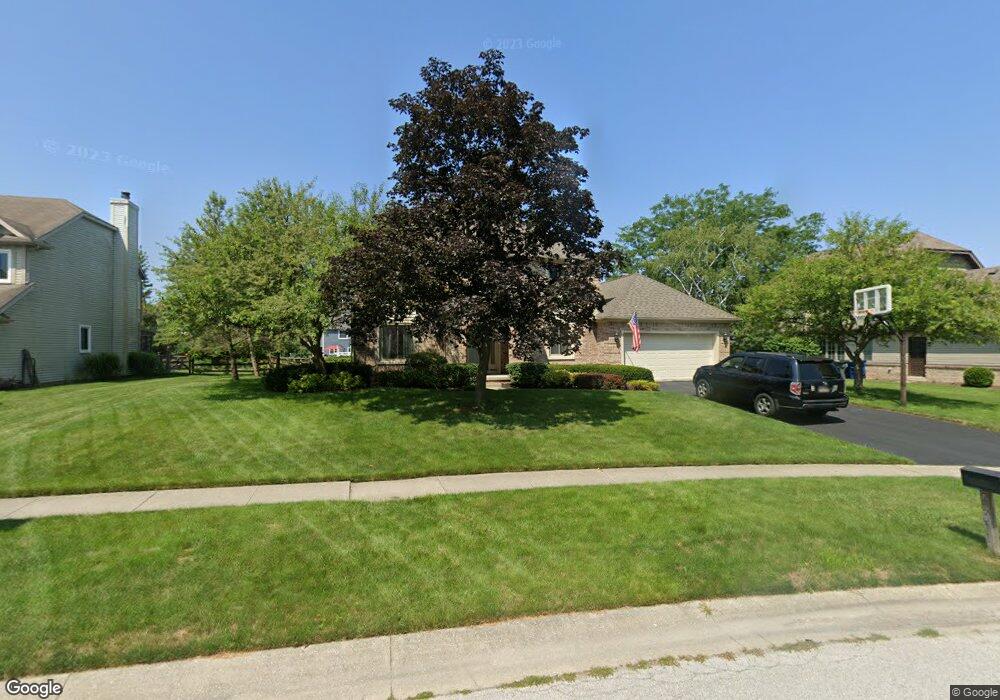
27071 Shawnee Dr Perrysburg, OH 43551
Estimated Value: $431,119 - $476,000
4
Beds
3
Baths
2,701
Sq Ft
$167/Sq Ft
Est. Value
About This Home
This home is located at 27071 Shawnee Dr, Perrysburg, OH 43551 and is currently estimated at $451,530, approximately $167 per square foot. 27071 Shawnee Dr is a home located in Wood County with nearby schools including Fort Meigs Elementary School, Perrysburg Junior High School, and Perrysburg High School.
Ownership History
Date
Name
Owned For
Owner Type
Purchase Details
Closed on
Jul 27, 2000
Sold by
Trustee Louisville Title Agency For Nw Oh I
Bought by
Mills Ernest T and Mills Rose W
Current Estimated Value
Home Financials for this Owner
Home Financials are based on the most recent Mortgage that was taken out on this home.
Original Mortgage
$165,500
Outstanding Balance
$59,881
Interest Rate
8.19%
Estimated Equity
$391,649
Purchase Details
Closed on
Nov 1, 1994
Sold by
Mallinson Charles E
Bought by
Louisville Title Agency Trst
Home Financials for this Owner
Home Financials are based on the most recent Mortgage that was taken out on this home.
Original Mortgage
$110,000
Interest Rate
8.68%
Mortgage Type
New Conventional
Create a Home Valuation Report for This Property
The Home Valuation Report is an in-depth analysis detailing your home's value as well as a comparison with similar homes in the area
Home Values in the Area
Average Home Value in this Area
Purchase History
| Date | Buyer | Sale Price | Title Company |
|---|---|---|---|
| Mills Ernest T | $235,500 | Northwest Title | |
| Louisville Title Agency Trst | $205,000 | -- |
Source: Public Records
Mortgage History
| Date | Status | Borrower | Loan Amount |
|---|---|---|---|
| Open | Mills Ernest T | $165,500 | |
| Previous Owner | Louisville Title Agency Trst | $110,000 |
Source: Public Records
Tax History Compared to Growth
Tax History
| Year | Tax Paid | Tax Assessment Tax Assessment Total Assessment is a certain percentage of the fair market value that is determined by local assessors to be the total taxable value of land and additions on the property. | Land | Improvement |
|---|---|---|---|---|
| 2024 | $7,252 | $125,335 | $18,725 | $106,610 |
| 2023 | $7,252 | $125,340 | $18,730 | $106,610 |
| 2021 | $6,107 | $97,160 | $14,350 | $82,810 |
| 2020 | $6,075 | $97,160 | $14,350 | $82,810 |
| 2019 | $5,604 | $86,980 | $14,350 | $72,630 |
| 2018 | $4,975 | $86,980 | $14,350 | $72,630 |
| 2017 | $4,942 | $86,980 | $14,350 | $72,630 |
| 2016 | $4,637 | $78,050 | $14,350 | $63,700 |
| 2015 | $4,637 | $78,050 | $14,350 | $63,700 |
| 2014 | $4,677 | $78,050 | $14,350 | $63,700 |
| 2013 | $4,785 | $78,050 | $14,350 | $63,700 |
Source: Public Records
Map
Nearby Homes
- 26951 Ottekee Dr
- 125 Ottekee Dr
- 26835 Mohawk Dr
- 1626 Woodstream Rd
- 2053 Lexington Dr
- 2062 Lexington Dr
- 13975 Eckel Junction Rd
- 700 Delaware Dr
- 26802 Fort Meigs Rd
- 471 Rutledge Ct
- 712 W Harrison St
- 670 Ridge Lake Ct
- 664 Little Creek Dr
- 0 Brookwoode Rd
- 454 S Ridge Dr
- 948 Joliet Dr
- 1380 Brookwoode Rd
- 2106 Ashley Ct
- 2107 Ashley Ct
- 504 W John St
- 27053 Shawnee Dr
- 27087 Shawnee Dr
- 26868 Riverford Dr
- 27037 Shawnee Dr
- 13751 Otusso Dr
- 26900 Riverford Dr
- 26852 Riverford Dr
- 13709 Otusso Dr
- 27046 Shawnee Dr
- 26916 Riverford Dr
- 27019 Shawnee Dr
- 26781 Riverford Dr
- 26766 Riverford Dr
- 26755 Riverford Dr
- 26836 Riverford Dr
- 0 Riverford Dr
- LOT 3 Riverford Dr
- 13763 Otusso Dr
- 13734 Otusso Dr
- 27022 Shawnee Dr