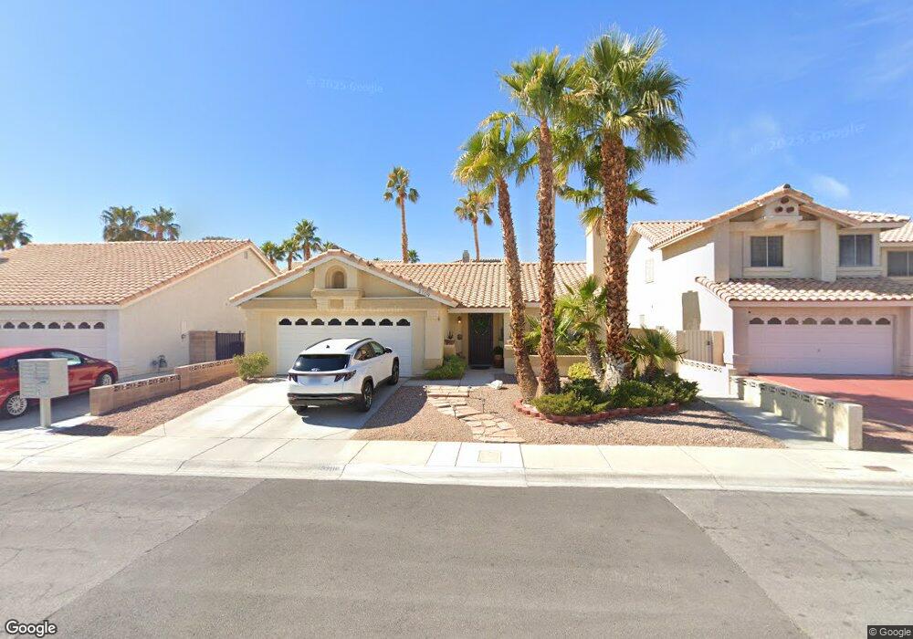
2709 Cloudsdale Cir Unit 8A Las Vegas, NV 89117
The Section Seven NeighborhoodEstimated Value: $436,000 - $471,000
3
Beds
2
Baths
1,536
Sq Ft
$296/Sq Ft
Est. Value
About This Home
This home is located at 2709 Cloudsdale Cir Unit 8A, Las Vegas, NV 89117 and is currently estimated at $454,135, approximately $295 per square foot. 2709 Cloudsdale Cir Unit 8A is a home located in Clark County with nearby schools including M J Christensen Elementary School, Clifford J Lawrence Junior High School, and Bonanza High School.
Ownership History
Date
Name
Owned For
Owner Type
Purchase Details
Closed on
Aug 5, 2002
Sold by
Clark Anthony C and Clark Alexandra E
Bought by
Hendrickson Randy L
Current Estimated Value
Home Financials for this Owner
Home Financials are based on the most recent Mortgage that was taken out on this home.
Original Mortgage
$151,619
Outstanding Balance
$63,974
Interest Rate
6.51%
Mortgage Type
FHA
Estimated Equity
$390,161
Purchase Details
Closed on
Jul 21, 1995
Sold by
Perez Rafael and Perez Marian
Bought by
Clark Anthony C and Clark Alexandra E
Home Financials for this Owner
Home Financials are based on the most recent Mortgage that was taken out on this home.
Original Mortgage
$100,000
Interest Rate
7.62%
Create a Home Valuation Report for This Property
The Home Valuation Report is an in-depth analysis detailing your home's value as well as a comparison with similar homes in the area
Home Values in the Area
Average Home Value in this Area
Purchase History
| Date | Buyer | Sale Price | Title Company |
|---|---|---|---|
| Hendrickson Randy L | $153,999 | Nevada Title Company | |
| Clark Anthony C | $125,000 | Land Title |
Source: Public Records
Mortgage History
| Date | Status | Borrower | Loan Amount |
|---|---|---|---|
| Open | Hendrickson Randy L | $151,619 | |
| Previous Owner | Clark Anthony C | $100,000 |
Source: Public Records
Tax History Compared to Growth
Tax History
| Year | Tax Paid | Tax Assessment Tax Assessment Total Assessment is a certain percentage of the fair market value that is determined by local assessors to be the total taxable value of land and additions on the property. | Land | Improvement |
|---|---|---|---|---|
| 2025 | $2,083 | $88,380 | $37,100 | $51,280 |
| 2024 | $2,023 | $88,380 | $37,100 | $51,280 |
| 2023 | $2,023 | $87,781 | $38,500 | $49,281 |
| 2022 | $1,964 | $75,298 | $29,750 | $45,548 |
| 2021 | $1,907 | $70,840 | $27,300 | $43,540 |
| 2020 | $1,848 | $68,968 | $25,550 | $43,418 |
| 2019 | $1,826 | $70,076 | $26,950 | $43,126 |
| 2018 | $1,742 | $68,523 | $26,600 | $41,923 |
| 2017 | $2,218 | $67,659 | $24,850 | $42,809 |
| 2016 | $1,632 | $60,654 | $17,500 | $43,154 |
| 2015 | $1,628 | $53,260 | $16,450 | $36,810 |
| 2014 | $1,580 | $46,756 | $8,750 | $38,006 |
Source: Public Records
Map
Nearby Homes
- 2712 Quail Roost Way
- 2913 Domino Way
- 9429 Abalone Way
- 9113 Anchor Cove Ct
- 9544 Lazy River Dr
- 9100 Shelter Cove Ct
- 9021 Feather River Ct
- 3009 Periscope Ct
- 8913 Antioch Way
- 8932 Antioch Way
- 2825 Waterview Dr
- 2724 Monrovia Dr
- 2728 Monrovia Dr
- 2757 Lodestone Dr Unit 59
- 2761 Lodestone Dr Unit 63
- 2200 S Fort Apache Rd Unit 2202
- 2200 S Fort Apache Rd Unit 1077
- 2200 S Fort Apache Rd Unit 2073
- 2200 S Fort Apache Rd Unit 2237
- 2200 S Fort Apache Rd Unit 1038
- 2713 Cloudsdale Cir
- 2705 Cloudsdale Cir
- 2712 Renwick Cir
- 2717 Cloudsdale Cir
- 2708 Renwick Cir
- 2716 Renwick Cir
- 2712 Cloudsdale Cir
- 2720 Renwick Cir
- 2704 Renwick Cir
- 2716 Cloudsdale Cir
- 2701 Cloudsdale Cir
- 2708 Cloudsdale Cir
- 2721 Cloudsdale Cir Unit none
- 2721 Cloudsdale Cir
- 2720 Cloudsdale Cir Unit na
- 2720 Cloudsdale Cir
- 2724 Renwick Cir
- 2700 Cloudsdale Cir
- 2704 Cloudsdale Cir
- 2725 Cloudsdale Cir Unit n/a