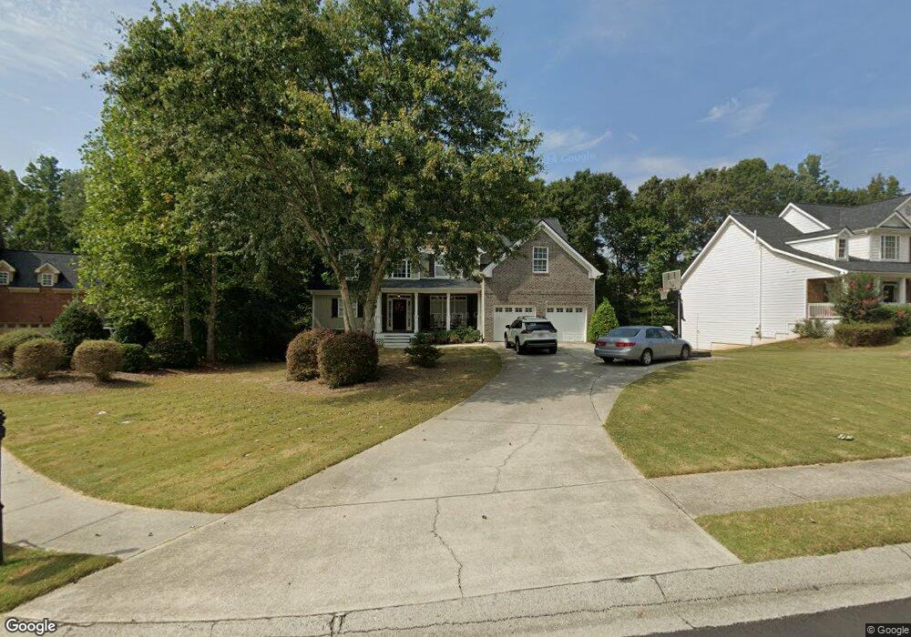
2709 Legislative Ln Unit 1 Buford, GA 30519
Estimated Value: $548,000 - $593,297
4
Beds
3
Baths
3,307
Sq Ft
$173/Sq Ft
Est. Value
About This Home
This home is located at 2709 Legislative Ln Unit 1, Buford, GA 30519 and is currently estimated at $573,074, approximately $173 per square foot. 2709 Legislative Ln Unit 1 is a home located in Hall County with nearby schools including Friendship Elementary School, Cherokee Bluff Middle School, and Cherokee Bluff High School.
Ownership History
Date
Name
Owned For
Owner Type
Purchase Details
Closed on
Dec 17, 2020
Sold by
Davis James Ross
Bought by
Davis Leslie Conger
Current Estimated Value
Purchase Details
Closed on
Oct 6, 2006
Sold by
Allman Suzanne B
Bought by
Davis James Ross and Davis Leslie C
Home Financials for this Owner
Home Financials are based on the most recent Mortgage that was taken out on this home.
Original Mortgage
$248,000
Interest Rate
6.31%
Mortgage Type
New Conventional
Purchase Details
Closed on
Dec 22, 2003
Sold by
Fordham Thomas J
Bought by
Allman Suzanne B
Home Financials for this Owner
Home Financials are based on the most recent Mortgage that was taken out on this home.
Original Mortgage
$258,305
Interest Rate
5.97%
Mortgage Type
New Conventional
Create a Home Valuation Report for This Property
The Home Valuation Report is an in-depth analysis detailing your home's value as well as a comparison with similar homes in the area
Home Values in the Area
Average Home Value in this Area
Purchase History
We collect this data history from publicly available records. To have your information removed, we recommend requesting removal directly through your county’s website.
| Date | Buyer | Sale Price | Title Company |
|---|---|---|---|
| Davis Leslie Conger | -- | -- | |
| Davis James Ross | $310,000 | -- | |
| Allman Suzanne B | $271,900 | -- |
Source: Public Records
Mortgage History
We collect this data history from publicly available records. To have your information removed, we recommend requesting removal directly through your county’s website.
| Date | Status | Borrower | Loan Amount |
|---|---|---|---|
| Previous Owner | Davis James Ross | $248,000 | |
| Previous Owner | Allman Suzanne B | $258,305 |
Source: Public Records
Tax History
| Year | Tax Paid | Tax Assessment Tax Assessment Total Assessment is a certain percentage of the fair market value that is determined by local assessors to be the total taxable value of land and additions on the property. | Land | Improvement |
|---|---|---|---|---|
| 2025 | $4,771 | $241,160 | $51,040 | $190,120 |
| 2024 | $6,129 | $244,240 | $50,440 | $193,800 |
| 2023 | $4,969 | $198,000 | $29,200 | $168,800 |
| 2022 | $4,446 | $170,040 | $27,600 | $142,440 |
| 2021 | $3,895 | $146,240 | $17,000 | $129,240 |
| 2020 | $3,879 | $141,480 | $17,000 | $124,480 |
| 2019 | $3,736 | $135,040 | $16,000 | $119,040 |
| 2018 | $3,844 | $134,520 | $16,000 | $118,520 |
| 2017 | $3,620 | $123,640 | $12,240 | $111,400 |
| 2016 | $3,086 | $107,920 | $12,240 | $95,680 |
| 2015 | $3,020 | $107,920 | $12,240 | $95,680 |
| 2014 | $3,020 | $104,777 | $12,240 | $92,536 |
Source: Public Records
Map
Nearby Homes
- 2638 Democracy Dr Unit 1
- 2342 Sparta Way
- 3138 Lantana Way
- 3088 Lantana Way
- 2244 Mayors Way
- 2824 Pleasant Oak Dr
- 2869 Wild Rose St
- 7512 Clover
- 7500 Clover
- 5749 Nantucket Row
- 7413 Quinn Place Unit 146
- 7437 Quinn Place
- 7405 Quinn Place Unit LOT 148
- 7420 Quinn Place
- 7433 Quinn Place
- 7449 Quinn Place
- 7429 Quinn Place
- 7401 Quinn Place Unit LOT 149
- 7412 Quinn Place Unit LOT 197
- 7436 Quinn Place
- 2713 Legislative Ln
- 2705 Legislative Ln
- 2628 Democracy Dr Unit 1
- 2717 Legislative Ln Unit 1
- 2620 Democracy Dr Unit 1
- 2710 Legislative Ln
- 2701 Legislative Ln Unit 1
- 2714 Legislative Ln Unit 1
- 2706 Legislative Ln Unit 1
- 2718 Legislative Ln Unit 1
- 2702 Legislative Ln Unit 1
- 2722 Legislative Ln
- 2623 Democracy Dr
- 2633 Democracy Dr
- 2637 Democracy Dr
- 2726 Legislative Ln
- 2729 Legislative Ln
- 2514 Representative Way
- 2506 Representative Way Unit 1
- 2730 Legislative Ln
Your Personal Tour Guide
Ask me questions while you tour the home.