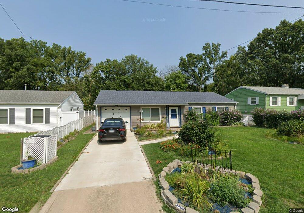
2709 W Hunt St Decatur, IL 62526
Home Park NeighborhoodEstimated Value: $107,000 - $118,000
--
Bed
--
Bath
1,181
Sq Ft
$96/Sq Ft
Est. Value
About This Home
This home is located at 2709 W Hunt St, Decatur, IL 62526 and is currently estimated at $113,299, approximately $95 per square foot. 2709 W Hunt St is a home located in Macon County with nearby schools including Stephen Decatur Middle School and Northwest Christian Campus.
Ownership History
Date
Name
Owned For
Owner Type
Purchase Details
Closed on
Feb 1, 2024
Sold by
Scammahorn Rhonda
Bought by
Ford Joseph W
Current Estimated Value
Home Financials for this Owner
Home Financials are based on the most recent Mortgage that was taken out on this home.
Original Mortgage
$98,500
Outstanding Balance
$96,759
Interest Rate
6.61%
Mortgage Type
New Conventional
Estimated Equity
$16,540
Purchase Details
Closed on
Mar 21, 2011
Sold by
Mckenzie Todd A and Mckenzie Terra Shea
Bought by
Scammahorn Rhonda
Home Financials for this Owner
Home Financials are based on the most recent Mortgage that was taken out on this home.
Original Mortgage
$76,899
Interest Rate
4.87%
Mortgage Type
FHA
Purchase Details
Closed on
Jul 1, 2003
Create a Home Valuation Report for This Property
The Home Valuation Report is an in-depth analysis detailing your home's value as well as a comparison with similar homes in the area
Home Values in the Area
Average Home Value in this Area
Purchase History
| Date | Buyer | Sale Price | Title Company |
|---|---|---|---|
| Ford Joseph W | $105,500 | None Listed On Document | |
| Ford Joseph W | $105,500 | None Listed On Document | |
| Scammahorn Rhonda | $79,000 | None Available | |
| -- | $49,000 | -- |
Source: Public Records
Mortgage History
| Date | Status | Borrower | Loan Amount |
|---|---|---|---|
| Open | Ford Joseph W | $98,500 | |
| Closed | Ford Joseph W | $98,500 | |
| Previous Owner | Scammahorn Rhonda | $76,899 |
Source: Public Records
Tax History Compared to Growth
Tax History
| Year | Tax Paid | Tax Assessment Tax Assessment Total Assessment is a certain percentage of the fair market value that is determined by local assessors to be the total taxable value of land and additions on the property. | Land | Improvement |
|---|---|---|---|---|
| 2024 | $2,103 | $27,727 | $3,340 | $24,387 |
| 2023 | $1,866 | $26,746 | $3,222 | $23,524 |
| 2022 | $1,693 | $24,554 | $2,786 | $21,768 |
| 2021 | $1,536 | $22,931 | $2,602 | $20,329 |
| 2020 | $1,474 | $21,866 | $2,481 | $19,385 |
| 2019 | $1,474 | $21,866 | $2,481 | $19,385 |
| 2018 | $1,470 | $19,987 | $3,505 | $16,482 |
| 2017 | $1,521 | $20,521 | $3,599 | $16,922 |
| 2016 | $1,557 | $20,731 | $3,636 | $17,095 |
| 2015 | $1,468 | $20,365 | $3,572 | $16,793 |
| 2014 | $1,358 | $20,164 | $3,537 | $16,627 |
| 2013 | $1,424 | $20,921 | $3,670 | $17,251 |
Source: Public Records
Map
Nearby Homes
- 2406 W Olive St
- 2262 Yorkshire Dr
- 2125 Clearmont Ave
- 2195 W Center St
- 3525 W Center St
- 1135 N Moffet Ln
- 2121 Barding Ave
- 2201 W Packard St
- 1650 N Sunnyside Rd
- 0 Valley View Place
- 3467 Sullivan Dr
- 2131 N Oakcrest Ct
- 1524 N Summit Ave
- 1720 N Sunnyside Rd
- 2320 N Kenwood Ct
- 1929 W Ravina Park Rd
- 2404 N Longwood Dr
- 2281 N Summit Ave
- 635 N Virginia Ave
- 1706 W Division St
- 2715 W Hunt St
- 2701 W Hunt St
- 2723 W Hunt St
- 2708 W Hunt St
- 2716 W Hunt St
- 2702 W Hunt St
- 2667 W Hunt St
- 2731 W Hunt St
- 2730 W Hunt St
- 2739 W Hunt St
- 1631 N Gregory Ave
- 2664 W Gregory Ct
- 1649 N Gregory Ave
- 1623 N Gregory Ave
- 1619 N Gregory Ave
- 1607 N Gregory Ave
- 20 Barclay Ct
- 18 Barclay Ct
- 1651 N Gregory Ave
- 2650 W Hunt St