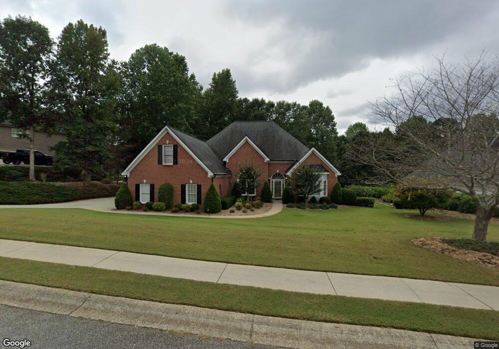
2709 White Rock Dr Buford, GA 30519
Estimated Value: $625,000 - $730,000
4
Beds
3
Baths
2,683
Sq Ft
$249/Sq Ft
Est. Value
About This Home
This home is located at 2709 White Rock Dr, Buford, GA 30519 and is currently estimated at $667,000, approximately $248 per square foot. 2709 White Rock Dr is a home located in Hall County with nearby schools including Friendship Elementary School, Cherokee Bluff Middle School, and Cherokee Bluff High School.
Ownership History
Date
Name
Owned For
Owner Type
Purchase Details
Closed on
Mar 10, 2010
Sold by
Shipley George M and Shipley Norma
Bought by
Wiley Kurby E and Wiley Linda L
Current Estimated Value
Home Financials for this Owner
Home Financials are based on the most recent Mortgage that was taken out on this home.
Original Mortgage
$100,000
Outstanding Balance
$66,410
Interest Rate
5.02%
Mortgage Type
New Conventional
Estimated Equity
$600,590
Purchase Details
Closed on
Jan 30, 2004
Bought by
Shipley George M and Shipley Norma
Purchase Details
Closed on
Aug 31, 2001
Sold by
Chateau Corners Development Corp
Bought by
R G Cloer Enterprises Inc
Create a Home Valuation Report for This Property
The Home Valuation Report is an in-depth analysis detailing your home's value as well as a comparison with similar homes in the area
Home Values in the Area
Average Home Value in this Area
Purchase History
| Date | Buyer | Sale Price | Title Company |
|---|---|---|---|
| Wiley Kurby E | $260,000 | -- | |
| Shipley George M | $285,000 | -- | |
| R G Cloer Enterprises Inc | $1,118,500 | -- |
Source: Public Records
Mortgage History
| Date | Status | Borrower | Loan Amount |
|---|---|---|---|
| Open | Wiley Kurby E | $100,000 |
Source: Public Records
Tax History Compared to Growth
Tax History
| Year | Tax Paid | Tax Assessment Tax Assessment Total Assessment is a certain percentage of the fair market value that is determined by local assessors to be the total taxable value of land and additions on the property. | Land | Improvement |
|---|---|---|---|---|
| 2024 | $1,796 | $207,600 | $33,440 | $174,160 |
| 2023 | $1,627 | $199,560 | $33,440 | $166,120 |
| 2022 | $1,349 | $139,840 | $23,200 | $116,640 |
| 2021 | $1,376 | $135,240 | $23,200 | $112,040 |
| 2020 | $1,409 | $135,720 | $13,080 | $122,640 |
| 2019 | $1,385 | $129,920 | $13,080 | $116,840 |
| 2018 | $1,340 | $122,080 | $13,080 | $109,000 |
| 2017 | $3,035 | $111,640 | $13,080 | $98,560 |
Source: Public Records
Map
Nearby Homes
- 2342 Sparta Way
- 3088 Lantana Way
- 3138 Lantana Way
- 3134 Perimeter Cir
- 2638 Democracy Dr Unit 1
- 4761 Moon Chase Dr
- 2732 Thompson Mill Rd
- 4732 Moon Chase Dr
- 2228 Mayors Way
- 4728 Moon Hollow Ct
- 2941 Climbing Rose St
- 5730 Nantucket Row
- Sierra Plan at Sherwood Square
- Sawnee Plan at Sherwood Square
- 2424 Pinnae Place
- 5378 Thompson Mill Rd
- 7296 Mulberry Trace Ln Unit LOT 180
- 7296 Mulberry Trace Ln
- 7289 Mulberry Trace Ln Unit LOT 178
- 7300 Mulberry Trace Ln
- 2715 White Rock Dr
- 2715 White Rock Dr Unit 2
- 2703 White Rock Dr
- 2721 White Rock Dr
- 2721 White Rock Dr Unit 26
- 2694 Oxbow Ct
- 2708 White Rock Dr
- 2704 White Rock Dr
- 2704 White Rock Dr Unit NA
- 2712 White Rock Dr
- 2685 Oxbow Ct
- 2718 White Rock Dr
- 2727 White Rock Dr Unit 2
- 2700 White Rock Dr
- 2698 Oxbow Ct
- 2695 Oxbow Ct
- 2691 Oxbow Ct
- 2680 White Rock Dr
- 2724 White Rock Dr
- 2675 White Rock Dr