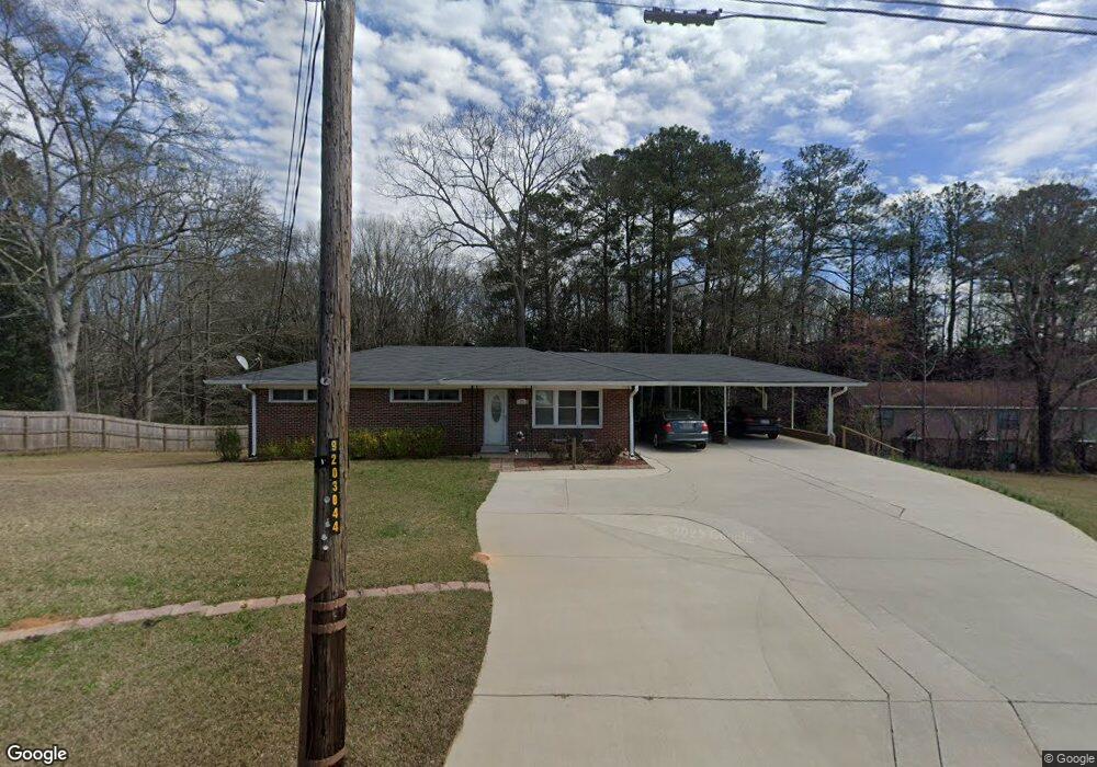
271 Arbacoochee Rd Tallapoosa, GA 30176
Estimated Value: $175,000 - $196,000
3
Beds
2
Baths
1,170
Sq Ft
$158/Sq Ft
Est. Value
About This Home
This home is located at 271 Arbacoochee Rd, Tallapoosa, GA 30176 and is currently estimated at $185,336, approximately $158 per square foot. 271 Arbacoochee Rd is a home located in Haralson County with nearby schools including Haralson County High School.
Ownership History
Date
Name
Owned For
Owner Type
Purchase Details
Closed on
Feb 8, 2024
Sold by
Parrish James L
Bought by
Parrish Lucille
Current Estimated Value
Purchase Details
Closed on
Jul 19, 2014
Sold by
Ward Reba Lynn
Bought by
Parrish James and Parrish Lucille
Purchase Details
Closed on
Jan 11, 2010
Sold by
Mcswain Colline Estate By Heir Mcswain R
Bought by
Ward Reba Lynn and Mcswain Colline Heirs O
Home Financials for this Owner
Home Financials are based on the most recent Mortgage that was taken out on this home.
Original Mortgage
$52,673
Interest Rate
4.8%
Mortgage Type
New Conventional
Purchase Details
Closed on
Nov 9, 1992
Sold by
City Of Tallapoosa
Bought by
Mcswain J R
Purchase Details
Closed on
Nov 2, 1992
Sold by
Mcswain J R
Bought by
Mcswain Mcswain J and Mcswain Colline
Purchase Details
Closed on
Sep 9, 1991
Sold by
City Of Tallapoosa
Bought by
Mcswain J R
Purchase Details
Closed on
Jan 10, 1983
Sold by
City Of Tallapoosa
Bought by
Mcswain J R
Create a Home Valuation Report for This Property
The Home Valuation Report is an in-depth analysis detailing your home's value as well as a comparison with similar homes in the area
Home Values in the Area
Average Home Value in this Area
Purchase History
| Date | Buyer | Sale Price | Title Company |
|---|---|---|---|
| Parrish Lucille | -- | -- | |
| Parrish James | $56,000 | -- | |
| Ward Reba Lynn | -- | -- | |
| Mcswain J R | -- | -- | |
| Mcswain Mcswain J | -- | -- | |
| Mcswain J R | -- | -- | |
| Mcswain J R | -- | -- |
Source: Public Records
Mortgage History
| Date | Status | Borrower | Loan Amount |
|---|---|---|---|
| Previous Owner | Ward Reba Lynn | $52,673 |
Source: Public Records
Tax History Compared to Growth
Tax History
| Year | Tax Paid | Tax Assessment Tax Assessment Total Assessment is a certain percentage of the fair market value that is determined by local assessors to be the total taxable value of land and additions on the property. | Land | Improvement |
|---|---|---|---|---|
| 2024 | $920 | $36,994 | $5,088 | $31,906 |
| 2023 | $357 | $40,669 | $4,800 | $35,869 |
| 2022 | $620 | $33,641 | $4,800 | $28,841 |
| 2021 | $615 | $32,452 | $4,800 | $27,652 |
| 2020 | $705 | $33,416 | $4,800 | $28,616 |
| 2019 | $702 | $32,357 | $4,800 | $27,557 |
| 2018 | $711 | $32,357 | $4,800 | $27,557 |
| 2017 | $663 | $28,486 | $4,800 | $23,686 |
| 2016 | $562 | $26,713 | $4,800 | $21,913 |
| 2015 | $437 | $25,552 | $4,800 | $20,752 |
| 2014 | $677 | $22,441 | $7,600 | $14,841 |
Source: Public Records
Map
Nearby Homes
- 244 Monroe St
- 250 Kiker St
- 438 Bowdon St
- 117 White St
- 0 Georgia 120 Unit 7646686
- 0 Georgia 120 Unit 10600882
- 0 Broad St Unit 10614514
- 0 Broad St Unit 10614479
- 0 Providence Lake Rd Unit 10576961
- 622 Cedartown Ave
- 0 W Mill St Unit 10604030
- 0 W Mill St Unit 7649366
- 281 Alewine Ave
- 4493 Stone Mountain St
- 2633 Georgia 120 (485 53 Acres)
- 110 Dunson Rd
- 711 Kay St
- 194 Faye St
- 174 Faye St
- 77 McDonald Rd
- 283 Arbacoochee Rd
- 293 Arbacoochee Rd
- 0 Arbacoochee Rd Unit 7399611
- 0 Arbacoochee Rd Unit 10313909
- 0 Arbacoochee Rd Unit 7316784
- 0 Arbacoochee Rd Unit 10235556
- 0 Arbacoochee Rd Unit 10128109
- 0 Arbacoochee Rd Unit 8219912
- 0 Arbacoochee Rd Unit 7449746
- 0 Arbacoochee Rd Unit 7539899
- 0 Arbacoochee Rd Unit 8109758
- 0 Arbacoochee Rd
- 230 Chestnut St
- 257 Taliaferro St
- 215 Arbacoochee Rd
- 274 White St
- 268 White St Unit 6
- 268 White St
- 316 White St
- 304 White St