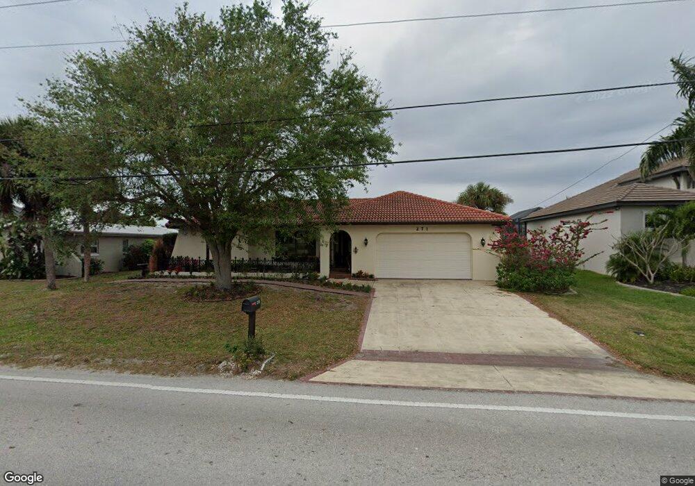
271 Bal Harbor Blvd Punta Gorda, FL 33950
Punta Gorda Isles NeighborhoodEstimated Value: $532,601 - $638,000
3
Beds
2
Baths
1,853
Sq Ft
$304/Sq Ft
Est. Value
About This Home
This home is located at 271 Bal Harbor Blvd, Punta Gorda, FL 33950 and is currently estimated at $563,150, approximately $303 per square foot. 271 Bal Harbor Blvd is a home located in Charlotte County with nearby schools including Sallie Jones Elementary School, Punta Gorda Middle School, and Charlotte High School.
Ownership History
Date
Name
Owned For
Owner Type
Purchase Details
Closed on
Feb 22, 2017
Sold by
Nelson Gary L
Bought by
Kowalski Sylvester J and Trube Mary Barbara
Current Estimated Value
Home Financials for this Owner
Home Financials are based on the most recent Mortgage that was taken out on this home.
Original Mortgage
$268,000
Interest Rate
4.12%
Mortgage Type
New Conventional
Purchase Details
Closed on
Jul 15, 1999
Sold by
Neitzke Robert A and Neitzke Barbara J
Bought by
Nelson Gary L and Nelson Ruthann
Create a Home Valuation Report for This Property
The Home Valuation Report is an in-depth analysis detailing your home's value as well as a comparison with similar homes in the area
Home Values in the Area
Average Home Value in this Area
Purchase History
| Date | Buyer | Sale Price | Title Company |
|---|---|---|---|
| Kowalski Sylvester J | $335,000 | Attorney | |
| Nelson Gary L | -- | Attorney | |
| Nelson Gary L | $171,500 | -- |
Source: Public Records
Mortgage History
| Date | Status | Borrower | Loan Amount |
|---|---|---|---|
| Previous Owner | Kowalski Sylvester J | $268,000 |
Source: Public Records
Tax History Compared to Growth
Tax History
| Year | Tax Paid | Tax Assessment Tax Assessment Total Assessment is a certain percentage of the fair market value that is determined by local assessors to be the total taxable value of land and additions on the property. | Land | Improvement |
|---|---|---|---|---|
| 2025 | $5,865 | $328,423 | -- | -- |
| 2024 | $5,688 | $319,167 | -- | -- |
| 2023 | $5,688 | $309,813 | $0 | $0 |
| 2022 | $5,388 | $299,385 | $0 | $0 |
| 2021 | $5,055 | $290,665 | $0 | $0 |
| 2020 | $4,792 | $286,652 | $136,000 | $150,652 |
| 2019 | $4,861 | $281,847 | $136,000 | $145,847 |
| 2018 | $5,198 | $277,653 | $136,000 | $141,653 |
| 2017 | $3,240 | $201,683 | $0 | $0 |
| 2016 | $3,231 | $197,535 | $0 | $0 |
| 2015 | $2,708 | $196,162 | $0 | $0 |
| 2014 | $2,710 | $194,605 | $0 | $0 |
Source: Public Records
Map
Nearby Homes
- 1620 Sea Haven Dr Unit 404
- 1624 Compass Pointe Ct Unit 203
- Miramar Plan at Seahaven
- 1624 Compass Pointe Ct Unit 202
- Sandestin Plan at Seahaven
- 1625 Compass Pointe Ct Unit 105
- 1735 Boca Raton Ct
- 1617 Sea Haven Dr Unit 501
- 1940 W Marion Ave
- 1623 Sea Haven Dr Unit 303
- 1623 Sea Haven Dr Unit 301
- 1650 W Marion Ave Unit 144
- 1600 W Marion Ave Unit 234
- 1764 Boca Raton Ct
- 399 Bal Harbor Blvd
- 253 Bal Harbor Blvd
- 0 Bal Harbor Blvd Unit C689235
- 0 Bal Harbor Blvd Unit C689232
- 0 Bal Harbor Blvd Unit C689209
- 0 Bal Harbor Blvd Unit C689208
- 0 Bal Harbor Blvd Unit C689349
- 0 Bal Harbor Blvd Unit D550675
- 0 Bal Harbor Blvd Unit C6992451
- 0 Bal Harbor Blvd Unit C6997898
- 0 Bal Harbor Blvd Unit C6997893
- 235 Bal Harbor Blvd
- 299 Bal Harbor Blvd
- 299 Bal Harbor Blvd
- 1708 Boca Raton Ct
- 1765 W Marion Ave
- 225 Bal Harbor Blvd
- 1749 W Marion Ave
- 1716 Boca Raton Ct
- 1781 W Marion Ave
- 1797 W Marion Ave