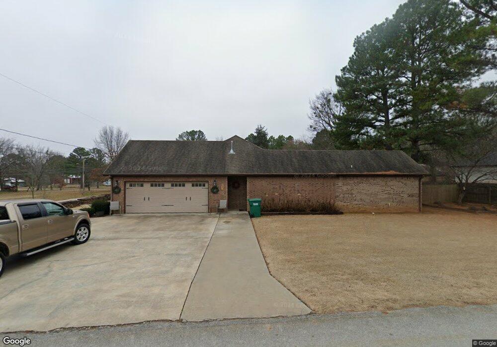
271 Bloyd St West Fork, AR 72774
Estimated Value: $314,000 - $382,730
3
Beds
2
Baths
1,954
Sq Ft
$176/Sq Ft
Est. Value
About This Home
This home is located at 271 Bloyd St, West Fork, AR 72774 and is currently estimated at $343,683, approximately $175 per square foot. 271 Bloyd St is a home located in Washington County with nearby schools including West Fork Elementary School, West Fork Middle School, and West Fork High School.
Ownership History
Date
Name
Owned For
Owner Type
Purchase Details
Closed on
May 4, 2010
Sold by
White Virgil D
Bought by
Karnes John David
Current Estimated Value
Home Financials for this Owner
Home Financials are based on the most recent Mortgage that was taken out on this home.
Original Mortgage
$157,500
Outstanding Balance
$105,004
Interest Rate
5.02%
Mortgage Type
New Conventional
Estimated Equity
$238,679
Purchase Details
Closed on
Jul 27, 1973
Bought by
White Clydean L and White Virgil D
Create a Home Valuation Report for This Property
The Home Valuation Report is an in-depth analysis detailing your home's value as well as a comparison with similar homes in the area
Home Values in the Area
Average Home Value in this Area
Purchase History
| Date | Buyer | Sale Price | Title Company |
|---|---|---|---|
| Karnes John David | $175,000 | Rtc | |
| White Clydean L | $17,000 | -- |
Source: Public Records
Mortgage History
| Date | Status | Borrower | Loan Amount |
|---|---|---|---|
| Open | Karnes John David | $157,500 |
Source: Public Records
Tax History
| Year | Tax Paid | Tax Assessment Tax Assessment Total Assessment is a certain percentage of the fair market value that is determined by local assessors to be the total taxable value of land and additions on the property. | Land | Improvement |
|---|---|---|---|---|
| 2025 | $1,886 | $74,000 | $6,000 | $68,000 |
| 2024 | $1,874 | $74,000 | $6,000 | $68,000 |
| 2023 | $1,854 | $74,000 | $6,000 | $68,000 |
| 2022 | $1,795 | $51,490 | $4,000 | $47,490 |
| 2021 | $1,701 | $51,490 | $4,000 | $47,490 |
| 2020 | $1,607 | $51,490 | $4,000 | $47,490 |
| 2019 | $1,512 | $35,540 | $3,000 | $32,540 |
| 2018 | $1,537 | $35,540 | $3,000 | $32,540 |
| 2017 | $1,484 | $35,540 | $3,000 | $32,540 |
| 2016 | $1,484 | $35,540 | $3,000 | $32,540 |
| 2015 | $1,436 | $35,540 | $3,000 | $32,540 |
| 2014 | $1,351 | $32,970 | $4,400 | $28,570 |
Source: Public Records
Map
Nearby Homes
- 222 Rivendale Dr
- 260 Culp Trail
- 0 W Smith St Unit 1334508
- 365 W Smith St
- 353 W Smith St
- 327 W Smith St
- 385 W Smith St
- 696 E Thornstone Ave
- 185 Wheeler St
- 163 Wheeler St
- 0000 Highway 170
- 224 Maple Ave
- 13653 W Mountain Rd
- 67 S Red Oak Ave
- 815 James Place
- 846 James Place
- 10768 Wooton Rd
- 14673 Union Star Rd
- 279 Bloyd St
- 283 Bloyd St
- 543 Mcknight Ave
- 517 Mcknight Ave
- 524 Mcknight Ave
- 285 Bloyd St
- 510 Center Ave
- 282 Bloyd St
- 503 Mcknight Ave
- 512 Mcknight Ave
- 299 Bloyd St
- 538 Mcknight Ave
- 266 Kelley Place
- 500 Center Ave
- 502 Center Ave
- 519 Center Ave
- 502 Mcknight Ave
- 493 Mcknight Ave
- 492 Center Ave
- 292 Kelley Place
Your Personal Tour Guide
Ask me questions while you tour the home.