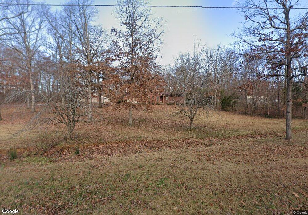
271 County Road 452 Poplar Bluff, MO 63901
Estimated Value: $262,000 - $406,000
--
Bed
--
Bath
2,150
Sq Ft
$146/Sq Ft
Est. Value
About This Home
This home is located at 271 County Road 452, Poplar Bluff, MO 63901 and is currently estimated at $314,280, approximately $146 per square foot. 271 County Road 452 is a home with nearby schools including Oak Grove Elementary School, Poplar Bluff Fifth & Sixth Grade Center, and Poplar Bluff Junior High School.
Ownership History
Date
Name
Owned For
Owner Type
Purchase Details
Closed on
Jun 7, 2021
Sold by
Bailey James A
Bought by
Bailey James A and James A Bailey Revocable Trust
Current Estimated Value
Purchase Details
Closed on
Oct 11, 2017
Sold by
Bailey Shannon R
Bought by
Bailey James A
Purchase Details
Closed on
Aug 24, 2012
Sold by
Culp Rondal
Bought by
Bailey James A and Bailey Shannon R
Home Financials for this Owner
Home Financials are based on the most recent Mortgage that was taken out on this home.
Original Mortgage
$158,560
Outstanding Balance
$108,932
Interest Rate
3.57%
Mortgage Type
Future Advance Clause Open End Mortgage
Estimated Equity
$205,348
Create a Home Valuation Report for This Property
The Home Valuation Report is an in-depth analysis detailing your home's value as well as a comparison with similar homes in the area
Home Values in the Area
Average Home Value in this Area
Purchase History
| Date | Buyer | Sale Price | Title Company |
|---|---|---|---|
| Bailey James A | -- | None Available | |
| Bailey James A | -- | None Available | |
| Bailey James A | -- | None Available |
Source: Public Records
Mortgage History
| Date | Status | Borrower | Loan Amount |
|---|---|---|---|
| Open | Bailey James A | $158,560 |
Source: Public Records
Tax History Compared to Growth
Tax History
| Year | Tax Paid | Tax Assessment Tax Assessment Total Assessment is a certain percentage of the fair market value that is determined by local assessors to be the total taxable value of land and additions on the property. | Land | Improvement |
|---|---|---|---|---|
| 2024 | $1,566 | $35,150 | $0 | $0 |
| 2023 | $1,565 | $35,150 | $0 | $0 |
| 2022 | $1,515 | $34,080 | $0 | $0 |
| 2021 | $1,515 | $34,080 | $0 | $0 |
| 2020 | $1,505 | $33,340 | $0 | $0 |
| 2019 | $1,504 | $33,340 | $0 | $0 |
| 2018 | $1,504 | $33,340 | $0 | $0 |
| 2017 | -- | $33,340 | $0 | $0 |
| 2016 | -- | $33,340 | $0 | $0 |
| 2015 | -- | $33,340 | $0 | $0 |
| 2014 | -- | $31,260 | $0 | $0 |
| 2012 | $1,190 | $31,260 | $0 | $0 |
Source: Public Records
Map
Nearby Homes
- 858 County Road 420
- 0 County Road 421
- 4 Woodland Heights W
- 9 Woodland Heights W
- 14 Woodland Heights W
- 6 Woodland Heights W
- 5 Woodland Heights W
- 3 Woodland Heights W
- 13 Woodland Heights W
- 10 Woodland Heights W
- 16 Woodland Heights W
- 11 Woodland Heights W
- 15 Woodland Heights W
- 2 Woodland Heights W
- 1 Woodland Heights W
- 10374 Highway 60 W
- 0 Brownwood Trails #18 Unit MIS25061746
- 607 County Road 423
- 3221 Scarlet Dr
- 6708 Brown Ln
- 347 Rd 421
- 284 Marigold Ln
- 238 Rd 422
- 152 County Road 452
- 541 County Road 420
- 204 County Road 452
- 141 Marigold Ln
- 120 County Road 452
- 477 County Road 420
- 522 County Road 420
- 597 County Road 420
- 61 Marigold Ln
- 355 County Road 420
- 576 County Road 420
- 6901 Highway 67 N
- 6773 Highway 67 N
- 6671 U S 60
- 120 Cr 452
- 7151 Highway 67 N
- 628 County Road 420