Estimated Value: $859,000 - $947,000
3
Beds
2
Baths
2,609
Sq Ft
$347/Sq Ft
Est. Value
About This Home
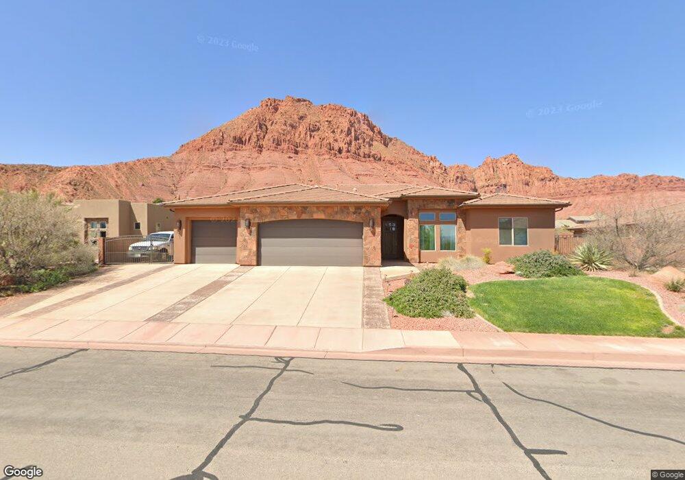
This home is located at 271 E 250 N, Ivins, UT 84738 and is currently estimated at $904,903, approximately $346 per square foot. 271 E 250 N is a home with nearby schools including Red Mountain School, Snow Canyon Middle School, and Lava Ridge Intermediate School.
Ownership History
Date
Name
Owned For
Owner Type
Purchase Details
Closed on
Dec 9, 2024
Sold by
Davis Steven Ray and Davis Debra Ann
Bought by
My Childrens Family Trust and Davis
Current Estimated Value
Purchase Details
Closed on
Jan 24, 2013
Sold by
Harper Terry and Harper Barbara
Bought by
Davis Steven Ray and Davis Debra Ann
Home Financials for this Owner
Home Financials are based on the most recent Mortgage that was taken out on this home.
Original Mortgage
$145,000
Interest Rate
3.28%
Mortgage Type
Unknown
Purchase Details
Closed on
Jun 17, 2011
Sold by
Rbc Real Estate Finance Inc
Bought by
Harper Terry and Harper Barbara
Purchase Details
Closed on
Jul 21, 2010
Sold by
Red Mountain Estates Llc
Bought by
Rbc Real Estate Finance Inc
Create a Home Valuation Report for This Property
The Home Valuation Report is an in-depth analysis detailing your home's value as well as a comparison with similar homes in the area
Purchase History
| Date | Buyer | Sale Price | Title Company |
|---|---|---|---|
| My Childrens Family Trust | -- | None Listed On Document | |
| Davis Steven Ray | -- | Skyview Title Insurance Agen | |
| Harper Terry | -- | Founders Title Company | |
| Rbc Real Estate Finance Inc | -- | None Available |
Source: Public Records
Mortgage History
| Date | Status | Borrower | Loan Amount |
|---|---|---|---|
| Previous Owner | Davis Steven Ray | $145,000 |
Source: Public Records
Tax History
| Year | Tax Paid | Tax Assessment Tax Assessment Total Assessment is a certain percentage of the fair market value that is determined by local assessors to be the total taxable value of land and additions on the property. | Land | Improvement |
|---|---|---|---|---|
| 2025 | $3,292 | $488,950 | $166,375 | $322,575 |
| 2023 | $3,153 | $471,955 | $151,250 | $320,705 |
| 2022 | $3,190 | $464,750 | $142,175 | $322,575 |
| 2021 | $2,817 | $577,300 | $159,500 | $417,800 |
| 2020 | $2,594 | $503,100 | $126,500 | $376,600 |
| 2019 | $2,616 | $496,200 | $104,500 | $391,700 |
| 2018 | $2,371 | $231,385 | $0 | $0 |
| 2017 | $2,270 | $215,545 | $0 | $0 |
| 2016 | $2,310 | $202,620 | $0 | $0 |
| 2015 | $2,377 | $200,695 | $0 | $0 |
| 2014 | $4,258 | $361,200 | $0 | $0 |
Source: Public Records
Map
Nearby Homes
- 266 E 350 N
- 155 E 200 N
- 165 E 350 N
- 1312 Willow Way 1 Unit 1
- 543 W Fox Tail Way
- 463 E Red Desert Trail
- 633 E Flint Rock Cir
- 676 E Palisades Dr
- 673 Coral Autumn Ln
- 163 S 480 E
- 691 Crimson Flare Ln
- Deacon Plan at Desert Cove
- Darius Plan at Desert Cove
- Harris Plan at Desert Cove
- Powell Plan at Desert Cove
- Pinecrest Plan at Desert Cove
- 88 N Apex Ln
- 143 N Apex Ln
- 362 N Turtle Point Dr
- 254 N Altura Way
Your Personal Tour Guide
Ask me questions while you tour the home.