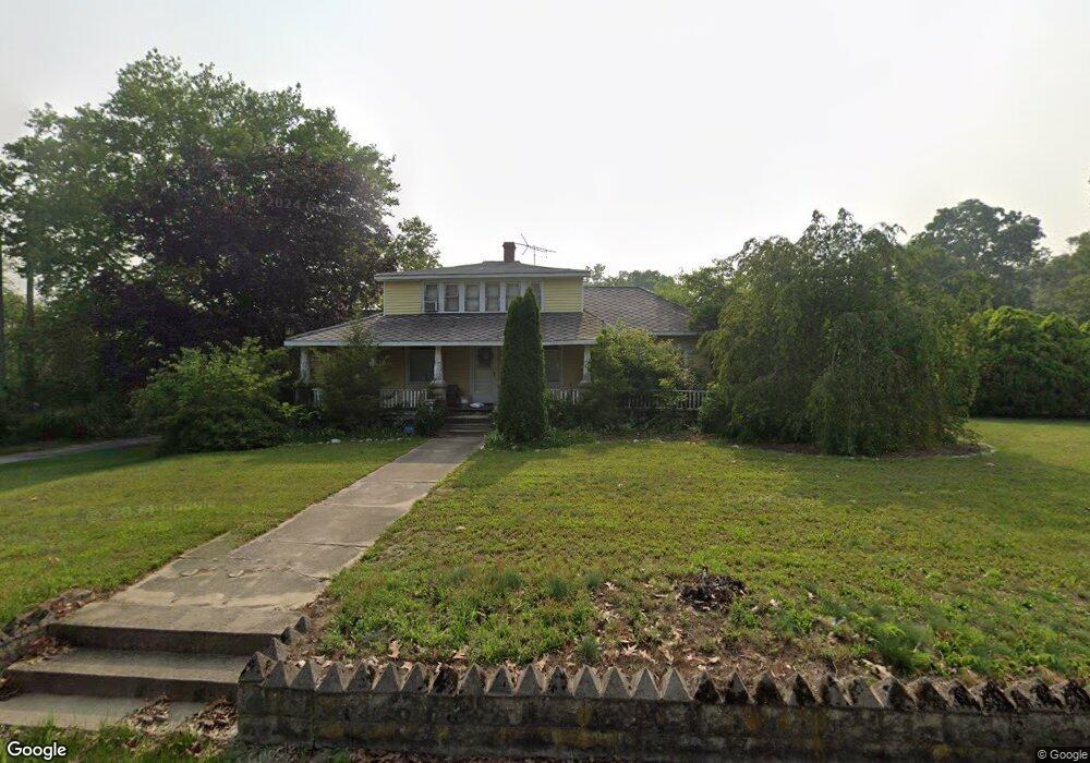
271 Fork Bridge Rd Elmer, NJ 08318
Pittsgrove Township Salem NeighborhoodEstimated Value: $190,000 - $324,000
--
Bed
--
Bath
--
Sq Ft
2.67
Acres
About This Home
This home is located at 271 Fork Bridge Rd, Elmer, NJ 08318 and is currently estimated at $258,924. 271 Fork Bridge Rd is a home located in Salem County with nearby schools including Elmer Elementary School, Pittsgrove Township Middle School, and Arthur P. Schalick High School.
Ownership History
Date
Name
Owned For
Owner Type
Purchase Details
Closed on
Jan 12, 2007
Sold by
Wilson John K Walker
Bought by
Harrington Robert W and Harrington Donna M
Current Estimated Value
Home Financials for this Owner
Home Financials are based on the most recent Mortgage that was taken out on this home.
Original Mortgage
$140,250
Outstanding Balance
$97,992
Interest Rate
9.5%
Mortgage Type
Purchase Money Mortgage
Estimated Equity
$160,932
Create a Home Valuation Report for This Property
The Home Valuation Report is an in-depth analysis detailing your home's value as well as a comparison with similar homes in the area
Home Values in the Area
Average Home Value in this Area
Purchase History
| Date | Buyer | Sale Price | Title Company |
|---|---|---|---|
| Harrington Robert W | $165,000 | -- |
Source: Public Records
Mortgage History
| Date | Status | Borrower | Loan Amount |
|---|---|---|---|
| Open | Harrington Robert W | $140,250 |
Source: Public Records
Tax History Compared to Growth
Tax History
| Year | Tax Paid | Tax Assessment Tax Assessment Total Assessment is a certain percentage of the fair market value that is determined by local assessors to be the total taxable value of land and additions on the property. | Land | Improvement |
|---|---|---|---|---|
| 2025 | $5,519 | $130,500 | $53,400 | $77,100 |
| 2024 | $5,228 | $130,500 | $53,400 | $77,100 |
| 2023 | $5,228 | $130,500 | $53,400 | $77,100 |
| 2022 | $5,167 | $130,500 | $53,400 | $77,100 |
| 2021 | $5,022 | $130,500 | $53,400 | $77,100 |
| 2020 | $4,883 | $130,500 | $53,400 | $77,100 |
| 2019 | $4,800 | $130,500 | $53,400 | $77,100 |
| 2018 | $4,693 | $130,500 | $53,400 | $77,100 |
| 2017 | $4,514 | $130,500 | $53,400 | $77,100 |
| 2016 | $3,984 | $121,400 | $53,400 | $68,000 |
| 2015 | $3,791 | $121,400 | $53,400 | $68,000 |
| 2014 | $3,634 | $121,400 | $53,400 | $68,000 |
Source: Public Records
Map
Nearby Homes
- 364 Fork Bridge Rd
- 461 3 Bridge Rd
- 0 Oak Ave
- 139 Taylor Rd Unit 141
- 106-118 Delsea Dr
- 30 2nd St
- 129 Malaga Park Dr
- 28 Malaga Terrace
- 32 5th St
- 26 Cedarwood Dr
- 0 Delsea (Block 5101 Lot 2 01) Dr Unit NJGL2041714
- 117 Hazelwood Dr
- 244 Leonard Cake Rd
- 200 Delsea Dr
- 18 Birchwood Dr
- 6 Hazelwood Dr
- 57 Hazelwood Dr
- 0 Pennsylvania Ave
- 1586 Delsea Dr
- 1664 Delsea Dr
- 2 Columbine Dr
- 272 Fork Bridge Rd
- Lot 60 Fork Bridge Rd
- 6 Columbine Dr
- 1 Columbine Dr
- 231 Fork Bridge Rd
- 283 Fork Bridge Rd
- 8 Columbine Dr
- 3 Columbine Dr
- 1 Rose Ct
- 10 Columbine Dr
- 2 Rose Ct
- 3 Rose Ct
- 55 Primrose Dr
- 310 Fork Bridge Rd
- 4 Rose Ct
- 21 Primrose Dr
- 56 Primrose Dr
- 314 Fork Bridge Rd
- 24 Primrose Dr