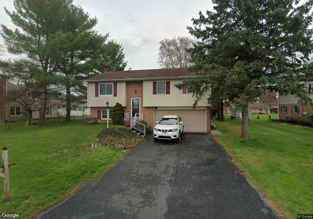
271 Hackman Rd Ephrata, PA 17522
Estimated Value: $298,060 - $368,000
3
Beds
1
Bath
1,068
Sq Ft
$316/Sq Ft
Est. Value
About This Home
This home is located at 271 Hackman Rd, Ephrata, PA 17522 and is currently estimated at $337,765, approximately $316 per square foot. 271 Hackman Rd is a home located in Lancaster County with nearby schools including Ephrata Intermediate School, Clay Elementary School, and Ephrata Senior High School.
Ownership History
Date
Name
Owned For
Owner Type
Purchase Details
Closed on
Sep 2, 2005
Sold by
Weaver Francis W and Weaver Marcella F
Bought by
Rybaltouski Veniamin K and Rybaltouskaya Iryna
Current Estimated Value
Home Financials for this Owner
Home Financials are based on the most recent Mortgage that was taken out on this home.
Original Mortgage
$177,378
Outstanding Balance
$94,838
Interest Rate
5.84%
Mortgage Type
Fannie Mae Freddie Mac
Estimated Equity
$242,927
Create a Home Valuation Report for This Property
The Home Valuation Report is an in-depth analysis detailing your home's value as well as a comparison with similar homes in the area
Home Values in the Area
Average Home Value in this Area
Purchase History
| Date | Buyer | Sale Price | Title Company |
|---|---|---|---|
| Rybaltouski Veniamin K | $173,900 | First American Title Ins Co |
Source: Public Records
Mortgage History
| Date | Status | Borrower | Loan Amount |
|---|---|---|---|
| Open | Rybaltouski Veniamin K | $177,378 |
Source: Public Records
Tax History Compared to Growth
Tax History
| Year | Tax Paid | Tax Assessment Tax Assessment Total Assessment is a certain percentage of the fair market value that is determined by local assessors to be the total taxable value of land and additions on the property. | Land | Improvement |
|---|---|---|---|---|
| 2025 | $3,360 | $146,700 | $50,600 | $96,100 |
| 2024 | $3,360 | $146,700 | $50,600 | $96,100 |
| 2023 | $3,273 | $146,700 | $50,600 | $96,100 |
| 2022 | $3,198 | $146,700 | $50,600 | $96,100 |
| 2021 | $3,129 | $146,700 | $50,600 | $96,100 |
| 2020 | $3,129 | $146,700 | $50,600 | $96,100 |
| 2019 | $3,085 | $146,700 | $50,600 | $96,100 |
| 2018 | $2,359 | $146,700 | $50,600 | $96,100 |
| 2017 | $3,392 | $133,100 | $51,800 | $81,300 |
| 2016 | $3,392 | $133,100 | $51,800 | $81,300 |
| 2015 | $670 | $133,100 | $51,800 | $81,300 |
| 2014 | $2,481 | $133,100 | $51,800 | $81,300 |
Source: Public Records
Map
Nearby Homes
- 124 Morning Dr
- 00 Morning Dr
- 131 Sunrise Ln
- 144 Sunrise Ln
- Atworth Plan at Wyndale
- Lawrence Plan at Wyndale
- Huntington Plan at Wyndale
- Brookfield Plan at Wyndale
- Darien Plan at Wyndale
- Perry Plan at Wyndale
- Kingston Plan at Wyndale
- Silverbrooke Plan at Wyndale
- Stonecroft Plan at Wyndale
- Westbrooke Plan at Wyndale
- Northfield Plan at Wyndale
- Amberbrook Plan at Wyndale
- Baker Plan at Wyndale
- Charlotte Plan at Wyndale
- Logan Plan at Wyndale
- Magnolia Plan at Wyndale
- 261 Hackman Rd
- 270 Meadowlark Dr
- 260 Meadowlark Dr
- 406 Countryside Dr
- 251 Hackman Rd
- 250 Meadowlark Dr
- 401 Countryside Dr
- 241 Hackman Rd
- 407 Countryside Dr
- 240 Meadowlark Dr
- 413 Countryside Dr
- 273 Meadowlark Dr
- 263 Meadowlark Dr
- 283 Meadowlark Dr
- 231 Hackman Rd
- 300 Hackman Rd
- 253 Meadowlark Dr
- 419 Countryside Dr
- 230 Meadowlark Dr
- 243 Meadowlark Dr