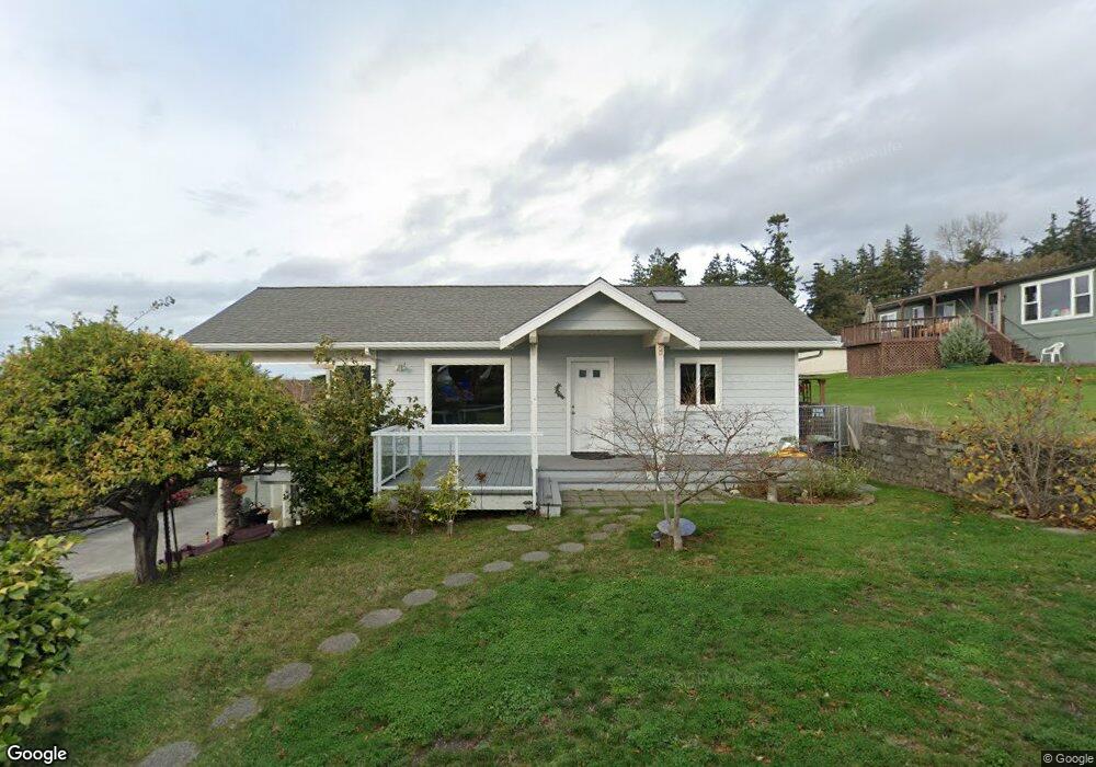
271 Kai Rd Freeland, WA 98249
Estimated Value: $736,000 - $998,000
2
Beds
3
Baths
1,834
Sq Ft
$479/Sq Ft
Est. Value
About This Home
This home is located at 271 Kai Rd, Freeland, WA 98249 and is currently estimated at $877,697, approximately $478 per square foot. 271 Kai Rd is a home located in Island County with nearby schools including South Whidbey Elementary School, South Whidbey Middle School, and South Whidbey High School.
Ownership History
Date
Name
Owned For
Owner Type
Purchase Details
Closed on
Oct 20, 2022
Sold by
Tabbal John C and Tabbal Janice R
Bought by
Tabbal Family Living Trust
Current Estimated Value
Purchase Details
Closed on
Dec 3, 2003
Sold by
Tabbal Janice R
Bought by
Tabbal John C and Tabbal Janice R
Home Financials for this Owner
Home Financials are based on the most recent Mortgage that was taken out on this home.
Original Mortgage
$200,000
Interest Rate
5%
Mortgage Type
Construction
Create a Home Valuation Report for This Property
The Home Valuation Report is an in-depth analysis detailing your home's value as well as a comparison with similar homes in the area
Home Values in the Area
Average Home Value in this Area
Purchase History
| Date | Buyer | Sale Price | Title Company |
|---|---|---|---|
| Tabbal Family Living Trust | -- | -- | |
| Tabbal John C | -- | -- |
Source: Public Records
Mortgage History
| Date | Status | Borrower | Loan Amount |
|---|---|---|---|
| Previous Owner | Tabbal John C | $200,000 |
Source: Public Records
Tax History Compared to Growth
Tax History
| Year | Tax Paid | Tax Assessment Tax Assessment Total Assessment is a certain percentage of the fair market value that is determined by local assessors to be the total taxable value of land and additions on the property. | Land | Improvement |
|---|---|---|---|---|
| 2025 | $5,241 | $776,158 | $390,000 | $386,158 |
| 2024 | $4,803 | $730,910 | $340,000 | $390,910 |
| 2023 | $4,803 | $735,663 | $340,000 | $395,663 |
| 2022 | $4,434 | $652,574 | $290,000 | $362,574 |
| 2021 | $3,752 | $559,036 | $240,000 | $319,036 |
| 2020 | $3,406 | $481,039 | $170,000 | $311,039 |
| 2019 | $3,052 | $448,052 | $200,000 | $248,052 |
| 2018 | $3,303 | $398,777 | $150,000 | $248,777 |
| 2017 | $3,034 | $400,180 | $150,000 | $250,180 |
| 2016 | $3,153 | $403,089 | $150,000 | $253,089 |
| 2015 | -- | $405,999 | $150,000 | $255,999 |
| 2013 | -- | $386,475 | $119,000 | $267,475 |
Source: Public Records
Map
Nearby Homes
- 287 Fairhaven Dr
- 4957 Scurlock Rd
- 330 Susana Dr
- 381 Susana Dr
- 111 Shippin Ln
- 4781 Smugglers Cove Rd
- 6425 RS Undisclosed
- 898 E Meadowood Ln
- 5392 Shore Meadow Rd
- 0 Woodland Ln Unit NWM2362874
- 0 Lot 9 Evergreen Ln
- 1059 Evergreen Ln
- 802 Old Beach Rd Unit 201
- 1231 Red Fox Ln
- 971 Ridge Dr
- 1031 Timber Ln
- 0 Ships Haven Dr Unit NWM2414859
- 0 S Minor Way
- 1249 Long Dr
- 5032 Eagle Ridge Dr
- 275 Kai Rd
- 4903 Magellan Dr
- 4902 Thistle Ln
- 4921 Thistle Ln
- 260 Kai Rd
- 4894 Thistle Ln
- 4909 Thistle Ln
- 245 Lighthouse Way
- 4936 Thistle Ln
- 4925 Magellan Dr
- 4901 Thistle Ln
- 4899 Thistle Ln
- 4892 Magellan Dr
- 4896 Magellan Dr
- 4883 Magellan Dr
- 4914 Scurlock Rd
- 4886 Thistle Ln
- 4885 Magellan Dr
- 4888 Magellan Dr
- 246 Lighthouse Way