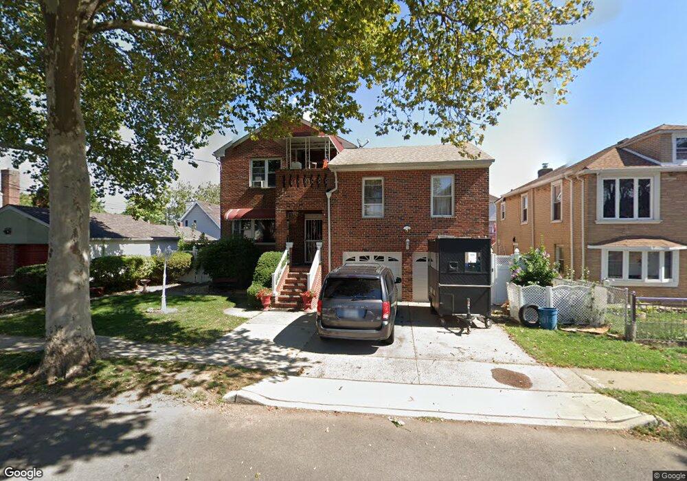
271 Mallory Ave Unit 1f Staten Island, NY 10305
South Beach NeighborhoodEstimated Value: $1,026,860 - $1,343,000
3
Beds
2
Baths
1,500
Sq Ft
$815/Sq Ft
Est. Value
About This Home
This home is located at 271 Mallory Ave Unit 1f, Staten Island, NY 10305 and is currently estimated at $1,221,965, approximately $814 per square foot. 271 Mallory Ave Unit 1f is a home located in Richmond County with nearby schools including P.S. 46 Albert V Maniscalco, I.S. 49 Berta A Dreyfus, and Curtis High School.
Ownership History
Date
Name
Owned For
Owner Type
Purchase Details
Closed on
Oct 24, 2018
Sold by
Zucca John A and Zucca Mary E
Bought by
Lin & Xu Group Llc
Current Estimated Value
Home Financials for this Owner
Home Financials are based on the most recent Mortgage that was taken out on this home.
Original Mortgage
$250,000
Outstanding Balance
$218,571
Interest Rate
4.62%
Mortgage Type
Adjustable Rate Mortgage/ARM
Estimated Equity
$1,003,394
Purchase Details
Closed on
May 20, 2002
Sold by
Zucca Lena
Bought by
Zucca John A and Zucca Mary E
Create a Home Valuation Report for This Property
The Home Valuation Report is an in-depth analysis detailing your home's value as well as a comparison with similar homes in the area
Home Values in the Area
Average Home Value in this Area
Purchase History
| Date | Buyer | Sale Price | Title Company |
|---|---|---|---|
| Lin & Xu Group Llc | $870,000 | Stewart Title Insurance Comp | |
| Zucca John A | -- | -- |
Source: Public Records
Mortgage History
| Date | Status | Borrower | Loan Amount |
|---|---|---|---|
| Open | Lin & Xu Group Llc | $250,000 |
Source: Public Records
Tax History Compared to Growth
Tax History
| Year | Tax Paid | Tax Assessment Tax Assessment Total Assessment is a certain percentage of the fair market value that is determined by local assessors to be the total taxable value of land and additions on the property. | Land | Improvement |
|---|---|---|---|---|
| 2025 | $9,007 | $59,940 | $7,317 | $52,623 |
| 2024 | $9,007 | $51,960 | $8,440 | $43,520 |
| 2023 | $9,038 | $44,504 | $7,168 | $37,336 |
| 2022 | $8,382 | $61,260 | $9,780 | $51,480 |
| 2021 | $8,336 | $55,200 | $9,780 | $45,420 |
| 2020 | $7,910 | $48,960 | $9,780 | $39,180 |
| 2019 | $7,817 | $51,000 | $9,780 | $41,220 |
| 2018 | $7,560 | $37,087 | $7,079 | $30,008 |
| 2017 | $6,833 | $34,988 | $9,081 | $25,907 |
| 2016 | $2,678 | $33,008 | $9,027 | $23,981 |
| 2015 | $2,379 | $31,140 | $8,160 | $22,980 |
| 2014 | $2,379 | $31,140 | $8,160 | $22,980 |
Source: Public Records
Map
Nearby Homes
- 182 Olympia Blvd
- 11 Lava St
- 236 Mallory Ave
- 40 Mclaughlin St
- 62 Mclaughlin St
- 49 Mclaughlin St
- 200 Mallory Ave
- 166 Jerome Ave
- 220 Norway Ave
- 504 Mcclean Ave
- 84 Winfield St
- 53 Andrews St
- 104 Winfield St
- 116 Bionia Ave
- 12 Reid Ave
- 150 Linwood Ave
- 71 Cameron Ave
- 109 Jerome Ave
- 55 Lansing St
- 46 Olympia Blvd
- 271 Mallory Ave Unit 2f
- 271 Mallory Ave
- 279 Mallory Ave
- 214 Foch Ave
- 263 Mallory Ave
- 210 Foch Ave
- 281 Mallory Ave
- 268 Lamport Blvd
- 264 Lamport Blvd
- 272 Lamport Blvd
- 202 Foch Ave
- 264 Mallory Ave
- 264 Mallory Ave Unit 2
- 276 Lamport Blvd
- 278 Mallory Ave
- 280 Mallory Ave
- 287 Mallory Ave
- 282 Mallory Ave
- 230 Foch Ave
- 284 Mallory Ave