Estimated Value: $245,000 - $346,420
5
Beds
2
Baths
2,430
Sq Ft
$125/Sq Ft
Est. Value
About This Home
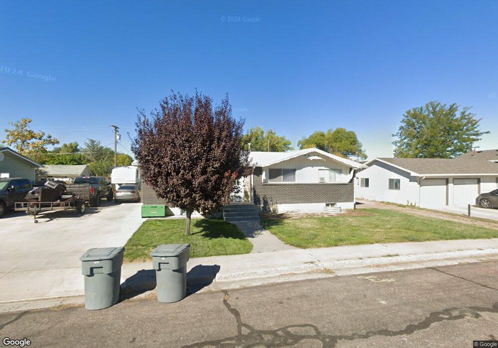
This home is located at 271 N 150 E, Delta, UT 84624 and is currently estimated at $304,355, approximately $125 per square foot. 271 N 150 E is a home located in Millard County.
Ownership History
Date
Name
Owned For
Owner Type
Purchase Details
Closed on
Jun 7, 2018
Sold by
Keel Jonathon and Keel Lacey
Bought by
Drage Justin D
Current Estimated Value
Home Financials for this Owner
Home Financials are based on the most recent Mortgage that was taken out on this home.
Original Mortgage
$156,120
Outstanding Balance
$136,686
Interest Rate
5.25%
Mortgage Type
FHA
Estimated Equity
$167,669
Purchase Details
Closed on
Jul 2, 2014
Sold by
Melvin J Melvin J and Dutson Layne E
Bought by
Keel Jonathon and Keel Lacey
Home Financials for this Owner
Home Financials are based on the most recent Mortgage that was taken out on this home.
Original Mortgage
$112,365
Interest Rate
4.1%
Mortgage Type
Stand Alone First
Purchase Details
Closed on
Oct 24, 2013
Sold by
Losee Lane and Rowlette Donna
Bought by
Dutson Melvin J and Dutson Layne E
Create a Home Valuation Report for This Property
The Home Valuation Report is an in-depth analysis detailing your home's value as well as a comparison with similar homes in the area
Home Values in the Area
Average Home Value in this Area
Purchase History
| Date | Buyer | Sale Price | Title Company |
|---|---|---|---|
| Drage Justin D | -- | First American Title | |
| Keel Jonathon | -- | First American Title Insur | |
| Dutson Melvin J | -- | First American Title Company |
Source: Public Records
Mortgage History
| Date | Status | Borrower | Loan Amount |
|---|---|---|---|
| Open | Drage Justin D | $156,120 | |
| Previous Owner | Keel Jonathon | $112,365 |
Source: Public Records
Tax History
| Year | Tax Paid | Tax Assessment Tax Assessment Total Assessment is a certain percentage of the fair market value that is determined by local assessors to be the total taxable value of land and additions on the property. | Land | Improvement |
|---|---|---|---|---|
| 2025 | $1,470 | $157,119 | $15,710 | $141,409 |
| 2024 | $1,470 | $140,575 | $14,485 | $126,090 |
| 2023 | $1,763 | $140,575 | $14,485 | $126,090 |
| 2022 | $1,328 | $99,916 | $13,168 | $86,748 |
| 2021 | $1,146 | $82,265 | $11,450 | $70,815 |
| 2020 | $1,066 | $76,060 | $10,409 | $65,651 |
| 2019 | $1,033 | $73,737 | $10,106 | $63,631 |
| 2018 | $896 | $64,481 | $10,106 | $54,375 |
| 2017 | $930 | $64,481 | $10,106 | $54,375 |
| 2016 | $901 | $64,481 | $10,106 | $54,375 |
| 2015 | $900 | $64,481 | $10,106 | $54,375 |
| 2014 | -- | $59,967 | $10,106 | $49,861 |
| 2013 | -- | $59,967 | $10,106 | $49,861 |
Source: Public Records
Map
Nearby Homes
- 325 N 100 W
- 0 E Highway 6 Unit LotWP001 16586023
- 445 Topaz Blvd Unit 10
- 44 E 300 S
- 7900 E 250 Rd N
- 149 N 200 W
- 520 E 450 North Rd
- 87 S 300 East Rd
- 163 W 100 S
- 321 E 200 S
- 628 Sunset St
- 451 W 300 N
- 901 E 750 Rd N
- 341 W 100 S
- 98 W 1000 N
- 294 S 300 W
- Locust Ave Unit LotWP001
- 648 Tamarix St
- 700 N Highway 6
- 7430 W 3000 N
Your Personal Tour Guide
Ask me questions while you tour the home.