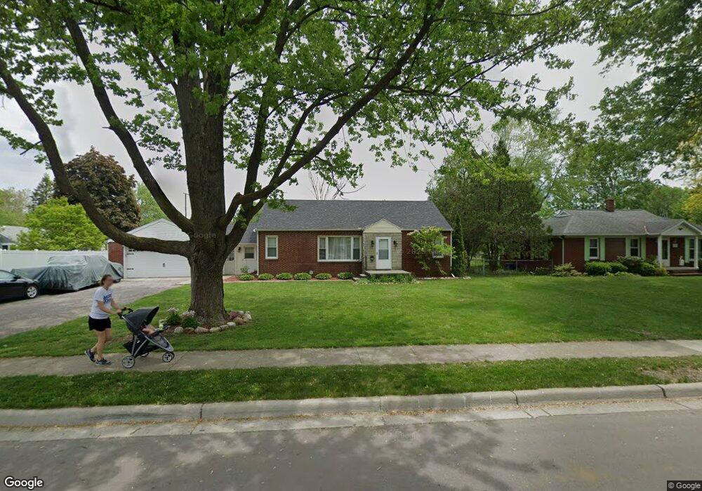
271 Outer Dr Dundee, MI 48131
Estimated Value: $218,700 - $257,000
3
Beds
1
Bath
1,511
Sq Ft
$156/Sq Ft
Est. Value
About This Home
This home is located at 271 Outer Dr, Dundee, MI 48131 and is currently estimated at $236,425, approximately $156 per square foot. 271 Outer Dr is a home located in Monroe County with nearby schools including Dundee Middle School, Dundee Elementary School, and Dundee Community High School.
Ownership History
Date
Name
Owned For
Owner Type
Purchase Details
Closed on
Jan 8, 2010
Sold by
Federal Home Loan Mortgage Corp
Bought by
Green Maggie
Current Estimated Value
Home Financials for this Owner
Home Financials are based on the most recent Mortgage that was taken out on this home.
Original Mortgage
$78,551
Outstanding Balance
$51,364
Interest Rate
4.87%
Mortgage Type
FHA
Estimated Equity
$185,061
Purchase Details
Closed on
Apr 13, 2001
Sold by
Aniol Micah
Bought by
Hober Chad and Bacarella Angela
Home Financials for this Owner
Home Financials are based on the most recent Mortgage that was taken out on this home.
Original Mortgage
$131,192
Interest Rate
7.05%
Mortgage Type
New Conventional
Purchase Details
Closed on
May 17, 1999
Sold by
Gram Brian
Bought by
Aniol Micah and Aniol Shelby
Home Financials for this Owner
Home Financials are based on the most recent Mortgage that was taken out on this home.
Original Mortgage
$112,066
Interest Rate
6.99%
Mortgage Type
FHA
Create a Home Valuation Report for This Property
The Home Valuation Report is an in-depth analysis detailing your home's value as well as a comparison with similar homes in the area
Home Values in the Area
Average Home Value in this Area
Purchase History
| Date | Buyer | Sale Price | Title Company |
|---|---|---|---|
| Green Maggie | $80,000 | -- | |
| Hober Chad | $135,250 | -- | |
| Aniol Micah | $113,000 | -- |
Source: Public Records
Mortgage History
| Date | Status | Borrower | Loan Amount |
|---|---|---|---|
| Open | Green Maggie | $78,551 | |
| Previous Owner | Hober Chad | $131,192 | |
| Previous Owner | Aniol Micah | $112,066 |
Source: Public Records
Tax History
| Year | Tax Paid | Tax Assessment Tax Assessment Total Assessment is a certain percentage of the fair market value that is determined by local assessors to be the total taxable value of land and additions on the property. | Land | Improvement |
|---|---|---|---|---|
| 2025 | $2,024 | $98,190 | $98,190 | $0 |
| 2024 | $1,916 | $100,180 | $0 | $0 |
| 2023 | $1,319 | $80,580 | $0 | $0 |
| 2022 | $1,755 | $80,580 | $0 | $0 |
| 2021 | $2,591 | $71,250 | $0 | $0 |
| 2020 | $2,578 | $66,530 | $0 | $0 |
| 2019 | $1,729 | $66,530 | $0 | $0 |
| 2018 | $2,415 | $58,570 | $0 | $0 |
| 2017 | $1,651 | $58,570 | $0 | $0 |
| 2016 | $1,213 | $55,180 | $0 | $0 |
| 2015 | $1,205 | $44,240 | $0 | $0 |
| 2014 | $1,603 | $44,240 | $0 | $0 |
| 2013 | $1,309 | $41,450 | $0 | $0 |
Source: Public Records
Map
Nearby Homes
- 150 Waterstradt Commerce Dr
- 626 Plank St
- 454 Tecumseh St
- 512 Brooks Hollow Ct
- 504 Brooks Hollow Ct
- 179 Timberbrook Ln
- 469 Corinth
- 264 Ypsilanti St
- 0 Tecumseh St
- 365 Sidney St
- 16484 Tecumseh St
- 190 Sidney St
- 16488 Tecumseh St
- 1353 W Lloyd Rd
- 535 Falcon Dr
- 301 White Owl Ln Unit 236
- 671 Elk Ridge Dr
- 439 E Monroe St
- 232 Dundee Ridge Dr
- 835 Henning St
Your Personal Tour Guide
Ask me questions while you tour the home.