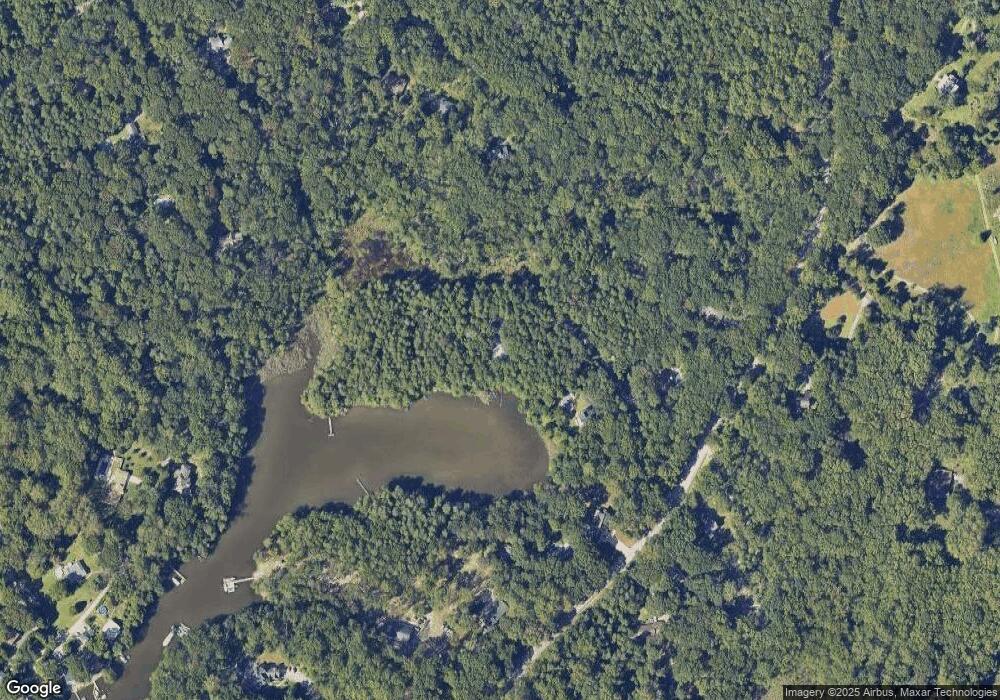
271 Peat Bog Ln Pasadena, MD 21122
Estimated Value: $921,000 - $1,234,000
Studio
4
Baths
3,846
Sq Ft
$286/Sq Ft
Est. Value
About This Home
This home is located at 271 Peat Bog Ln, Pasadena, MD 21122 and is currently estimated at $1,099,902, approximately $285 per square foot. 271 Peat Bog Ln is a home located in Anne Arundel County with nearby schools including Bodkin Elementary School, Chesapeake Bay Middle School, and Chesapeake High School.
Ownership History
Date
Name
Owned For
Owner Type
Purchase Details
Closed on
Dec 31, 2002
Sold by
Kaper James B
Bought by
Kaper James B and Tacket Carol O
Current Estimated Value
Purchase Details
Closed on
Jun 30, 1986
Sold by
S Ptnshp G H
Bought by
Kertfoot Charles S
Home Financials for this Owner
Home Financials are based on the most recent Mortgage that was taken out on this home.
Original Mortgage
$200,000
Interest Rate
10.62%
Create a Home Valuation Report for This Property
The Home Valuation Report is an in-depth analysis detailing your home's value as well as a comparison with similar homes in the area
Home Values in the Area
Average Home Value in this Area
Purchase History
| Date | Buyer | Sale Price | Title Company |
|---|---|---|---|
| Kaper James B | -- | -- | |
| Kertfoot Charles S | $229,000 | -- |
Source: Public Records
Mortgage History
| Date | Status | Borrower | Loan Amount |
|---|---|---|---|
| Previous Owner | Kertfoot Charles S | $200,000 |
Source: Public Records
Tax History
| Year | Tax Paid | Tax Assessment Tax Assessment Total Assessment is a certain percentage of the fair market value that is determined by local assessors to be the total taxable value of land and additions on the property. | Land | Improvement |
|---|---|---|---|---|
| 2025 | $6,791 | $1,018,367 | -- | -- |
| 2024 | $6,791 | $1,000,600 | $557,900 | $442,700 |
| 2023 | $6,536 | $957,167 | $0 | $0 |
| 2022 | $6,954 | $913,733 | $0 | $0 |
| 2020 | $6,660 | $870,300 | $485,900 | $384,400 |
| 2019 | $6,565 | $870,300 | $485,900 | $384,400 |
| 2018 | $9,337 | $920,800 | $537,900 | $382,900 |
| 2017 | $6,230 | $884,200 | $0 | $0 |
| 2016 | -- | $847,600 | $0 | $0 |
| 2015 | -- | $811,000 | $0 | $0 |
| 2014 | -- | $811,000 | $0 | $0 |
Source: Public Records
Map
Nearby Homes
- 443 New York Ave
- 0 Maryland Ave
- 415 Edgewater Rd
- 333 Sturtons Ln
- 301 Sturtons Ln
- 828A Swift Rd
- 511 Sylvan Way
- 8407 Bodkin Ave
- 94 Pine Rd
- 797 David Dr
- 308 Cockey Dr
- 813 Mago Vista Rd
- 509A Edgewater Rd
- 370 Magothy Rd
- 360 Magothy Rd Unit 8H
- 360 Magothy Rd Unit 5A
- 360 Magothy Rd Unit 4I
- 360 Magothy Rd Unit L2
- 360 Magothy Rd Unit 11K
- 360 Magothy Rd Unit 14H
- 281 Peat Bog Ln
- 280 Peat Bog Ln
- 261 Sundew Ln
- 300 Eagle Hill Rd
- 336 Eagle Hill Rd
- 322 Eagle Hill Rd
- 260 Sundew Ln
- 332 Eagle Hill Rd
- 309 Eagle Hill Rd
- 241 Sundew Ln
- 311 Eagle Hill Rd
- 251 Leatherleaf Ln
- 279 Eagle Hill Rd
- 319 Eagle Hill Rd
- 421 Shady Ln
- 241 Leatherleaf Ln
- 274 Lions Watch Dr
- 231 Sundew Ln
- 420 Shady Ln
- 366 Eagle Hill Rd
Your Personal Tour Guide
Ask me questions while you tour the home.
