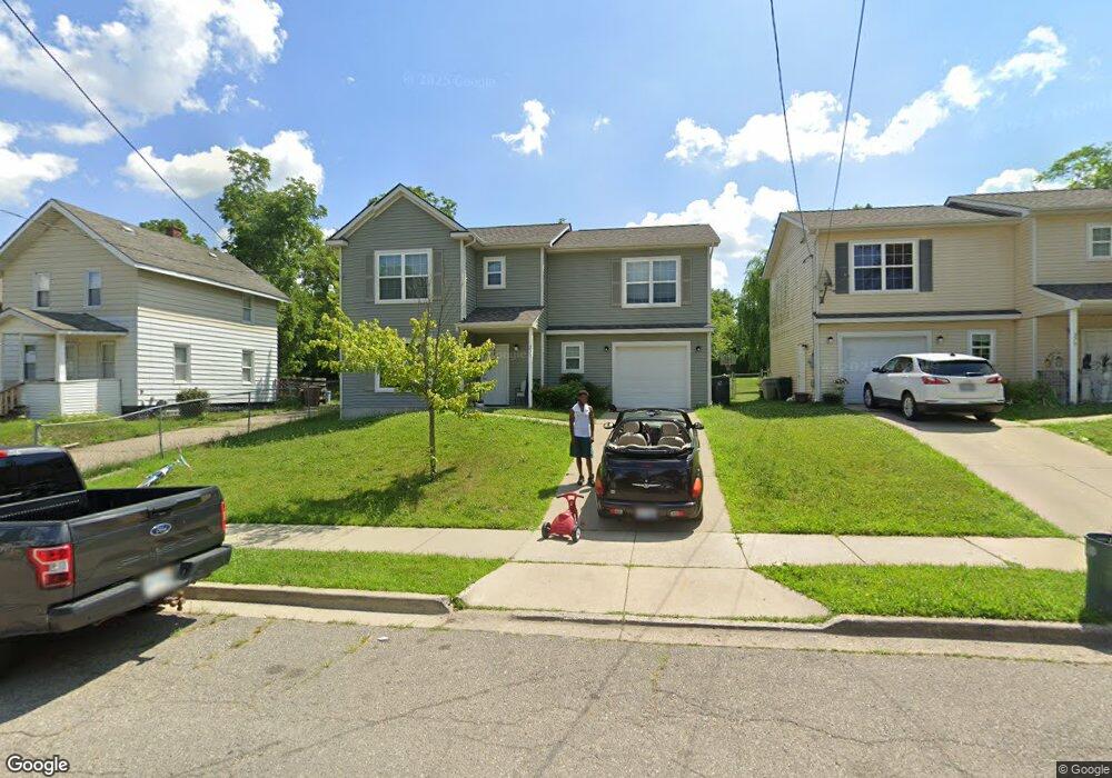
271 S Shirley St Pontiac, MI 48342
Estimated Value: $180,000 - $263,000
4
Beds
2
Baths
1,845
Sq Ft
$114/Sq Ft
Est. Value
About This Home
This home is located at 271 S Shirley St, Pontiac, MI 48342 and is currently estimated at $211,240, approximately $114 per square foot. 271 S Shirley St is a home with nearby schools including Walt Whitman Elementary School, Pontiac Middle School, and Pontiac High School.
Ownership History
Date
Name
Owned For
Owner Type
Purchase Details
Closed on
Feb 16, 2018
Sold by
Community Housing Network Inc
Bought by
Chn Unity Park Ldha Lp
Current Estimated Value
Purchase Details
Closed on
Nov 26, 2013
Sold by
Community Housing Network
Bought by
Chn Unity Park Limited Dividend Housing
Home Financials for this Owner
Home Financials are based on the most recent Mortgage that was taken out on this home.
Original Mortgage
$5,470,000
Interest Rate
4.14%
Mortgage Type
Purchase Money Mortgage
Purchase Details
Closed on
Aug 9, 2013
Sold by
The State Of Michigan
Bought by
Community Housing Network Inc
Purchase Details
Closed on
Aug 18, 2011
Sold by
City Of Pontiac
Bought by
The Michigan Land Bank Fast Track Author
Purchase Details
Closed on
Dec 17, 2002
Sold by
Dohany Patrick M
Bought by
Treas City Of Pontiac
Create a Home Valuation Report for This Property
The Home Valuation Report is an in-depth analysis detailing your home's value as well as a comparison with similar homes in the area
Home Values in the Area
Average Home Value in this Area
Purchase History
| Date | Buyer | Sale Price | Title Company |
|---|---|---|---|
| Chn Unity Park Ldha Lp | -- | None Available | |
| Chn Unity Park Limited Dividend Housing | $72,000 | Capital Fund Title Services | |
| Community Housing Network Inc | -- | None Available | |
| The Michigan Land Bank Fast Track Author | $1,000 | None Available | |
| Treas City Of Pontiac | -- | -- |
Source: Public Records
Mortgage History
| Date | Status | Borrower | Loan Amount |
|---|---|---|---|
| Previous Owner | Chn Unity Park Limited Dividend Housing | $5,470,000 |
Source: Public Records
Tax History Compared to Growth
Tax History
| Year | Tax Paid | Tax Assessment Tax Assessment Total Assessment is a certain percentage of the fair market value that is determined by local assessors to be the total taxable value of land and additions on the property. | Land | Improvement |
|---|---|---|---|---|
| 2019 | $1,811 | $41,650 | $0 | $0 |
| 2018 | $1,760 | $33,640 | $0 | $0 |
| 2017 | $1,682 | $32,310 | $0 | $0 |
| 2016 | $1,700 | $31,460 | $0 | $0 |
| 2015 | -- | $29,520 | $0 | $0 |
| 2014 | -- | $0 | $0 | $0 |
Source: Public Records
Map
Nearby Homes
- 240 S Shirley St
- 328 Whittemore St
- 187 Wall St
- 306 Whittemore St
- 397 S Jessie St
- 000 Wall St
- 389 Osmun St
- 176 S Francis Ave
- 505 Auburn Ave
- 317 Prospect St
- 33 S Tasmania St
- 18 S Shirley St
- 472 S Jessie St
- 511 E Pike St
- 209 Ferry Ave
- 28 S Marshall St
- 447 S Marshall St
- 440 Martin Luther King Junior Blvd S
- 55 N Roselawn St
- 465 S Marshall St
- 275 S Shirley St
- 267 S Shirley St
- 263 S Shirley St
- 272 S Sanford St
- 259 S Shirley St
- 195 Wall St
- 199 Wall St
- 272 S Shirley St
- 255 S Shirley St
- 268 S Shirley St
- 276 S Shirley St
- 282 S Sanford St
- 256 S Sanford St
- 175 Wall St
- 252 S Sanford St
- 248 S Sanford St
- 246 S Shirley St
- 184 Wall St
- 190 Wall St
- 000 S Sanford St