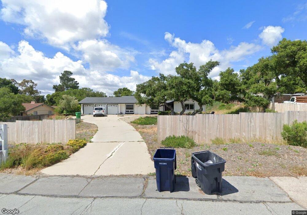
271 Saint Andrews Way Lompoc, CA 93436
Estimated Value: $916,826 - $935,000
5
Beds
3
Baths
2,241
Sq Ft
$413/Sq Ft
Est. Value
About This Home
This home is located at 271 Saint Andrews Way, Lompoc, CA 93436 and is currently estimated at $924,957, approximately $412 per square foot. 271 Saint Andrews Way is a home located in Santa Barbara County with nearby schools including Buena Vista Elementary School, Cabrillo High School, and Olive Grove Charter - Lompoc.
Ownership History
Date
Name
Owned For
Owner Type
Purchase Details
Closed on
Apr 28, 2021
Sold by
Manchester Dana L and Manchester Barbara K
Bought by
Daniel Cody and Daniel Kate
Current Estimated Value
Home Financials for this Owner
Home Financials are based on the most recent Mortgage that was taken out on this home.
Original Mortgage
$639,000
Outstanding Balance
$579,094
Interest Rate
3.1%
Mortgage Type
New Conventional
Estimated Equity
$345,863
Purchase Details
Closed on
May 20, 2005
Sold by
Manchester Dana L and Manchester Barbara K
Bought by
Manchester Dana L and Manchester Barbara K
Home Financials for this Owner
Home Financials are based on the most recent Mortgage that was taken out on this home.
Original Mortgage
$103,000
Interest Rate
5.41%
Mortgage Type
New Conventional
Purchase Details
Closed on
Aug 16, 2001
Sold by
Manchester Dana L and Manchester Barbara K
Bought by
Manchester Dana L and Manchester Barbara K
Create a Home Valuation Report for This Property
The Home Valuation Report is an in-depth analysis detailing your home's value as well as a comparison with similar homes in the area
Home Values in the Area
Average Home Value in this Area
Purchase History
We collect this data history from publicly available records. To have your information removed, we recommend requesting removal directly through your county’s website.
| Date | Buyer | Sale Price | Title Company |
|---|---|---|---|
| Daniel Cody | $710,000 | First American Title Company | |
| Manchester Dana L | -- | -- | |
| Manchester Dana L | -- | -- | |
| Manchester Dana L | -- | -- |
Source: Public Records
Mortgage History
We collect this data history from publicly available records. To have your information removed, we recommend requesting removal directly through your county’s website.
| Date | Status | Borrower | Loan Amount |
|---|---|---|---|
| Open | Daniel Cody | $639,000 | |
| Previous Owner | Manchester Dana L | $103,000 |
Source: Public Records
Tax History
| Year | Tax Paid | Tax Assessment Tax Assessment Total Assessment is a certain percentage of the fair market value that is determined by local assessors to be the total taxable value of land and additions on the property. | Land | Improvement |
|---|---|---|---|---|
| 2025 | $8,575 | $768,525 | $216,485 | $552,040 |
| 2023 | $8,575 | $738,684 | $208,080 | $530,604 |
| 2022 | $8,435 | $724,200 | $204,000 | $520,200 |
| 2021 | $4,063 | $318,272 | $132,608 | $185,664 |
| 2020 | $4,023 | $315,010 | $131,249 | $183,761 |
| 2019 | $3,965 | $308,834 | $128,676 | $180,158 |
| 2018 | $3,910 | $302,779 | $126,153 | $176,626 |
| 2017 | $3,755 | $296,843 | $123,680 | $173,163 |
| 2016 | $3,422 | $291,023 | $121,255 | $169,768 |
| 2014 | $3,349 | $281,038 | $117,095 | $163,943 |
Source: Public Records
Map
Nearby Homes
- 4050 Saint Andrews Ct
- 384 Falcon Crest Dr
- 4173 Oakwood Ct
- 372 Falcon Crest Dr
- 107 Inverness Ave
- 131 Deneb Place
- 649 Burning Tree Way
- 259 Burton Mesa Blvd Unit A
- 277 Burton Mesa Blvd Unit B
- 73 Stanford Cir
- 6 Stanford Cir
- 0 Oak Hill Dr Unit 24-783
- 25 Galaxy Way
- 4220 Constellation Rd
- 18 Galaxy Way
- 4603 Falcon Dr
- 240 Oak Hill Dr
- 4486 Titan Ave
- 549 Palomar Cir
- 3725 Jupiter Ave
- 238 Saint Andrews Way
- 3996 Burnham Dr
- 266 Saint Andrews Way
- 3988 Burnham Dr
- 241 Saint Andrews Way
- 259 St Andrews Way Unit 259 S
- 222 Saint Andrews Way
- 221 St Andrews Way
- 221 Saint Andrews Way
- 284 Saint Andrews Way
- 3974 Burnham Dr
- 3991 Burnham Dr
- 216 Saint Annes Place
- 3902 Club House Ct
- 3902 Clubhouse Ct
- 220 St Annes Pl Place
- 220 Saint Annes Place
- 3913 Club House Ct
- 3989 Club House Rd
- 3985 Burnham Dr
Your Personal Tour Guide
Ask me questions while you tour the home.