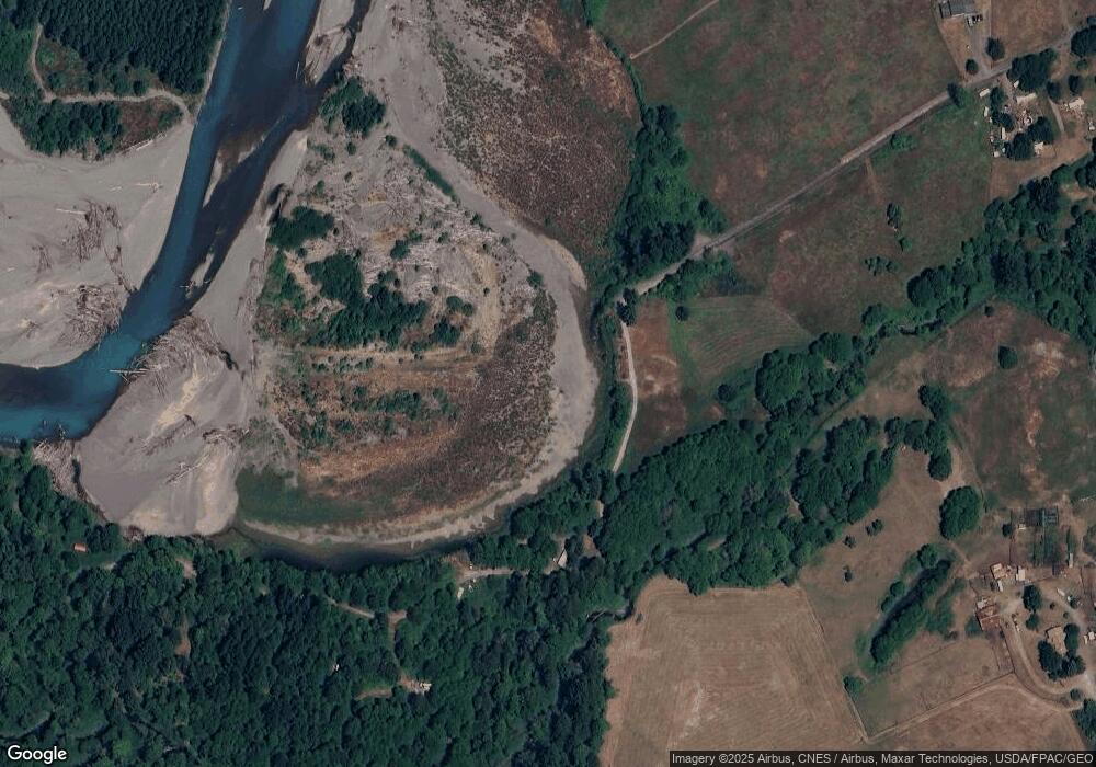
271 Stover Rd Randle, WA 98377
Estimated Value: $49,378 - $142,000
--
Bed
1
Bath
624
Sq Ft
$146/Sq Ft
Est. Value
About This Home
This home is located at 271 Stover Rd, Randle, WA 98377 and is currently estimated at $91,126, approximately $146 per square foot. 271 Stover Rd is a home located in Lewis County with nearby schools including White Pass Elementary School and White Pass Junior/Senior High School.
Ownership History
Date
Name
Owned For
Owner Type
Purchase Details
Closed on
Apr 14, 2008
Sold by
Skogen Mark
Bought by
Olson John W and Olson Tonya
Current Estimated Value
Home Financials for this Owner
Home Financials are based on the most recent Mortgage that was taken out on this home.
Original Mortgage
$9,100
Interest Rate
6.22%
Mortgage Type
Purchase Money Mortgage
Purchase Details
Closed on
Mar 12, 2008
Sold by
Reisert Peter E and Reisert Debra L
Bought by
Skogen Mark
Home Financials for this Owner
Home Financials are based on the most recent Mortgage that was taken out on this home.
Original Mortgage
$9,100
Interest Rate
6.22%
Mortgage Type
Purchase Money Mortgage
Create a Home Valuation Report for This Property
The Home Valuation Report is an in-depth analysis detailing your home's value as well as a comparison with similar homes in the area
Home Values in the Area
Average Home Value in this Area
Purchase History
| Date | Buyer | Sale Price | Title Company |
|---|---|---|---|
| Olson John W | $8,700 | Lewis County Title | |
| Skogen Mark | $5,000 | Title Guaranty |
Source: Public Records
Mortgage History
| Date | Status | Borrower | Loan Amount |
|---|---|---|---|
| Closed | Olson John W | $9,100 |
Source: Public Records
Tax History Compared to Growth
Tax History
| Year | Tax Paid | Tax Assessment Tax Assessment Total Assessment is a certain percentage of the fair market value that is determined by local assessors to be the total taxable value of land and additions on the property. | Land | Improvement |
|---|---|---|---|---|
| 2025 | $30 | $4,500 | $4,500 | -- |
| 2024 | $30 | $3,400 | $3,400 | -- |
| 2023 | $31 | $3,400 | $3,400 | $0 |
| 2022 | $31 | $2,600 | $2,600 | $0 |
| 2021 | $35 | $2,600 | $2,600 | $0 |
| 2020 | $39 | $2,700 | $2,700 | $0 |
| 2019 | $39 | $2,700 | $2,700 | $0 |
| 2018 | $33 | $2,500 | $2,500 | $0 |
| 2017 | $30 | $2,500 | $2,500 | $0 |
| 2016 | $31 | $2,500 | $2,500 | $0 |
| 2015 | $147 | $2,500 | $2,500 | $0 |
| 2013 | $147 | $0 | $0 | $0 |
Source: Public Records
Map
Nearby Homes
- 167 Burton Creek Rd
- 182 Burton Creek Rd
- 735 Carr Rd
- 226 Bennett Rd
- 11377 U S 12
- 120 Bonell Rd Unit 44
- 0 Lot A-8 Lot A-8 River Ranch Rd
- 202 Kauer Rd
- 0 Lot A-9 Pompey Peak Dr
- 115 Horseshoe Ln
- 11166 U S 12
- 173 River Ranch Rd
- 11164 U S 12
- 0 Lot B9C Lone Tree Rd
- 0 Lot B8C Lone Tree Rd
- 241 Pompey Peak Dr 104 Horseshoe
- 106 Baise Ln
- 12813 US Highway 12
- 0 Craig Rd Unit Lot B2 NWM2382885
- 0 Craig Rd Unit Lot B3 NWM2382907
- 271 Stover Rd Unit C
- 110 Burton Creek Rd
- 0 Burton Creek Rd
- 0 Burton Creek Rd
- 0 Burton Creek Rd Unit NWM2297861
- 0 Burton Creek Rd Unit 23526673
- 226 Stover Rd
- 181 Burton Creek Rd
- 217 Stover Rd
- 213 Stover Rd
- 11737 Us Highway 12
- 204 Burton Creek Rd
- 11797 Us Highway 12
- 132 Hillbilly Dr
- 11158 Us Highway 12
- 11158 Us Highway 12
- 11697 U S 12
- 130 Hillbilly Dr
- 197 Stover Rd
