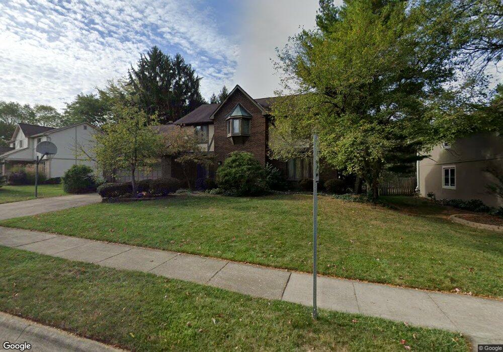
271 Tallowwood Dr Westerville, OH 43081
Estimated Value: $466,000 - $561,000
4
Beds
3
Baths
3,020
Sq Ft
$170/Sq Ft
Est. Value
About This Home
This home is located at 271 Tallowwood Dr, Westerville, OH 43081 and is currently estimated at $512,630, approximately $169 per square foot. 271 Tallowwood Dr is a home located in Franklin County with nearby schools including Mcvay Elementary School, Walnut Springs Middle School, and Westerville-North High School.
Ownership History
Date
Name
Owned For
Owner Type
Purchase Details
Closed on
Aug 29, 2002
Sold by
Schnipke Wanda K and Schnipke Wanda K
Bought by
Connor Norman C and Wright Connor Shirri A
Current Estimated Value
Home Financials for this Owner
Home Financials are based on the most recent Mortgage that was taken out on this home.
Original Mortgage
$210,900
Outstanding Balance
$90,026
Interest Rate
6.54%
Mortgage Type
Purchase Money Mortgage
Estimated Equity
$422,604
Purchase Details
Closed on
Apr 13, 2000
Sold by
Euans Thomas D and Euans Joan E
Bought by
Schnipke Wanda K
Home Financials for this Owner
Home Financials are based on the most recent Mortgage that was taken out on this home.
Original Mortgage
$180,000
Interest Rate
8.22%
Purchase Details
Closed on
Aug 2, 1985
Bought by
Euans Thomas D
Purchase Details
Closed on
Aug 1, 1978
Create a Home Valuation Report for This Property
The Home Valuation Report is an in-depth analysis detailing your home's value as well as a comparison with similar homes in the area
Home Values in the Area
Average Home Value in this Area
Purchase History
| Date | Buyer | Sale Price | Title Company |
|---|---|---|---|
| Connor Norman C | $222,000 | Title First Agency Inc | |
| Schnipke Wanda K | $225,000 | Title First Agency Inc | |
| Euans Thomas D | $160,000 | -- | |
| -- | $103,500 | -- |
Source: Public Records
Mortgage History
| Date | Status | Borrower | Loan Amount |
|---|---|---|---|
| Open | Connor Norman C | $210,900 | |
| Closed | Schnipke Wanda K | $180,000 |
Source: Public Records
Tax History Compared to Growth
Tax History
| Year | Tax Paid | Tax Assessment Tax Assessment Total Assessment is a certain percentage of the fair market value that is determined by local assessors to be the total taxable value of land and additions on the property. | Land | Improvement |
|---|---|---|---|---|
| 2024 | $7,573 | $133,250 | $33,250 | $100,000 |
| 2023 | $7,412 | $133,245 | $33,250 | $99,995 |
| 2022 | $7,691 | $105,560 | $27,020 | $78,540 |
| 2021 | $7,755 | $105,560 | $27,020 | $78,540 |
| 2020 | $7,733 | $105,560 | $27,020 | $78,540 |
| 2019 | $7,918 | $102,030 | $22,540 | $79,490 |
| 2018 | $7,435 | $102,030 | $22,540 | $79,490 |
| 2017 | $7,563 | $102,030 | $22,540 | $79,490 |
| 2016 | $7,339 | $87,540 | $23,910 | $63,630 |
| 2015 | $7,108 | $87,540 | $23,910 | $63,630 |
| 2014 | $7,114 | $87,540 | $23,910 | $63,630 |
| 2013 | $3,382 | $83,335 | $22,750 | $60,585 |
Source: Public Records
Map
Nearby Homes
- 1368 Nutmeg Ct
- 1146 Forest Rise Dr
- 1209 Chatham Ridge Rd
- 613 Valley Wood Ct
- 969 Farrington Dr
- 1201 Wallean Dr
- 1003 Autumn Meadows Dr
- 750 Autumn Branch Rd
- 737 Autumn Branch Rd
- 994 Autumn Lake Ct
- 90 Spring Creek Dr
- 73 Keethler Dr S
- 640 Brook Run Dr
- 192 Buckeye Ct
- 800 S Spring Rd
- 371 Delaware Dr
- 768 Collingwood Dr
- 461 Delaware Ct
- 6452 Rockhold Dr
- 182 Hillcrest Dr
- 259 Tallowwood Dr
- 283 Tallowwood Dr
- 1360 Nutmeg Ct
- 249 Tallowwood Dr
- 266 Tallowwood Dr
- 297 Tallowwood Dr
- 263 Chinkapin Way
- 1352 Nutmeg Ct
- 278 Tallowwood Dr
- 239 Tallowwood Dr
- 262 Chinkapin Way
- 450 Buckhorn Ct
- 311 Tallowwood Dr
- 286 Tallowwood Dr
- 238 Tallowwood Dr
- 251 Chinkapin Way
- 456 Buckhorn Ct
- 294 Tallowwood Dr
- 254 Chinkapin Way
- 229 Tallowwood Dr