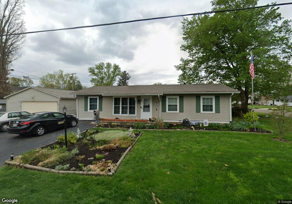
271 W Shields St Newark, OH 43055
Estimated Value: $187,000 - $221,982
3
Beds
1
Bath
1,248
Sq Ft
$164/Sq Ft
Est. Value
About This Home
This home is located at 271 W Shields St, Newark, OH 43055 and is currently estimated at $204,996, approximately $164 per square foot. 271 W Shields St is a home located in Licking County with nearby schools including John Clem Elementary School, Liberty Middle School, and Newark High School.
Ownership History
Date
Name
Owned For
Owner Type
Purchase Details
Closed on
Jun 18, 1996
Sold by
Caron Thomas M
Bought by
Spiker Randy L and Spiker Susan B
Current Estimated Value
Home Financials for this Owner
Home Financials are based on the most recent Mortgage that was taken out on this home.
Original Mortgage
$82,500
Outstanding Balance
$5,391
Interest Rate
8.25%
Mortgage Type
New Conventional
Estimated Equity
$199,605
Create a Home Valuation Report for This Property
The Home Valuation Report is an in-depth analysis detailing your home's value as well as a comparison with similar homes in the area
Home Values in the Area
Average Home Value in this Area
Purchase History
| Date | Buyer | Sale Price | Title Company |
|---|---|---|---|
| Spiker Randy L | $79,500 | -- |
Source: Public Records
Mortgage History
| Date | Status | Borrower | Loan Amount |
|---|---|---|---|
| Open | Spiker Randy L | $82,500 |
Source: Public Records
Tax History Compared to Growth
Tax History
| Year | Tax Paid | Tax Assessment Tax Assessment Total Assessment is a certain percentage of the fair market value that is determined by local assessors to be the total taxable value of land and additions on the property. | Land | Improvement |
|---|---|---|---|---|
| 2024 | $2,009 | $56,180 | $13,130 | $43,050 |
| 2023 | $2,005 | $56,180 | $13,130 | $43,050 |
| 2022 | $2,315 | $41,340 | $7,390 | $33,950 |
| 2021 | $1,740 | $41,340 | $7,390 | $33,950 |
| 2020 | $1,779 | $41,340 | $7,390 | $33,950 |
| 2019 | $1,443 | $32,270 | $6,160 | $26,110 |
| 2018 | $1,444 | $0 | $0 | $0 |
| 2017 | $1,485 | $0 | $0 | $0 |
| 2016 | $1,552 | $0 | $0 | $0 |
| 2015 | $1,586 | $0 | $0 | $0 |
| 2014 | $2,032 | $0 | $0 | $0 |
| 2013 | $1,580 | $0 | $0 | $0 |
Source: Public Records
Map
Nearby Homes
- 425 N 11th St
- 333 N 10th St
- 355 Eddy St
- 383 Central Ave
- 408 Granville St
- 361 Granville St
- 467 Mount Vernon Rd
- 64 N 10th St
- 218 Granville St
- 69 Wallace St
- 542 Mount Vernon Rd
- 403 Meadowbrook Dr
- 533 Leslie Dr
- 247 Buckingham St
- 188 Meadow Dr
- 184 Meadow Dr
- 27 W North St
- 370 Meadowbrook Dr
- 52 Charles St
- 251 Merchant St
- 384 Mellars Ln
- 270 W Shields St
- 379 N 11th St
- 383 N 11th St
- 372 Mellars Ln
- 375 N 11th St
- 256 W Shields St
- 373 N 11th St
- 385 Mellars Ln
- 412 Sherwood Dr E
- 405 Mellars Ln
- 405 N 11th St
- 371 N 11th St
- 366 Mellars Ln
- 373 Mellars Ln
- 409 N 11th St
- 369 N 11th St
- 411 Sherwood Dr E
- 420 Sherwood Dr E
- 365 Mellars Ln