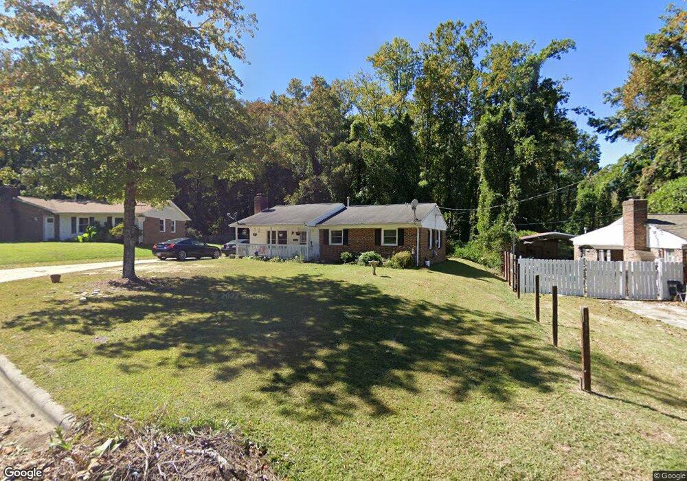
2710 Ernest St High Point, NC 27263
Greater High Point NeighborhoodEstimated Value: $160,000 - $195,000
3
Beds
2
Baths
1,130
Sq Ft
$153/Sq Ft
Est. Value
About This Home
This home is located at 2710 Ernest St, High Point, NC 27263 and is currently estimated at $173,040, approximately $153 per square foot. 2710 Ernest St is a home located in Guilford County with nearby schools including Allen Jay Elementary School, Southern Guilford Middle, and Southern Guilford High School.
Ownership History
Date
Name
Owned For
Owner Type
Purchase Details
Closed on
Jan 9, 2006
Sold by
Mccorquodlae Daniel Brandon and Mccorquodale Elizabeth
Bought by
Ali Khurshid and Ali Rita
Current Estimated Value
Home Financials for this Owner
Home Financials are based on the most recent Mortgage that was taken out on this home.
Original Mortgage
$64,800
Outstanding Balance
$43,161
Interest Rate
9.62%
Mortgage Type
Fannie Mae Freddie Mac
Estimated Equity
$129,880
Purchase Details
Closed on
Nov 20, 2000
Sold by
Mccorquodale Frances R
Bought by
Mccorquodale Daniel Brandon
Create a Home Valuation Report for This Property
The Home Valuation Report is an in-depth analysis detailing your home's value as well as a comparison with similar homes in the area
Home Values in the Area
Average Home Value in this Area
Purchase History
| Date | Buyer | Sale Price | Title Company |
|---|---|---|---|
| Ali Khurshid | $72,000 | None Available | |
| Mccorquodale Daniel Brandon | -- | -- |
Source: Public Records
Mortgage History
| Date | Status | Borrower | Loan Amount |
|---|---|---|---|
| Open | Ali Khurshid | $64,800 |
Source: Public Records
Tax History
| Year | Tax Paid | Tax Assessment Tax Assessment Total Assessment is a certain percentage of the fair market value that is determined by local assessors to be the total taxable value of land and additions on the property. | Land | Improvement |
|---|---|---|---|---|
| 2025 | $1,277 | $92,700 | $20,000 | $72,700 |
| 2024 | $1,277 | $92,700 | $20,000 | $72,700 |
| 2023 | $1,277 | $92,700 | $20,000 | $72,700 |
| 2022 | $1,250 | $92,700 | $20,000 | $72,700 |
| 2021 | $919 | $66,700 | $17,000 | $49,700 |
| 2020 | $919 | $66,700 | $17,000 | $49,700 |
| 2019 | $919 | $66,700 | $0 | $0 |
| 2018 | $915 | $66,700 | $0 | $0 |
| 2017 | $915 | $66,700 | $0 | $0 |
| 2016 | $1,081 | $77,100 | $0 | $0 |
| 2015 | $1,087 | $77,100 | $0 | $0 |
| 2014 | $1,106 | $77,100 | $0 | $0 |
Source: Public Records
Map
Nearby Homes
- 914 Nance Ave
- 1105 E Springfield Rd
- 717 Belmont Dr
- 921 Norton St
- 600 E Fairfield Rd
- 715 Baker Rd
- 611 Liberty Rd
- 000 Liberty Rd
- 1535 E Fairfield Rd
- 126 Apollo Cir
- 609 Martha Place
- 607 Martha Place
- 1501 Cox Ct
- 312 Playground Rd
- 312 Model Farm Rd
- 10844 N Main St
- 10812, 10822, 10828 N Main St
- 206 E Moore Ave
- 1638 Kersey Valley Rd
- 510 Aldridge Rd
- 2712 Ernest St
- 2714 Ernest St
- 800 Miriam Ave
- 2713 Ernest St
- 2704 Ernest St
- 2715 Ernest St
- 2711 Ernest St
- 802 Miriam Ave
- 1027 Pegram Ave
- 1031 Pegram Ave
- 1025 Pegram Ave
- 801 Miriam Ave
- 1014 Gaines Ave
- 1033 Pegram Ave
- 804 Miriam Ave
- 1035 Pegram Ave
- 2704 Miriam Ct
- 2706 Miriam Ct
- 803 Miriam Ave
- 2702 Ernest St
Your Personal Tour Guide
Ask me questions while you tour the home.