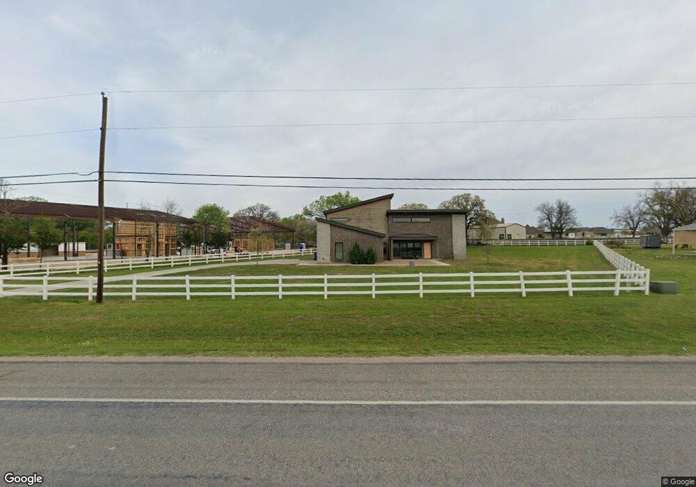
2710 Ranger Hwy Weatherford, TX 76088
Estimated Value: $278,577 - $485,000
--
Bed
--
Bath
1,794
Sq Ft
$220/Sq Ft
Est. Value
About This Home
This home is located at 2710 Ranger Hwy, Weatherford, TX 76088 and is currently estimated at $393,894, approximately $219 per square foot. 2710 Ranger Hwy is a home with nearby schools including Wright Elementary School, Hall Middle School, and Weatherford High School.
Ownership History
Date
Name
Owned For
Owner Type
Purchase Details
Closed on
Jun 6, 2018
Sold by
Barber James R
Bought by
Barber James R and Barber Barbara K
Current Estimated Value
Purchase Details
Closed on
Jan 15, 2008
Sold by
Carlise Daniel K and Carlisle Daniel Keith
Bought by
Montanez Oscar and Montanez Esperanza
Purchase Details
Closed on
Oct 12, 2007
Sold by
Powell John
Bought by
Montanez Oscar and Montanez Esperanza
Purchase Details
Closed on
Oct 20, 1983
Bought by
Montanez Oscar and Montanez Esperanza
Create a Home Valuation Report for This Property
The Home Valuation Report is an in-depth analysis detailing your home's value as well as a comparison with similar homes in the area
Home Values in the Area
Average Home Value in this Area
Purchase History
| Date | Buyer | Sale Price | Title Company |
|---|---|---|---|
| Barber James R | -- | None Available | |
| Montanez Oscar | -- | Sendera Title | |
| Montanez Oscar | -- | -- | |
| Montanez Oscar | -- | -- |
Source: Public Records
Tax History Compared to Growth
Tax History
| Year | Tax Paid | Tax Assessment Tax Assessment Total Assessment is a certain percentage of the fair market value that is determined by local assessors to be the total taxable value of land and additions on the property. | Land | Improvement |
|---|---|---|---|---|
| 2025 | $4,068 | $300,538 | $112,000 | $188,538 |
| 2024 | $4,068 | $220,000 | $100,000 | $120,000 |
| 2023 | $4,068 | $243,480 | $100,000 | $143,480 |
| 2022 | $3,556 | $175,180 | $50,000 | $125,180 |
| 2021 | $3,740 | $175,180 | $50,000 | $125,180 |
| 2020 | $3,085 | $141,560 | $30,000 | $111,560 |
| 2019 | $3,305 | $141,560 | $30,000 | $111,560 |
| 2018 | $2,612 | $111,570 | $20,000 | $91,570 |
| 2017 | $2,567 | $111,570 | $20,000 | $91,570 |
| 2016 | $2,074 | $90,160 | $16,000 | $74,160 |
| 2015 | $2,048 | $90,160 | $16,000 | $74,160 |
| 2014 | $1,974 | $86,580 | $15,000 | $71,580 |
Source: Public Records
Map
Nearby Homes
- 330 Pack Saddle Ct
- 2800 Ranger Hwy
- 2894 Ranger Hwy
- 169 Pack Saddle Trail
- 177 Pack Saddle Trail
- 305 Wrangler Ct
- 313 Wrangler Ct
- 142 Wood Oak Trail
- 121 Desperado Way
- 143 Desperado Way
- 124 Desperado Way
- 111 Diamond Ridge Ln
- TBD Diamond Ridge Ln
- 112 Tigers Eye Ct
- 105 Michael Ln
- 119 Michael Ln
- 2045 Eagles Ridge Dr
- 209 Grace Ct
- 3180 Old Brock Rd
- 3703 Greenwood Rd
- 329 Pack Saddle Ct
- 2678 Ranger Hwy
- 2674 Ranger Hwy
- 318 Pack Saddle Ct
- 2336 Greenwood Cut Off Rd
- 2677 Ranger Hwy
- 209 Pack Saddle Ct
- 2330 Greenwood Cut Off Rd
- 2760B Ranger Hwy
- 2760 Ranger Hwy
- 2671 Ranger Hwy
- 2324 Greenwood Cut Off Rd
- 306 Pack Saddle Ct
- 113 Buck Ct
- 112 Buck Ct
- 115 Pack Saddle Trail
- 123 Pack Saddle Trail
- 131 Pack Saddle Trail
- 2310 Greenwood Cut Off Rd
- 109 Buck Ct