
Seller's Agent in 2025
Nathan Murray
RE/MAX
(443) 540-7987
1 in this area
9 Total Sales
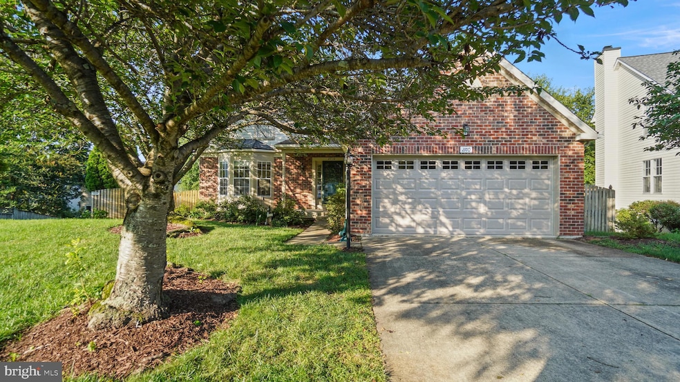
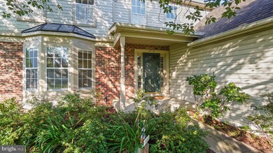
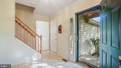
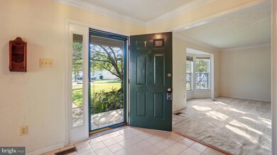
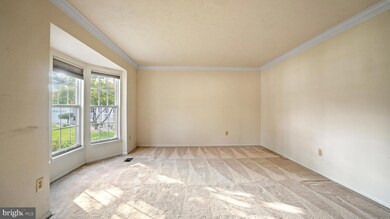
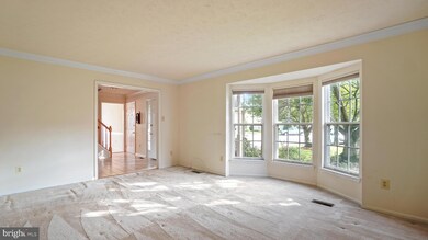
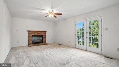
Great opportunity in Chapman Farms. This large 3620 SF, 5 Bedroom 2.5 Bath home sits at the end of a quiet cul-de-sac, it features an oversized garage and an fully fenced back yard. Several systems have been replaced, Roof in 2016, HVAC in 2020 and hot water heater in 2022, Kitchen appliances are newer and all stainless steel. This home is owned by the original owners and is primed for a refresh cosmetically. Have the freedom to choose your own flooring and paint colors to make this home truly yours. The large open basement has high ceilings is already roughed in for a bath and is at walkout level to the back yard. The primary bedroom is large, features two walk in closets, cathedral ceilings, and skylights in the large bathroom with soaking tub and shower.
Last Agent to Sell the Property
(443) 540-7987 nathanmurray@remax.net RE/MAX Executive License #582750 Listed on: 07/18/2025
Last Buyer's Agent
(301) 651-3556 rosetaylorrealty@gmail.com RE/MAX United Real Estate License #590657
| Date | Type | Sale Price | Title Company |
|---|---|---|---|
| Deed | $725,000 | In House Title | |
| Deed | -- | -- | |
| Deed | -- | -- | |
| Deed | $247,991 | -- |
| Date | Status | Loan Amount | Loan Type |
|---|---|---|---|
| Open | $748,925 | VA | |
| Previous Owner | $198,300 | No Value Available |
| Date | Event | Price | List to Sale | Price per Sq Ft |
|---|---|---|---|---|
| 09/24/2025 09/24/25 | Sold | $725,000 | 0.0% | $298 / Sq Ft |
| 08/17/2025 08/17/25 | Pending | -- | -- | -- |
| 08/17/2025 08/17/25 | Price Changed | $725,000 | +1.4% | $298 / Sq Ft |
| 07/31/2025 07/31/25 | Price Changed | $715,000 | -1.4% | $294 / Sq Ft |
| 07/18/2025 07/18/25 | For Sale | $725,000 | -- | $298 / Sq Ft |
| Year | Tax Paid | Tax Assessment Tax Assessment Total Assessment is a certain percentage of the fair market value that is determined by local assessors to be the total taxable value of land and additions on the property. | Land | Improvement |
|---|---|---|---|---|
| 2025 | $4,778 | $609,900 | -- | -- |
| 2024 | $4,778 | $579,800 | $0 | $0 |
| 2023 | $4,634 | $549,700 | $274,200 | $275,500 |
| 2022 | $5,707 | $546,133 | $0 | $0 |
| 2021 | $8,563 | $542,567 | $0 | $0 |
| 2020 | $4,174 | $539,000 | $279,200 | $259,800 |
| 2019 | $8,059 | $535,333 | $0 | $0 |
| 2018 | $5,391 | $531,667 | $0 | $0 |
| 2017 | $3,821 | $528,000 | $0 | $0 |
| 2016 | -- | $501,500 | $0 | $0 |
| 2015 | -- | $475,000 | $0 | $0 |
| 2014 | -- | $448,500 | $0 | $0 |
Seller's Agent in 2025
Nathan Murray
RE/MAX
(443) 540-7987
1 in this area
9 Total Sales
Buyer's Agent in 2025
Rose Taylor
RE/MAX
(301) 651-3556
15 in this area
119 Total Sales
Source: Bright MLS
MLS Number: MDAA2115072
APN: 02-647-90082780
Disclaimer: Certain information contained herein is derived from information provided by parties other than Homes.com. All information provided is deemed reliable, but is not guaranteed to be accurate and should be independently verified.
![]() The data relating to real estate for sale on this website appears in part through the BRIGHT Internet Data Exchange program, a voluntary cooperative exchange of property listing data between licensed real estate brokerage firms, and is provided by BRIGHT through a licensing agreement.
The data relating to real estate for sale on this website appears in part through the BRIGHT Internet Data Exchange program, a voluntary cooperative exchange of property listing data between licensed real estate brokerage firms, and is provided by BRIGHT through a licensing agreement.
Listing information is from various brokers who participate in the Bright MLS IDX program and not all listings may be visible on the site.
The property information being provided on or through the website is for the personal, non-commercial use of consumers and such information may not be used for any purpose other than to identify prospective properties consumers may be interested in purchasing.
Some properties which appear for sale on the website may no longer be available because they are for instance, under contract, sold or are no longer being offered for sale.
Property information displayed is deemed reliable but is not guaranteed.
Copyright 2025 Bright MLS, Inc.