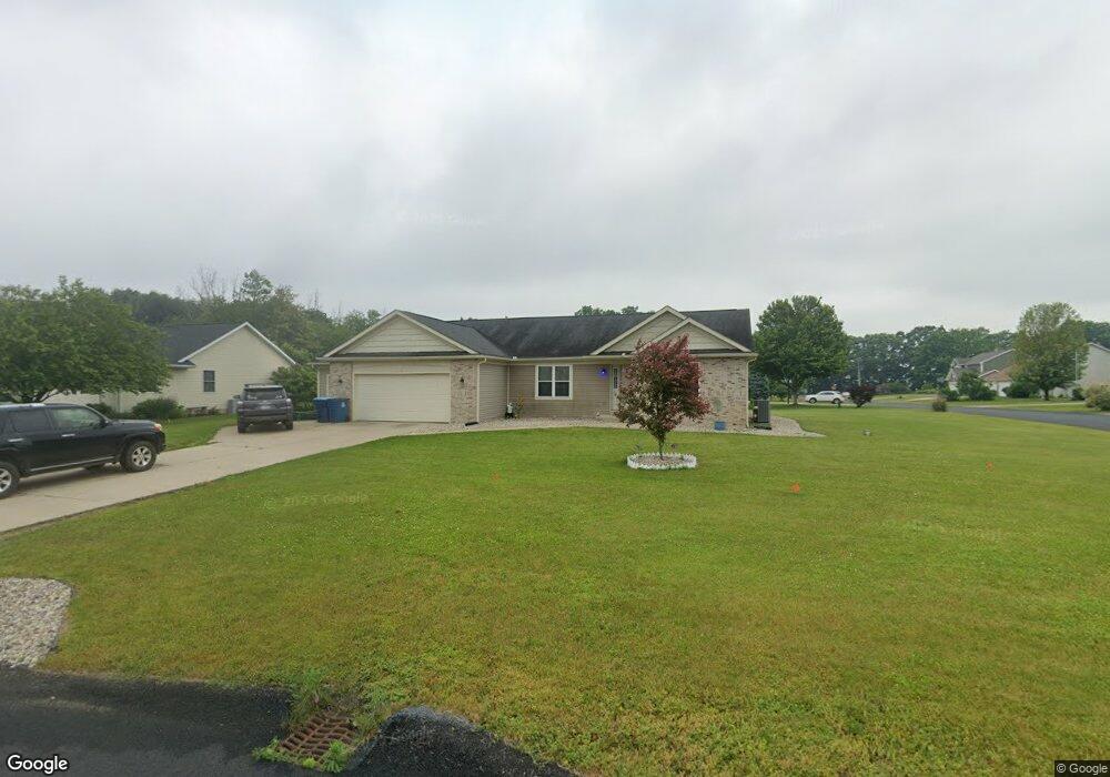
2711 Nighthawk Ave Schoolcraft, MI 49087
Estimated Value: $417,000 - $543,000
Studio
--
Bath
1,766
Sq Ft
$269/Sq Ft
Est. Value
About This Home
This home is located at 2711 Nighthawk Ave, Schoolcraft, MI 49087 and is currently estimated at $475,695, approximately $269 per square foot. 2711 Nighthawk Ave is a home located in Kalamazoo County with nearby schools including Schoolcraft Upper Elementary School, Schoolcraft Middle School, and Schoolcraft High School.
Ownership History
Date
Name
Owned For
Owner Type
Purchase Details
Closed on
Jan 27, 2017
Sold by
Lyster Matthew
Bought by
Lyster Properties Llc
Current Estimated Value
Purchase Details
Closed on
Feb 11, 2014
Sold by
Lyster Matthew
Bought by
Lyster Matthew R and The Matthew R Lyster Living Trust
Purchase Details
Closed on
Dec 18, 2012
Sold by
Drallette Mark
Bought by
Lyster Matthew
Purchase Details
Closed on
Dec 20, 2007
Sold by
Lyster Matthew
Bought by
Drallette Mark
Purchase Details
Closed on
Aug 17, 2005
Sold by
Prairie Edge Estates Llc
Bought by
Lyster Matthew
Home Financials for this Owner
Home Financials are based on the most recent Mortgage that was taken out on this home.
Original Mortgage
$26,000
Interest Rate
7.87%
Mortgage Type
Fannie Mae Freddie Mac
Create a Home Valuation Report for This Property
The Home Valuation Report is an in-depth analysis detailing your home's value as well as a comparison with similar homes in the area
Home Values in the Area
Average Home Value in this Area
Purchase History
| Date | Buyer | Sale Price | Title Company |
|---|---|---|---|
| Lyster Properties Llc | -- | Devon Title Company | |
| Lyster Matthew R | -- | None Available | |
| Lyster Matthew | -- | None Available | |
| Drallette Mark | $175,000 | None Available | |
| Lyster Matthew | $26,000 | Devon Title Agency |
Source: Public Records
Mortgage History
| Date | Status | Borrower | Loan Amount |
|---|---|---|---|
| Previous Owner | Lyster Matthew | $26,000 |
Source: Public Records
Tax History
| Year | Tax Paid | Tax Assessment Tax Assessment Total Assessment is a certain percentage of the fair market value that is determined by local assessors to be the total taxable value of land and additions on the property. | Land | Improvement |
|---|---|---|---|---|
| 2025 | $1,520 | $227,300 | $0 | $0 |
| 2024 | $1,476 | $209,500 | $0 | $0 |
| 2023 | $1,408 | $187,100 | $0 | $0 |
| 2022 | $6,420 | $171,700 | $0 | $0 |
| 2021 | $6,227 | $159,600 | $0 | $0 |
| 2020 | $6,099 | $144,000 | $0 | $0 |
| 2019 | $5,457 | $140,800 | $0 | $0 |
| 2018 | $5,329 | $139,100 | $0 | $0 |
| 2017 | $0 | $130,000 | $0 | $0 |
| 2016 | -- | $120,200 | $0 | $0 |
| 2015 | -- | $109,900 | $13,400 | $96,500 |
| 2014 | -- | $109,900 | $0 | $0 |
Source: Public Records
Map
Nearby Homes
- 11457 Circle Dr Unit 44
- 2810 Avalon Woods Dr
- 11025 Higley Cir W
- 2150 Oak Leaf Trail
- 2633 Rolling Hill Ave
- 10476 Schrier Ln
- 1817 Alder Ave
- 10382 Pennridge Dr
- 10565 Pierport Dr
- 560 Sand Pointe Trail
- 705 Briella Ct
- 735 Briella Ct
- 775 Chloe Jane Ave
- 739 Chloe Jane Ave
- 10545 Sharon Lee Ln
- 729 Chloe Jane Ave
- 10197 Pennridge Dr
- 720 Janelle Ct
- 721 Briella Ct
- 10597 Sharon Lee Ln Unit 88
- 2677 Nighthawk Ave
- 2677 Nighthawk Ave
- 11937 Prairie Edge St
- 11906 Prairie Edge St
- 11924 Prairie Edge St
- 11942 Prairie Edge St
- 11955 Prairie Edge St
- 2647 Nighthawk Ave
- 2712 Nighthawk Ave
- 11888 Prairie Edge St
- 11960 Prairie Edge St
- 2678 Nighthawk Ave
- 11973 Prairie Edge St
- 2648 Nighthawk Ave
- 11976 Prairie Edge St
- 12955 Prairie Edge St
- 2613 Nighthawk Ave
- 11862 Prairie Edge St
- 2614 Nighthawk St
- 2614 Nighthawk Ave
Your Personal Tour Guide
Ask me questions while you tour the home.