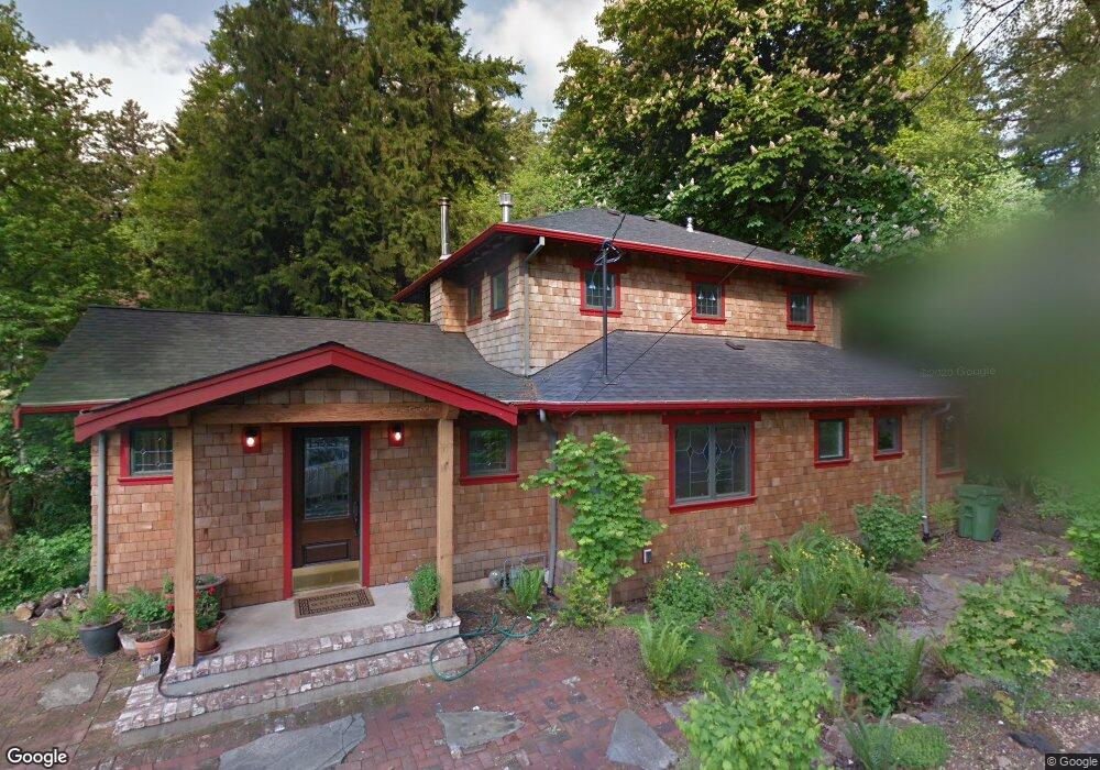
2711 Summit Dr Lake Oswego, OR 97034
Lakeview-Summit NeighborhoodEstimated Value: $1,266,000 - $1,604,898
4
Beds
2
Baths
2,385
Sq Ft
$574/Sq Ft
Est. Value
About This Home
This home is located at 2711 Summit Dr, Lake Oswego, OR 97034 and is currently estimated at $1,368,475, approximately $573 per square foot. 2711 Summit Dr is a home located in Clackamas County with nearby schools including Lake Grove Elementary School, Lake Oswego Junior High School, and Lake Oswego Senior High School.
Ownership History
Date
Name
Owned For
Owner Type
Purchase Details
Closed on
Aug 2, 2023
Sold by
Maslen David R
Bought by
Maslen David R and Maslen Colleen
Current Estimated Value
Purchase Details
Closed on
Jun 13, 2003
Sold by
Denning Jay D
Bought by
Maslen David R
Home Financials for this Owner
Home Financials are based on the most recent Mortgage that was taken out on this home.
Original Mortgage
$195,000
Interest Rate
5.61%
Mortgage Type
Purchase Money Mortgage
Create a Home Valuation Report for This Property
The Home Valuation Report is an in-depth analysis detailing your home's value as well as a comparison with similar homes in the area
Home Values in the Area
Average Home Value in this Area
Purchase History
| Date | Buyer | Sale Price | Title Company |
|---|---|---|---|
| Maslen David R | -- | None Listed On Document | |
| Maslen David R | $340,000 | First Amer Title Ins Co Of O |
Source: Public Records
Mortgage History
| Date | Status | Borrower | Loan Amount |
|---|---|---|---|
| Previous Owner | Maslen David R | $195,000 |
Source: Public Records
Tax History Compared to Growth
Tax History
| Year | Tax Paid | Tax Assessment Tax Assessment Total Assessment is a certain percentage of the fair market value that is determined by local assessors to be the total taxable value of land and additions on the property. | Land | Improvement |
|---|---|---|---|---|
| 2025 | $12,409 | $646,181 | -- | -- |
| 2024 | $12,078 | $627,361 | -- | -- |
| 2023 | $12,078 | $609,089 | $0 | $0 |
| 2022 | $11,376 | $591,349 | $0 | $0 |
| 2021 | $10,507 | $574,126 | $0 | $0 |
| 2020 | $10,243 | $557,404 | $0 | $0 |
| 2019 | $9,991 | $541,169 | $0 | $0 |
| 2018 | $9,501 | $525,407 | $0 | $0 |
| 2017 | $9,168 | $510,104 | $0 | $0 |
| 2016 | $8,346 | $495,247 | $0 | $0 |
| 2015 | $8,064 | $480,822 | $0 | $0 |
| 2014 | $7,959 | $466,817 | $0 | $0 |
Source: Public Records
Map
Nearby Homes
- 15948 Twin Fir Rd
- 2240 Summit Ct
- 15947 Twin Fir Rd
- 1990 Indian Trail
- 3525 Lake Grove Ave
- 2703 Glen Eagles Rd
- 3537 Lake Grove Ave
- 15370 Twin Fir Rd
- 16878 Canyon Dr
- 2560 Glen Eagles Place
- 3548 Lakeview Blvd
- 0 S Shore Blvd
- 2255 Glen Haven Rd
- 3600 Lakeview Blvd
- 2217 Prestwick Rd
- 3730 Upper Dr
- 3850 Lake Grove Ave
- 2627 Park Rd
- 3884 Lake Grove Ave
- 16636 Maple Cir
- 15847 Springbrook Ct
- 2720 Summit Dr
- 15821 Springbrook Ct
- 15848 Springbrook Ct
- 2625 Summit Dr
- 2700 Summit Dr
- 2751 Summit Dr
- 2646 Summit Dr
- 15815 Springbrook Ct
- 15818 Springbrook Ct
- 2575 Summit Dr
- 2624 Summit Dr
- 2738 Summit Dr
- 2711 Lakeview Blvd
- 2701 Lakeview Blvd
- 2701 Lakeview Blvd Unit 2
- 15773 Springbrook Ct
- 2600 Summit Dr
- 15810 Springbrook Ct
- 2552 Summit Dr