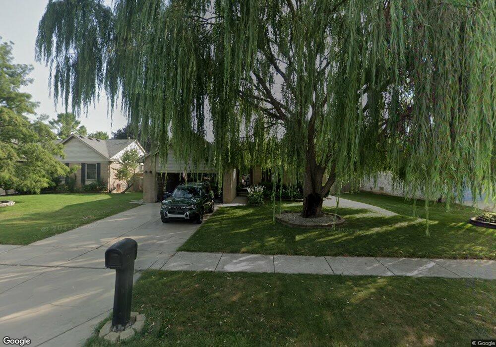
27113 Telstar St Chesterfield, MI 48051
Estimated Value: $262,315 - $347,000
--
Bed
1
Bath
1,314
Sq Ft
$240/Sq Ft
Est. Value
About This Home
This home is located at 27113 Telstar St, Chesterfield, MI 48051 and is currently estimated at $315,329, approximately $239 per square foot. 27113 Telstar St is a home with nearby schools including L'Anse Creuse High School - North and Austin Catholic Academy.
Ownership History
Date
Name
Owned For
Owner Type
Purchase Details
Closed on
Feb 15, 2018
Sold by
Derocha Michele
Bought by
Derocha John M
Current Estimated Value
Home Financials for this Owner
Home Financials are based on the most recent Mortgage that was taken out on this home.
Original Mortgage
$196,886
Outstanding Balance
$166,239
Interest Rate
3.87%
Mortgage Type
FHA
Estimated Equity
$149,090
Purchase Details
Closed on
Aug 21, 2012
Sold by
Derocha John C
Bought by
Derocha Michele
Create a Home Valuation Report for This Property
The Home Valuation Report is an in-depth analysis detailing your home's value as well as a comparison with similar homes in the area
Home Values in the Area
Average Home Value in this Area
Purchase History
| Date | Buyer | Sale Price | Title Company |
|---|---|---|---|
| Derocha John M | $215,000 | None Available | |
| Derocha Michele | -- | Homeowners Title Agency |
Source: Public Records
Mortgage History
| Date | Status | Borrower | Loan Amount |
|---|---|---|---|
| Open | Derocha John M | $196,886 |
Source: Public Records
Tax History Compared to Growth
Tax History
| Year | Tax Paid | Tax Assessment Tax Assessment Total Assessment is a certain percentage of the fair market value that is determined by local assessors to be the total taxable value of land and additions on the property. | Land | Improvement |
|---|---|---|---|---|
| 2025 | $3,024 | $133,100 | $0 | $0 |
| 2024 | $2,021 | $131,800 | $0 | $0 |
| 2023 | $1,917 | $125,300 | $0 | $0 |
| 2022 | $2,671 | $110,900 | $0 | $0 |
| 2021 | $2,598 | $105,900 | $0 | $0 |
| 2020 | $1,760 | $101,900 | $0 | $0 |
| 2019 | $2,394 | $95,700 | $0 | $0 |
| 2018 | $2,323 | $89,200 | $15,100 | $74,100 |
| 2017 | $2,272 | $79,750 | $15,100 | $64,650 |
| 2016 | $2,268 | $79,750 | $0 | $0 |
| 2015 | $766 | $75,050 | $0 | $0 |
| 2014 | $766 | $67,400 | $15,100 | $52,300 |
| 2012 | -- | $0 | $0 | $0 |
Source: Public Records
Map
Nearby Homes
- 27188 Robin Dr
- 26377 Pine Gate Dr
- 49520 Gratiot Ave
- 49431 Fuller Rd
- 49050 Fuller Rd
- 48749 Smokey Glen Ct Unit 82
- 27944 Cotton Rd
- 49263 Stratford Dr
- 28315 Gold Rd
- 28327 Nadia Ln
- 28326 Nadia Ln
- 48936 Gratiot Ave
- 28342 Nadia Ln
- 50325 Maurice Rd
- 49157 Maurice Dr
- 48117 Cotton Creek Blvd
- 28691 Yorkshire Dr
- 26430 Sanajo Ct Unit 20
- 0 Gratiot Ave Unit G50003850
- 0 Gratiot Ave Unit 50101527
- 27101 Telstar St
- 27125 Telstar St
- 27125 Telstar St
- 27089 Telstar St
- 27114 Sparrow Ct
- 27137 Telstar St
- 27126 Sparrow Ct
- 27102 Sparrow Ct
- 27138 Sparrow Ct
- 27212 Telstar St
- 27077 Telstar St
- 27188 Telstar St
- 27149 Telstar St
- 27200 Telstar St
- 27090 Sparrow Ct
- 27150 Sparrow Ct
- 49677 Michelle Ann Dr
- 27176 Telstar St
- 27230 Telstar St
- 27161 Telstar St