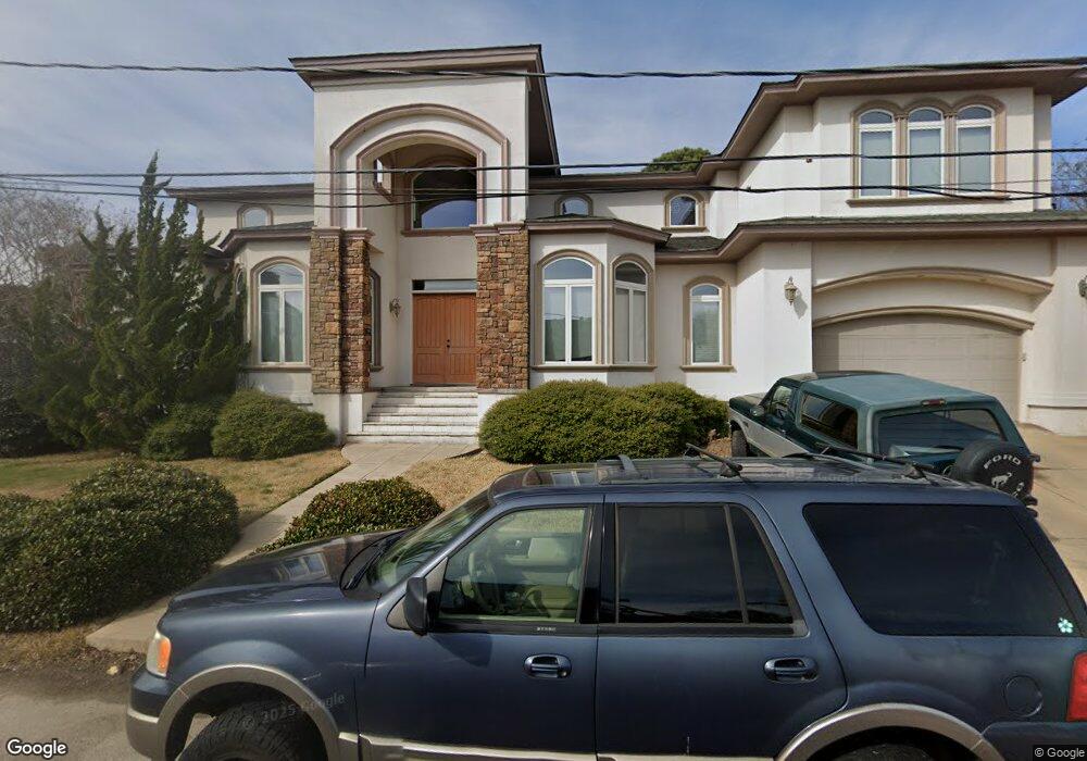
2712 Canal Rd Virginia Beach, VA 23451
Broad Bay Island NeighborhoodEstimated Value: $1,193,000 - $1,788,000
5
Beds
5
Baths
4,914
Sq Ft
$328/Sq Ft
Est. Value
About This Home
This home is located at 2712 Canal Rd, Virginia Beach, VA 23451 and is currently estimated at $1,613,594, approximately $328 per square foot. 2712 Canal Rd is a home located in Virginia Beach City with nearby schools including John B. Dey Elementary School, Great Neck Middle School, and Frank W. Cox High School.
Ownership History
Date
Name
Owned For
Owner Type
Purchase Details
Closed on
Dec 28, 1998
Sold by
Mueller Daviud P
Bought by
Bryant Richard L
Current Estimated Value
Home Financials for this Owner
Home Financials are based on the most recent Mortgage that was taken out on this home.
Original Mortgage
$180,750
Outstanding Balance
$41,270
Interest Rate
6.84%
Estimated Equity
$1,572,324
Create a Home Valuation Report for This Property
The Home Valuation Report is an in-depth analysis detailing your home's value as well as a comparison with similar homes in the area
Home Values in the Area
Average Home Value in this Area
Purchase History
| Date | Buyer | Sale Price | Title Company |
|---|---|---|---|
| Bryant Richard L | $241,000 | -- |
Source: Public Records
Mortgage History
| Date | Status | Borrower | Loan Amount |
|---|---|---|---|
| Open | Bryant Richard L | $180,750 |
Source: Public Records
Tax History Compared to Growth
Tax History
| Year | Tax Paid | Tax Assessment Tax Assessment Total Assessment is a certain percentage of the fair market value that is determined by local assessors to be the total taxable value of land and additions on the property. | Land | Improvement |
|---|---|---|---|---|
| 2025 | $12,719 | $1,340,100 | $595,100 | $745,000 |
| 2024 | $12,719 | $1,311,200 | $595,100 | $716,100 |
| 2023 | $12,770 | $1,289,900 | $574,200 | $715,700 |
| 2022 | $10,955 | $1,106,600 | $480,200 | $626,400 |
| 2021 | $10,120 | $1,022,200 | $412,400 | $609,800 |
| 2020 | $10,449 | $1,026,900 | $412,400 | $614,500 |
| 2019 | $9,502 | $822,100 | $391,500 | $430,600 |
| 2018 | $8,242 | $822,100 | $391,500 | $430,600 |
| 2017 | $7,973 | $795,300 | $375,800 | $419,500 |
| 2016 | $7,561 | $763,700 | $360,200 | $403,500 |
| 2015 | $7,364 | $743,800 | $360,200 | $383,600 |
| 2014 | $6,638 | $713,800 | $360,200 | $353,600 |
Source: Public Records
Map
Nearby Homes
- 2021 Thomas Bishop Ln
- 2005 Bay Rd
- 2637 Broad Bay Rd
- 2036 Alphine Rd
- 2123 Wake Forest St
- 2219 Oak St
- 2509 Lone Pine Point
- 2264 Cape Arbor Dr
- 2911 Breezy Rd
- The Savannah Plan at Cape Story by The Sea - Capestory by The Sea
- The Newcastle Plan at Cape Story by The Sea - Capestory by The Sea
- 2924 Breezy Rd
- 2921 Summerhaven Rd
- 1700 Tranquil Ct
- 2300 Croix Dr
- 2940 Breezy Rd
- 3009 Lynnhaven Dr
- 1850 S Woodside Ln
- 2508 Queens Elm Place
- 2830 Shore Dr Unit 507
- 2708 Canal Rd
- 2716 Canal Rd
- 2709 Canal Rd
- 2717 Canal Rd
- 2741 Broad Bay Rd
- 2737 Broad Bay Rd
- 2704 Canal Rd
- 2700 Canal Rd
- 2720 Canal Rd
- 2733 Broad Bay Rd
- 2749 Broad Bay Rd
- 2721 Canal Rd
- 2729 Broad Bay Rd
- 2753 Broad Bay Rd
- 2724 Canal Rd
- 2725 Broad Bay Rd
- 2738 Broad Bay Rd
- 2725 Canal Rd
- 2757 Broad Bay Rd
- 2744 Broad Bay Rd