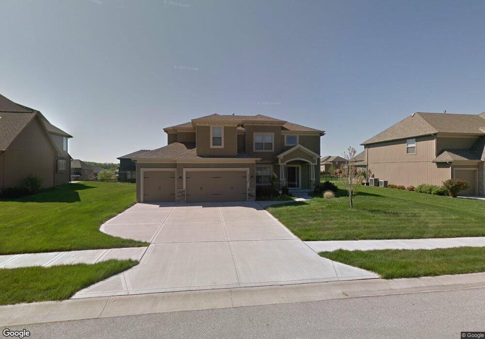
2713 NW Olmstead Dr Lees Summit, MO 64081
Estimated Value: $655,494 - $796,000
About This Home
This home is located at 2713 NW Olmstead Dr, Lees Summit, MO 64081 and is currently estimated at $716,874, approximately $269 per square foot. 2713 NW Olmstead Dr is a home located in Jackson County with nearby schools including Cedar Creek Elementary School, Pleasant Lea Middle School, and Lee's Summit Senior High School.
Ownership History
We collect this data history from publicly available records. To have your information removed, we recommend requesting removal directly through your county’s website.
Purchase Details
Home Financials for this Owner
Home Financials are based on the most recent Mortgage that was taken out on this home.Purchase Details
Home Financials for this Owner
Home Financials are based on the most recent Mortgage that was taken out on this home.Purchase Details
Home Financials for this Owner
Home Financials are based on the most recent Mortgage that was taken out on this home.Purchase Details
Home Financials for this Owner
Home Financials are based on the most recent Mortgage that was taken out on this home.Home Values in the Area
Average Home Value in this Area
Purchase History
We collect this data history from publicly available records. To have your information removed, we recommend requesting removal directly through your county’s website.
| Date | Buyer | Sale Price | Title Company |
|---|---|---|---|
| -- | Kansas City Title Inc | ||
| -- | Kansas City Title Inc | ||
| -- | Chicago Title | ||
| -- | Chicago Title |
Mortgage History
We collect this data history from publicly available records. To have your information removed, we recommend requesting removal directly through your county’s website.
| Date | Status | Borrower | Loan Amount |
|---|---|---|---|
| Previous Owner | $268,000 | ||
| Previous Owner | $361,550 | ||
| Previous Owner | $347,700 | ||
| Previous Owner | $284,000 |
Tax History
We collect this data history from publicly available records. To have your information removed, we recommend requesting removal directly through your county’s website.
| Year | Tax Paid | Tax Assessment Tax Assessment Total Assessment is a certain percentage of the fair market value that is determined by local assessors to be the total taxable value of land and additions on the property. | Land | Improvement |
|---|---|---|---|---|
| 2025 | $6,543 | $104,213 | $16,777 | $87,436 |
| 2024 | $6,496 | $90,621 | $12,293 | $78,328 |
| 2023 | $6,496 | $90,621 | $15,020 | $75,601 |
| 2022 | $6,687 | $82,840 | $13,350 | $69,490 |
| 2021 | $6,826 | $82,840 | $13,350 | $69,490 |
| 2020 | $6,561 | $78,850 | $13,350 | $65,500 |
| 2019 | $6,382 | $78,850 | $13,350 | $65,500 |
| 2018 | $6,496 | $74,484 | $11,619 | $62,865 |
| 2017 | $6,496 | $74,484 | $11,619 | $62,865 |
| 2016 | $6,398 | $72,618 | $14,934 | $57,684 |
| 2014 | $6,148 | $68,400 | $13,965 | $54,435 |
Map
- 202 NW Joshua Dr
- 129 NW Morton Dr
- 100 SW Gray Cir
- 341 NW Thoreau Cir
- 3121 SW Merriam Dr
- 336 NW Thoreau Cir
- 2905 SW Muir Dr
- 2634 SW Wintervalley Dr
- 2648 NW Ashurst Ln
- 2520 SW Winterbond Cir
- 317 NW Lovins
- 316 NW Lovins
- 320 NW Lovins
- 321 NW Lovins
- 232 SW Winterpark Cir
- 3104 NW Berkebile Ln
- 319 NW Rockwood Ct
- 321 NW Earle Ln
- 240 SW Winterpark Cir
- 2605 SW Winterview Cir
- 2709 NW Olmstead Dr
- 2717 NW Olmstead Dr
- 124 NW Morton Ct
- 2705 NW Olmstead Dr
- 2712 NW Olmstead Dr
- 2716 NW Olmstead Dr
- 117 NW Lewis Dr
- 120 NW Morton Ct
- 2708 NW Olmstead Dr
- 113 NW Lewis Dr
- 2720 NW Olmstead Dr
- 128 NW Morton Ct
- 2701 NW Olmstead Dr
- 109 NW Lewis Dr
- 2704 NW Olmstead Dr
- 2713 NW Thoreau Dr
- 2717 NW Thoreau Dr
- 2709 NW Thoreau Dr
- 105 NW Lewis Dr
- 2725 NW Thoreau Dr
Ask me questions while you tour the home.