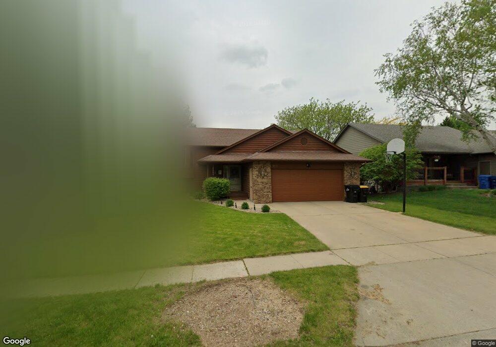
2713 S Groveland Ave Sioux Falls, SD 57110
East Side NeighborhoodEstimated Value: $381,000 - $408,000
5
Beds
3
Baths
2,523
Sq Ft
$157/Sq Ft
Est. Value
About This Home
This home is located at 2713 S Groveland Ave, Sioux Falls, SD 57110 and is currently estimated at $396,604, approximately $157 per square foot. 2713 S Groveland Ave is a home located in Minnehaha County with nearby schools including Harvey Dunn Elementary School, Washington High School, and Train Up A Child Preschool/Kindergarten.
Ownership History
Date
Name
Owned For
Owner Type
Purchase Details
Closed on
Apr 5, 2013
Sold by
Yarbrough Mark G and Yarbrough Jane E
Bought by
Sandholm Jessica L
Current Estimated Value
Home Financials for this Owner
Home Financials are based on the most recent Mortgage that was taken out on this home.
Original Mortgage
$181,649
Outstanding Balance
$129,833
Interest Rate
3.75%
Mortgage Type
FHA
Estimated Equity
$266,771
Create a Home Valuation Report for This Property
The Home Valuation Report is an in-depth analysis detailing your home's value as well as a comparison with similar homes in the area
Home Values in the Area
Average Home Value in this Area
Purchase History
| Date | Buyer | Sale Price | Title Company |
|---|---|---|---|
| Sandholm Jessica L | $185,000 | -- |
Source: Public Records
Mortgage History
| Date | Status | Borrower | Loan Amount |
|---|---|---|---|
| Open | Sandholm Jessica L | $181,649 |
Source: Public Records
Tax History Compared to Growth
Tax History
| Year | Tax Paid | Tax Assessment Tax Assessment Total Assessment is a certain percentage of the fair market value that is determined by local assessors to be the total taxable value of land and additions on the property. | Land | Improvement |
|---|---|---|---|---|
| 2024 | $4,604 | $342,100 | $29,400 | $312,700 |
| 2023 | $4,616 | $330,400 | $29,400 | $301,000 |
| 2022 | $4,687 | $316,800 | $27,400 | $289,400 |
| 2021 | $3,500 | $257,700 | $0 | $0 |
| 2020 | $3,500 | $225,700 | $0 | $0 |
| 2019 | $3,322 | $210,143 | $0 | $0 |
| 2018 | $3,040 | $205,453 | $0 | $0 |
| 2017 | $2,992 | $193,026 | $25,650 | $167,376 |
| 2016 | $2,992 | $190,063 | $25,650 | $164,413 |
| 2015 | $2,921 | $178,270 | $24,225 | $154,045 |
| 2014 | -- | $167,182 | $22,980 | $144,202 |
Source: Public Records
Map
Nearby Homes
- 4913 E 33rd St
- 2520 S Alpine Ave
- 5117 E Blueridge Dr
- 2709 S Chapelwood Ave
- 4504 E 36th St
- 2405 S Chapelwood Ave
- 4504 E Kearney Place
- 4423 E 37th St
- 4501 E Kearney Place
- 4700 E Alpine Cir
- 2813 S Cinnabar Cir
- 5015 E Newcastle St
- 2213 S Saddle Ridge Dr
- 5215 E Belmont St
- 5500 E Surrey Cir Cir
- 5501 E Morningside Cir
- 2309 S Red Oak Ave
- 2208 S Saddle Ridge Dr
- 4509 E Belmont St
- 5504 E Surrey Cir
- 2717 S Groveland Ave
- 2709 S Groveland Ave
- 2720 S Maywood Dr
- 2724 S Maywood Dr
- 4804 E 36th St
- 2714 S Maywood Dr
- 2721 S Groveland Ave
- 2705 S Groveland Ave
- 4800 E 36th St
- 2708 S Maywood Dr
- 2712 S Groveland Ave
- 2716 S Groveland Ave
- 2708 S Groveland Ave
- 2720 S Groveland Ave
- 4719 E 33rd St
- 4721 E 33rd St
- 2700 S Maywood Dr
- 2721 S Maywood Dr
- 2725 S Maywood Dr
- 2727 S Maywood Dr