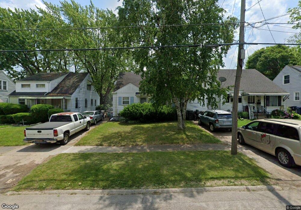
2713 Yale St Flint, MI 48503
Southwest Flint NeighborhoodEstimated Value: $77,854 - $93,000
3
Beds
1
Bath
1,188
Sq Ft
$71/Sq Ft
Est. Value
About This Home
This home is located at 2713 Yale St, Flint, MI 48503 and is currently estimated at $84,214, approximately $70 per square foot. 2713 Yale St is a home located in Genesee County with nearby schools including Eisenhower School, Flint Southwestern Classical Academy, and St. Paul Lutheran School.
Ownership History
Date
Name
Owned For
Owner Type
Purchase Details
Closed on
Jun 12, 2019
Sold by
Berry Joan and Cox James Michael
Bought by
Cox David
Current Estimated Value
Purchase Details
Closed on
Oct 9, 2009
Sold by
Donovan Shaun
Bought by
Cox James M
Purchase Details
Closed on
Feb 10, 2009
Sold by
Bank Of New York
Bought by
The Secretary Of Housing & Urban Develop
Purchase Details
Closed on
Aug 11, 2008
Sold by
Mortgage Electronic Registration Systems
Bought by
Bank Of New York and Cwmbs 2005-R1
Purchase Details
Closed on
Aug 6, 2008
Sold by
Speer Donald and Newbold Carrie
Bought by
Mortgage Electronic Registration Systems
Purchase Details
Closed on
Jun 10, 2004
Sold by
Mitchell Steven J and Mitchell Tonya M
Bought by
Speer Donald and Newbold Carrie
Create a Home Valuation Report for This Property
The Home Valuation Report is an in-depth analysis detailing your home's value as well as a comparison with similar homes in the area
Home Values in the Area
Average Home Value in this Area
Purchase History
| Date | Buyer | Sale Price | Title Company |
|---|---|---|---|
| Cox David | -- | None Available | |
| Cox James M | $15,110 | None Available | |
| The Secretary Of Housing & Urban Develop | -- | None Available | |
| Bank Of New York | -- | None Available | |
| Mortgage Electronic Registration Systems | $94,920 | None Available | |
| Speer Donald | $78,000 | Sargents Title Company |
Source: Public Records
Tax History Compared to Growth
Tax History
| Year | Tax Paid | Tax Assessment Tax Assessment Total Assessment is a certain percentage of the fair market value that is determined by local assessors to be the total taxable value of land and additions on the property. | Land | Improvement |
|---|---|---|---|---|
| 2025 | $1,387 | $29,000 | $0 | $0 |
| 2024 | $1,243 | $27,500 | $0 | $0 |
| 2023 | $1,213 | $22,300 | $0 | $0 |
| 2022 | $0 | $19,100 | $0 | $0 |
| 2021 | $1,361 | $20,300 | $0 | $0 |
| 2020 | $1,210 | $19,900 | $0 | $0 |
| 2019 | $984 | $15,500 | $0 | $0 |
| 2018 | $1,032 | $15,700 | $0 | $0 |
| 2017 | $1,045 | $0 | $0 | $0 |
| 2016 | $1,037 | $0 | $0 | $0 |
| 2015 | -- | $0 | $0 | $0 |
| 2014 | -- | $0 | $0 | $0 |
| 2012 | -- | $19,400 | $0 | $0 |
Source: Public Records
Map
Nearby Homes
- 1516 Gainey Ave
- 2608 Cumings Ave
- 2618 Brown St
- 2926 Yale St
- 3001 Yale St
- 2537 Swayze St
- 1126 Clancy Ave
- 1114 Clancy Ave
- 1326 Hughes Ave
- 2433 Brown St
- 2429 Brown St
- 1506 Downey St
- 1414 Knapp Ave
- 1725 Lincoln Dr
- 2509 Corunna Rd
- 1505 Downey St
- 1006 Hammond Ave
- 1318 Knapp Ave
- 2710 Reynolds St
- 3102 Westwood Pkwy