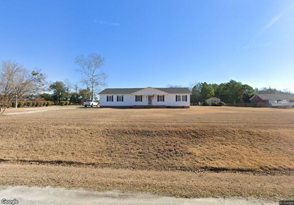
2714 Arthur Rd Florence, SC 29505
Estimated Value: $216,000 - $251,000
4
Beds
3
Baths
2,062
Sq Ft
$110/Sq Ft
Est. Value
About This Home
This home is located at 2714 Arthur Rd, Florence, SC 29505 and is currently estimated at $226,772, approximately $109 per square foot. 2714 Arthur Rd is a home located in Florence County with nearby schools including Greenwood Elementary School, Southside Middle School, and South Florence High School.
Ownership History
Date
Name
Owned For
Owner Type
Purchase Details
Closed on
Jun 8, 2019
Sold by
Byars Ralph L and Byars Jamie C
Bought by
Byars Ralph L and Byars Jamie C
Current Estimated Value
Purchase Details
Closed on
Jun 30, 2003
Sold by
Lawson Phillip Wayne and Lawson Angela L
Bought by
Byars Ralph L and Byars Jamie S
Create a Home Valuation Report for This Property
The Home Valuation Report is an in-depth analysis detailing your home's value as well as a comparison with similar homes in the area
Home Values in the Area
Average Home Value in this Area
Purchase History
| Date | Buyer | Sale Price | Title Company |
|---|---|---|---|
| Byars Ralph L | -- | None Available | |
| Byars Ralph L | $117,000 | -- |
Source: Public Records
Tax History Compared to Growth
Tax History
| Year | Tax Paid | Tax Assessment Tax Assessment Total Assessment is a certain percentage of the fair market value that is determined by local assessors to be the total taxable value of land and additions on the property. | Land | Improvement |
|---|---|---|---|---|
| 2024 | $557 | $6,207 | $551 | $5,656 |
| 2023 | $486 | $4,636 | $552 | $4,084 |
| 2022 | $658 | $4,636 | $552 | $4,084 |
| 2021 | $601 | $4,640 | $0 | $0 |
| 2020 | $606 | $4,640 | $0 | $0 |
| 2019 | $607 | $4,636 | $552 | $4,084 |
| 2018 | $546 | $4,640 | $0 | $0 |
| 2017 | $584 | $4,640 | $0 | $0 |
| 2016 | $492 | $4,640 | $0 | $0 |
| 2015 | $487 | $4,640 | $0 | $0 |
| 2014 | $456 | $4,636 | $552 | $4,084 |
Source: Public Records
Map
Nearby Homes
- 2120 Carriage Place Dr
- 2156 Waverly Woods Dr
- 12.44 Acres Claussen Rd
- 19.25 Acres Claussen Rd
- 15.15 Acres Claussen Rd
- 2137 Waverly Woods Dr
- 2104 Steeple View Dr
- 1604 Carlsbad Ln
- 2205 2207 Blass Dr
- 2618 Harleston Green Dr
- 1623 Kelly Dr
- 3073 Trent Dr
- 3091 West Ct
- 3104 Longfellow Dr
- 2413 S Purvis Dr
- 2613 Whitestone Dr
- 1432 Pamplico Hwy
- 3133 Haven Straits Rd
- 2600 Kingston Dr
- 1444 Cabrillo Dr
- 2706 Arthur Rd
- 2722 Arthur Rd
- 2715 Arthur Rd
- 2719 Arthur Rd
- 2709 Arthur Rd
- 2725 Arthur Rd
- 2703 Arthur Rd
- 2618 Arthur Rd
- 2720 Arthur Rd
- 2729 Arthur Rd
- 2733 Arthur Rd
- 2612 Arthur Rd
- 2728 Arthur Rd
- 2607 Claussen Rd
- 2635 Claussen Rd
- 2629 Claussen Rd
- 2604 Arthur Rd
- 2645 Claussen Rd
- 3041 Bridle Cir
- 2711 Sandifer Ln