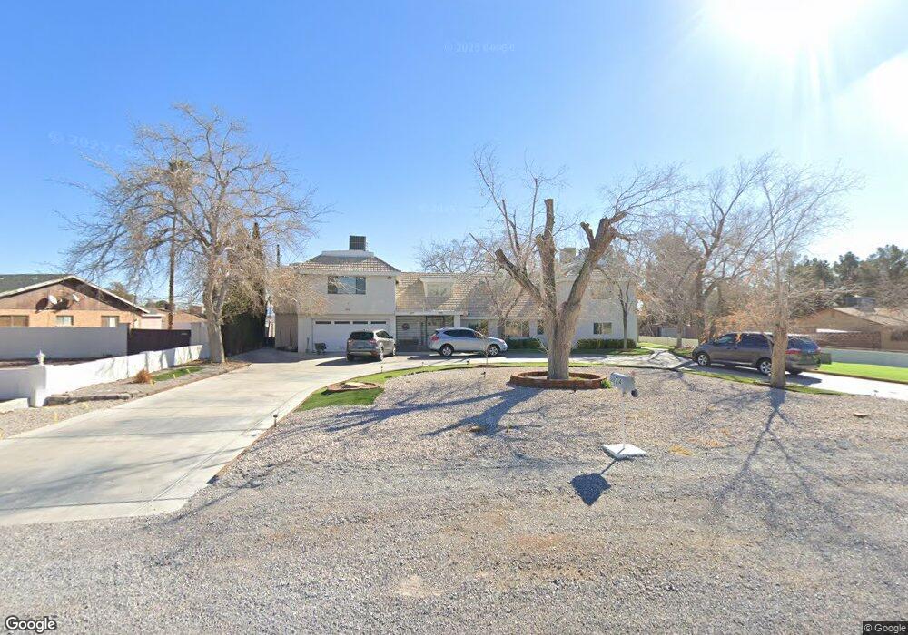
2714 Westwind Rd Las Vegas, NV 89146
Estimated Value: $893,717 - $1,593,000
7
Beds
6
Baths
5,481
Sq Ft
$220/Sq Ft
Est. Value
About This Home
This home is located at 2714 Westwind Rd, Las Vegas, NV 89146 and is currently estimated at $1,207,179, approximately $220 per square foot. 2714 Westwind Rd is a home located in Clark County with nearby schools including Elaine Wynn Elementary School, Dr. C Owen Roundy Elementary School, and Kenny C Guinn Middle School.
Ownership History
Date
Name
Owned For
Owner Type
Purchase Details
Closed on
Sep 11, 2024
Sold by
Westwind Trust and Tingey Dean Merritt
Bought by
Tingey Lucksanawadee Juljue
Current Estimated Value
Purchase Details
Closed on
Sep 10, 2024
Sold by
Tingey Lucksanawadee Juljue
Bought by
Ljt Trust and Tingey
Purchase Details
Closed on
Jan 26, 2018
Sold by
Tingey Don C and Tingey Dean Merritt
Bought by
Tingey Don C and Tingey Dean Merritt
Purchase Details
Closed on
Jun 16, 2006
Sold by
Tingey Don C and Tingey Judith W
Bought by
Tingey Don C and Tingey Judith W
Create a Home Valuation Report for This Property
The Home Valuation Report is an in-depth analysis detailing your home's value as well as a comparison with similar homes in the area
Home Values in the Area
Average Home Value in this Area
Purchase History
| Date | Buyer | Sale Price | Title Company |
|---|---|---|---|
| Tingey Lucksanawadee Juljue | -- | None Listed On Document | |
| Ljt Trust | -- | None Listed On Document | |
| Tingey Don C | -- | None Available | |
| Tingey Don C | -- | None Available |
Source: Public Records
Tax History Compared to Growth
Tax History
| Year | Tax Paid | Tax Assessment Tax Assessment Total Assessment is a certain percentage of the fair market value that is determined by local assessors to be the total taxable value of land and additions on the property. | Land | Improvement |
|---|---|---|---|---|
| 2025 | $3,834 | $167,140 | $77,350 | $89,790 |
| 2024 | $3,550 | $167,140 | $77,350 | $89,790 |
| 2023 | $3,550 | $159,876 | $77,350 | $82,526 |
| 2022 | $3,447 | $142,801 | $68,250 | $74,551 |
| 2021 | $3,347 | $130,609 | $60,515 | $70,094 |
| 2020 | $3,246 | $127,736 | $59,150 | $68,586 |
| 2019 | $3,152 | $117,199 | $47,775 | $69,424 |
| 2018 | $3,060 | $116,130 | $47,775 | $68,355 |
| 2017 | $3,486 | $118,874 | $47,775 | $71,099 |
| 2016 | $2,897 | $99,470 | $25,200 | $74,270 |
| 2015 | $2,892 | $95,661 | $21,000 | $74,661 |
| 2014 | $2,807 | $94,874 | $21,000 | $73,874 |
Source: Public Records
Map
Nearby Homes
- 2675 Westwind Rd
- 2645 Lindell Rd
- 2625 Westwind Rd
- 2885 Duneville St
- 5785 Edna Ave
- 5414 Stampa Ave
- 2691 Rimpacific Cir
- 5181 Eldora Ave
- 2814 Edmond St Unit 2
- 2622 Rimpacific Cir
- 5336 Regal Ave
- 5117 Eldora Ave Unit 4
- 0 Palmyra Unit 2715168
- 3090 Westwind Rd
- 3085 Duneville St
- 0 S Bronco St
- 5045 Stampa Ave
- 5048 Via de Palma Dr
- 2175 Westwind Rd
- 2221 Mohawk St
- 5613 Eldora Ave
- 2750 Westwind Rd
- 2281 Westwind Rd
- 0 Westwind Rd
- 5595 Eldora Ave
- 2766 Westwind Rd
- 2715 Westwind Rd
- 2745 Westwind Rd
- 5545 Eldora Ave
- 5545 Eldora Ave Unit n/a
- 5700 Eldora Ave
- 2765 Westwind Rd
- 5640 Eldora Ave
- 5610 Eldora Ave
- 5580 Eldora Ave
- 2795 Lindell Rd
- 2745 Lindell Rd
- 2715 Lindell Rd
- 2785 Westwind Rd
- 2775 Lindell Rd