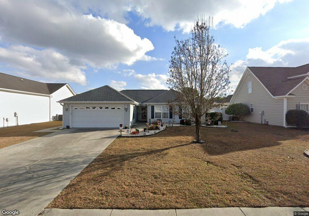
2715 Canvasback Trail Myrtle Beach, SC 29588
Estimated Value: $289,443 - $307,000
3
Beds
2
Baths
1,447
Sq Ft
$206/Sq Ft
Est. Value
About This Home
This home is located at 2715 Canvasback Trail, Myrtle Beach, SC 29588 and is currently estimated at $298,111, approximately $206 per square foot. 2715 Canvasback Trail is a home located in Horry County with nearby schools including Forestbrook Elementary School, Forestbrook Middle School, and Socastee High School.
Ownership History
Date
Name
Owned For
Owner Type
Purchase Details
Closed on
Mar 16, 2001
Sold by
Royal Oaks Construction Inc
Bought by
Suzzo Benjamin and Suzzo Catherine
Current Estimated Value
Home Financials for this Owner
Home Financials are based on the most recent Mortgage that was taken out on this home.
Original Mortgage
$105,500
Interest Rate
7.02%
Mortgage Type
Purchase Money Mortgage
Purchase Details
Closed on
Sep 29, 2000
Sold by
Hunters Ridge Of Myrtle Beach Inc
Bought by
Franc Ellen
Create a Home Valuation Report for This Property
The Home Valuation Report is an in-depth analysis detailing your home's value as well as a comparison with similar homes in the area
Home Values in the Area
Average Home Value in this Area
Purchase History
| Date | Buyer | Sale Price | Title Company |
|---|---|---|---|
| Suzzo Benjamin | $131,900 | -- | |
| Royal Oaks Construction Inc | $24,900 | -- | |
| Franc Ellen | $33,900 | -- |
Source: Public Records
Mortgage History
| Date | Status | Borrower | Loan Amount |
|---|---|---|---|
| Previous Owner | Royal Oaks Construction Inc | $105,500 |
Source: Public Records
Tax History
| Year | Tax Paid | Tax Assessment Tax Assessment Total Assessment is a certain percentage of the fair market value that is determined by local assessors to be the total taxable value of land and additions on the property. | Land | Improvement |
|---|---|---|---|---|
| 2025 | $551 | $0 | $0 | $0 |
| 2024 | $551 | $11,342 | $4,021 | $7,321 |
| 2023 | $551 | $6,101 | $1,126 | $4,975 |
| 2021 | $477 | $6,838 | $1,282 | $5,556 |
| 2020 | $575 | $6,838 | $1,282 | $5,556 |
| 2019 | $575 | $6,838 | $1,282 | $5,556 |
| 2018 | $519 | $5,304 | $968 | $4,336 |
| 2017 | $504 | $5,304 | $968 | $4,336 |
| 2016 | -- | $5,304 | $968 | $4,336 |
| 2015 | $504 | $5,305 | $969 | $4,336 |
| 2014 | $466 | $5,305 | $969 | $4,336 |
Source: Public Records
Map
Nearby Homes
- 2540 Bearstand Trail
- 2459 Hunters Trail
- 2560 Wild Game Trail Unit Hunters Ridge
- 281 La Patos Dr
- 2611 Ringneck Trail
- 425 Dog Pen Ct
- 2425 Hunters Trail
- 400 Dog Pen Ct
- 780 Harrison Mill St
- 746 Harrison Mill St
- 3312 Piney Woods Way
- 2410 Hunters Trail
- 407 Big Woods Ct
- 837 Harrison Mill St
- 629 Cottontail Trail Unit Hunters Ridge Crossi
- 317 Forestbrook Cove Cir
- 6096 Zoe Way Unit 819
- 6108 Zoe Way Unit 822
- 6100 Zoe Way Unit 820
- 125 Marsh Rabbit Dr
- 2713 Canvasback Trail
- 2717 Canvasback Trail
- LOT 182 Canvasback Trail
- 2711 Canvasback Trail
- 2719 Canvasback Trail
- 2619 Corn Pile Rd
- 2716 Canvasback Trail
- 2709 Canvasback Trail
- 2712 Canvasback Trail
- 2721 Canvasback Trail
- 2617 Corn Pile Rd
- 2710 Canvasback Trail
- 2625 Corn Pile Rd
- 2625 Corn Pile Rd
- 2718 Canvasback Trail
- 2707 Canvasback Trail
- 2615 Corn Pile Rd
- 2720 Canvasback Trail
- 2627 Corn Pile Rd
- 2708 Canvasback Trail
Your Personal Tour Guide
Ask me questions while you tour the home.