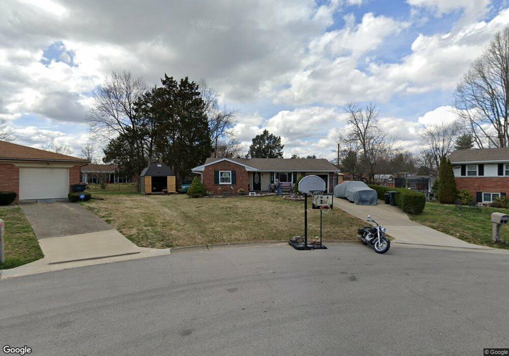
2715 Mohawk Dr New Albany, IN 47150
Estimated Value: $199,000 - $225,000
3
Beds
2
Baths
1,040
Sq Ft
$202/Sq Ft
Est. Value
About This Home
This home is located at 2715 Mohawk Dr, New Albany, IN 47150 and is currently estimated at $210,226, approximately $202 per square foot. 2715 Mohawk Dr is a home located in Floyd County with nearby schools including Hazelwood Middle School, New Albany Senior High School, and Holy Family School.
Ownership History
Date
Name
Owned For
Owner Type
Purchase Details
Closed on
Jun 27, 2016
Sold by
Phillimore Elizabeth C
Bought by
Sparrow Jacqueline K
Current Estimated Value
Home Financials for this Owner
Home Financials are based on the most recent Mortgage that was taken out on this home.
Original Mortgage
$115,764
Outstanding Balance
$92,534
Interest Rate
3.62%
Mortgage Type
FHA
Estimated Equity
$117,692
Purchase Details
Closed on
Mar 15, 2007
Sold by
Fannie Mae
Bought by
Stacy Elizabeth
Home Financials for this Owner
Home Financials are based on the most recent Mortgage that was taken out on this home.
Original Mortgage
$78,000
Interest Rate
6.31%
Mortgage Type
New Conventional
Purchase Details
Closed on
Nov 30, 2006
Sold by
Nash Donald M
Bought by
Federal National Mortgage Association
Purchase Details
Closed on
Nov 10, 2006
Sold by
Nash Dunald M and Nash Alecia M
Bought by
Federal National Mortgage Association
Create a Home Valuation Report for This Property
The Home Valuation Report is an in-depth analysis detailing your home's value as well as a comparison with similar homes in the area
Home Values in the Area
Average Home Value in this Area
Purchase History
| Date | Buyer | Sale Price | Title Company |
|---|---|---|---|
| Sparrow Jacqueline K | -- | -- | |
| Stacy Elizabeth | -- | None Available | |
| Federal National Mortgage Association | -- | None Available | |
| Federal National Mortgage Association | $99,359 | None Available |
Source: Public Records
Mortgage History
| Date | Status | Borrower | Loan Amount |
|---|---|---|---|
| Open | Sparrow Jacqueline K | $115,764 | |
| Previous Owner | Stacy Elizabeth | $78,000 |
Source: Public Records
Tax History Compared to Growth
Tax History
| Year | Tax Paid | Tax Assessment Tax Assessment Total Assessment is a certain percentage of the fair market value that is determined by local assessors to be the total taxable value of land and additions on the property. | Land | Improvement |
|---|---|---|---|---|
| 2024 | $1,800 | $170,500 | $20,700 | $149,800 |
| 2023 | $1,894 | $178,900 | $20,700 | $158,200 |
| 2022 | $1,661 | $156,700 | $20,700 | $136,000 |
| 2021 | $1,508 | $141,700 | $20,700 | $121,000 |
| 2020 | $1,484 | $139,300 | $20,700 | $118,600 |
| 2019 | $1,280 | $127,400 | $20,700 | $106,700 |
| 2018 | $1,277 | $127,800 | $20,700 | $107,100 |
| 2017 | $1,284 | $126,700 | $20,700 | $106,000 |
| 2016 | $1,172 | $125,500 | $20,700 | $104,800 |
| 2014 | $981 | $107,100 | $20,800 | $86,300 |
| 2013 | -- | $104,200 | $20,700 | $83,500 |
Source: Public Records
Map
Nearby Homes
- 602 Navajo Dr
- 6369 Indiana 111
- 528 Drawbrook Cir
- 805 Elmwood Ave
- 823 Elmwood Ave
- 2403 Jacobs Dr
- 2251 Park Ave
- 8 Robin Ct
- 2928 Green Valley Rd
- 37 Nassau Dr
- 3105 Murr Ln
- 2550 Broadway St
- 2548 Broadway St
- 1809 Vance Ave
- 1833 Grant Line Rd
- 1464 South St
- 2218 Fairmont Ave
- 2206 Green Valley Rd
- 301 Country Club Dr
- 1418 Vance Ave
- 2713 Mohawk Dr
- 2714 Navajo Dr
- 2716 Navajo Dr
- 511 Cherokee Dr
- 513 Cherokee Dr
- 2712 Navajo Dr
- 515 Cherokee Dr
- 2711 Mohawk Dr
- 509 Cherokee Dr
- 2710 Navajo Dr
- 517 Cherokee Dr
- 2710 Mohawk Dr
- 2718 Mohawk Dr
- 2721 Mohawk Dr
- 512 Navajo Dr
- 510 Navajo Dr
- 519 Cherokee Dr
- 2715 Navajo Dr
- 508 Navajo Dr
- 510 Cherokee Dr