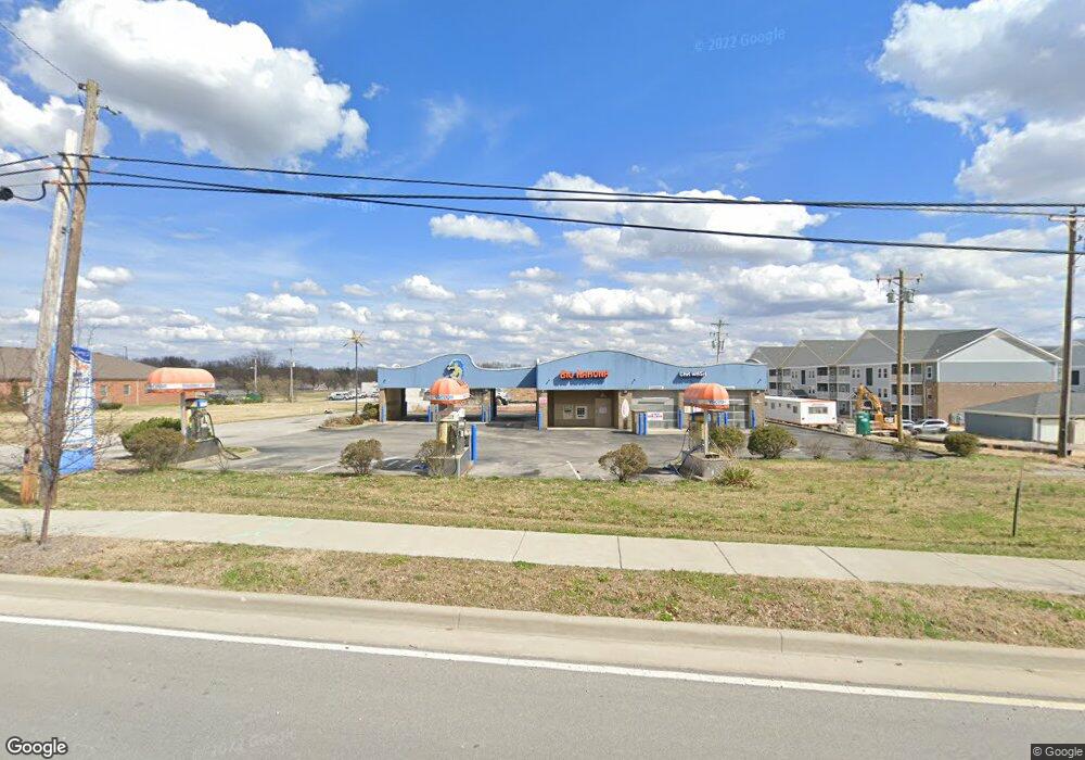
2716 Grant Line Rd New Albany, IN 47150
--
Bed
--
Bath
--
Sq Ft
0.57
Acres
About This Home
This home is located at 2716 Grant Line Rd, New Albany, IN 47150. 2716 Grant Line Rd is a home located in Floyd County with nearby schools including Hazelwood Middle School, New Albany Senior High School, and Our Lady of Perpetual Help School.
Ownership History
Date
Name
Owned For
Owner Type
Purchase Details
Closed on
Jun 1, 2021
Sold by
Ejw Investments Llc
Bought by
Shg 2716 Llc
Purchase Details
Closed on
Apr 21, 2017
Sold by
Lakeland West Capital Iv Llc
Bought by
Ejw Investment Llc
Home Financials for this Owner
Home Financials are based on the most recent Mortgage that was taken out on this home.
Original Mortgage
$200,200
Interest Rate
4.23%
Mortgage Type
Commercial
Purchase Details
Closed on
Jul 15, 2014
Sold by
Floyd County Sheriff
Bought by
Lakeland West Capital Iv Llc
Create a Home Valuation Report for This Property
The Home Valuation Report is an in-depth analysis detailing your home's value as well as a comparison with similar homes in the area
Home Values in the Area
Average Home Value in this Area
Purchase History
| Date | Buyer | Sale Price | Title Company |
|---|---|---|---|
| Shg 2716 Llc | -- | Louisville Title | |
| Ejw Investment Llc | -- | Paul B Conway, Attorney At Law | |
| Lakeland West Capital Iv Llc | $500,000 | -- |
Source: Public Records
Mortgage History
| Date | Status | Borrower | Loan Amount |
|---|---|---|---|
| Previous Owner | Ejw Investment Llc | $200,200 |
Source: Public Records
Tax History Compared to Growth
Tax History
| Year | Tax Paid | Tax Assessment Tax Assessment Total Assessment is a certain percentage of the fair market value that is determined by local assessors to be the total taxable value of land and additions on the property. | Land | Improvement |
|---|---|---|---|---|
| 2024 | $7,389 | $263,000 | $149,700 | $113,300 |
| 2023 | $11,703 | $297,100 | $149,700 | $147,400 |
| 2022 | $6,189 | $213,500 | $149,700 | $63,800 |
| 2021 | $6,721 | $230,700 | $149,700 | $81,000 |
| 2020 | $6,558 | $230,700 | $149,700 | $81,000 |
| 2019 | $6,350 | $230,700 | $149,700 | $81,000 |
| 2018 | $6,995 | $254,700 | $149,700 | $105,000 |
| 2017 | $7,059 | $253,000 | $149,700 | $103,300 |
| 2016 | $10,075 | $389,700 | $249,500 | $140,200 |
| 2014 | $12,942 | $457,500 | $249,500 | $208,000 |
| 2013 | -- | $450,800 | $249,500 | $201,300 |
Source: Public Records
Map
Nearby Homes
- 6369 Indiana 111
- 805 Elmwood Ave
- 823 Elmwood Ave
- 816 Elmwood Ave
- 8 Robin Ct
- 528 Drawbrook Cir
- 2550 Broadway St
- 2548 Broadway St
- 3105 Murr Ln
- 511 E Daisy Ln
- 2424 Stover Dr
- 627 Roseview Terrace
- 1749 McDonald Ln
- 205 Robin Lynne Dr
- 2218 Fairmont Ave
- 61 Wolfe Trace Ct
- 1324 Roosevelt Ave
- 2115 Loop Island Way
- 2111 Loop Island Way
- 2103 Loop Island Way
- 2722 Grant Line Rd
- 710 Cherokee Dr
- 711 Cherokee Dr
- 2818 Grant Line Rd
- 708 Cherokee Dr
- 709 Cherokee Dr
- 710 Navajo Dr
- 706 Cherokee Dr
- 2820 Grant Line Rd
- 708 Navajo Dr
- 2818 2820 Grantline Rd
- 707 Cherokee Dr
- 704 Cherokee Dr
- 706 Navajo Dr
- 705 Cherokee Dr
- 702 Cherokee Dr
- 614 Cherokee Dr
- 703 Cherokee Dr
- 711 Navajo Dr
- 704 Navajo Dr