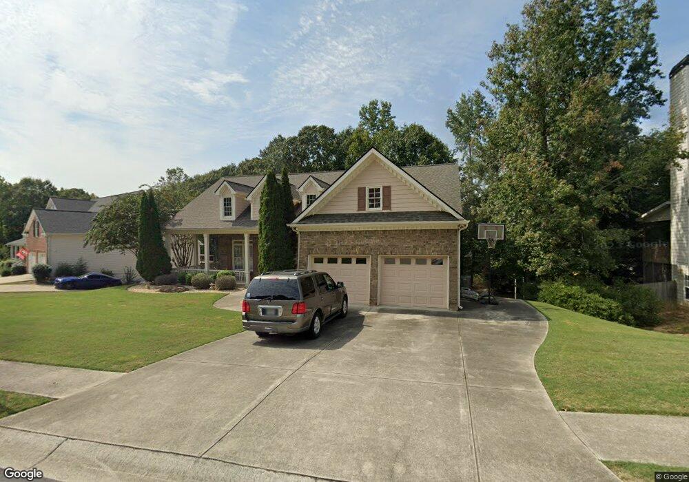
2717 Legislative Ln Unit 1 Buford, GA 30519
Estimated Value: $535,000 - $568,000
3
Beds
4
Baths
2,443
Sq Ft
$227/Sq Ft
Est. Value
About This Home
This home is located at 2717 Legislative Ln Unit 1, Buford, GA 30519 and is currently estimated at $555,402, approximately $227 per square foot. 2717 Legislative Ln Unit 1 is a home located in Hall County with nearby schools including Friendship Elementary School, Cherokee Bluff Middle School, and Cherokee Bluff High School.
Ownership History
Date
Name
Owned For
Owner Type
Purchase Details
Closed on
May 10, 2006
Sold by
Property Asset Management Inc
Bought by
Rodriguez Marie
Current Estimated Value
Home Financials for this Owner
Home Financials are based on the most recent Mortgage that was taken out on this home.
Original Mortgage
$336,210
Interest Rate
6.55%
Mortgage Type
New Conventional
Purchase Details
Closed on
Mar 7, 2006
Sold by
Addison Doris A
Bought by
Property Asset Management Inc
Purchase Details
Closed on
Mar 28, 2003
Sold by
Willow Brook Builders Inc
Bought by
Addison Doris A
Home Financials for this Owner
Home Financials are based on the most recent Mortgage that was taken out on this home.
Original Mortgage
$205,400
Interest Rate
5.5%
Mortgage Type
New Conventional
Purchase Details
Closed on
Feb 11, 2002
Sold by
Chateau Corners Development Corp
Bought by
Willow Brook Builders Inc
Create a Home Valuation Report for This Property
The Home Valuation Report is an in-depth analysis detailing your home's value as well as a comparison with similar homes in the area
Home Values in the Area
Average Home Value in this Area
Purchase History
| Date | Buyer | Sale Price | Title Company |
|---|---|---|---|
| Rodriguez Marie | $333,000 | -- | |
| Property Asset Management Inc | $314,768 | -- | |
| Property Asset Management Inc | $314,800 | -- | |
| Addison Doris A | $273,900 | -- | |
| Willow Brook Builders Inc | $440,000 | -- |
Source: Public Records
Mortgage History
| Date | Status | Borrower | Loan Amount |
|---|---|---|---|
| Previous Owner | Rodriguez Marie | $336,210 | |
| Previous Owner | Addison Doris A | $205,400 |
Source: Public Records
Tax History Compared to Growth
Tax History
| Year | Tax Paid | Tax Assessment Tax Assessment Total Assessment is a certain percentage of the fair market value that is determined by local assessors to be the total taxable value of land and additions on the property. | Land | Improvement |
|---|---|---|---|---|
| 2024 | $1,795 | $214,280 | $41,200 | $173,080 |
| 2023 | $4,368 | $174,040 | $29,200 | $144,840 |
| 2022 | $4,458 | $170,520 | $27,600 | $142,920 |
| 2021 | $3,937 | $147,800 | $17,000 | $130,800 |
| 2020 | $3,972 | $144,880 | $17,000 | $127,880 |
| 2019 | $3,784 | $136,800 | $16,000 | $120,800 |
| 2018 | $3,860 | $135,080 | $16,000 | $119,080 |
| 2017 | $3,695 | $126,200 | $12,000 | $114,200 |
| 2016 | $3,149 | $110,150 | $12,030 | $98,120 |
| 2015 | $3,233 | $110,150 | $12,030 | $98,120 |
| 2014 | $3,233 | $112,209 | $12,030 | $100,179 |
Source: Public Records
Map
Nearby Homes
- 2638 Democracy Dr Unit 1
- 2342 Sparta Way
- 3088 Lantana Way
- 3138 Lantana Way
- 2228 Mayors Way
- 3134 Perimeter Cir
- Sierra Plan at Sherwood Square
- Sawnee Plan at Sherwood Square
- 7289 Mulberry Trace Ln Unit LOT 178
- 7296 Mulberry Trace Ln Unit LOT 180
- 7296 Mulberry Trace Ln
- 7300 Mulberry Trace Ln
- 7300 Mulberry Trace Ln Unit LOT 181
- 7304 Mulberry Trace Ln Unit LOT 182
- 7304 Mulberry Trace Ln
- 7235 Coral Lake Dr
- 7308 Mulberry Trace Ln Unit LOT 183
- 7308 Mulberry Trace Ln
- 7312 Mulberry Trace Ln Unit LOT 184
- 7312 Mulberry Trace Ln
- 2713 Legislative Ln
- 2628 Democracy Dr Unit 1
- 2709 Legislative Ln Unit 1
- 2718 Legislative Ln Unit 1
- 2722 Legislative Ln
- 2710 Legislative Ln
- 2726 Legislative Ln
- 2729 Legislative Ln
- 2637 Democracy Dr
- 2633 Democracy Dr
- 2620 Democracy Dr Unit 1
- 2705 Legislative Ln
- 2623 Democracy Dr
- 2730 Legislative Ln
- 2735 Legislative Ln
- 2706 Legislative Ln Unit 1
- 0 Executive Ct Unit 7174293
- 2751 Executive Ct
- 2747 Executive Ct
- 2734 Legislative Ln