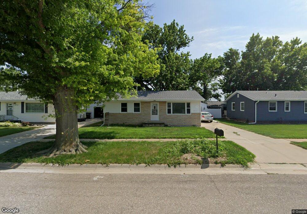
2717 W 9th St Hastings, NE 68901
Estimated Value: $169,000 - $194,000
2
Beds
1
Bath
864
Sq Ft
$210/Sq Ft
Est. Value
About This Home
This home is located at 2717 W 9th St, Hastings, NE 68901 and is currently estimated at $181,379, approximately $209 per square foot. 2717 W 9th St is a home located in Adams County with nearby schools including Hastings Senior High School, St. Michael's Preschool & Elementary School, and Zion Lutheran School.
Ownership History
Date
Name
Owned For
Owner Type
Purchase Details
Closed on
Sep 28, 2020
Sold by
Zubrod Joel L and Zubrod Janel
Bought by
Nutz Jacob C
Current Estimated Value
Home Financials for this Owner
Home Financials are based on the most recent Mortgage that was taken out on this home.
Original Mortgage
$126,417
Outstanding Balance
$112,441
Interest Rate
2.9%
Mortgage Type
FHA
Estimated Equity
$68,938
Purchase Details
Closed on
Sep 13, 2016
Sold by
Zubrod Joel L
Bought by
Zubrod Joel L and Mavon C Zubrod Family Trust
Purchase Details
Closed on
Dec 19, 2007
Sold by
Zubrod Curtis J and Zubrod Mavon C
Bought by
Zubrod Curtis J and Zubrod Mavon C
Purchase Details
Closed on
Nov 30, 2007
Sold by
Hughes Harold R and Hughes Carmen N
Bought by
Zubrod Curtis J and Zubrod Mavon C
Create a Home Valuation Report for This Property
The Home Valuation Report is an in-depth analysis detailing your home's value as well as a comparison with similar homes in the area
Home Values in the Area
Average Home Value in this Area
Purchase History
| Date | Buyer | Sale Price | Title Company |
|---|---|---|---|
| Nutz Jacob C | $129,000 | None Available | |
| Zubrod Joel L | -- | None Available | |
| Zubrod Curtis J | -- | None Available | |
| Zubrod Curtis J | $30,000 | None Available |
Source: Public Records
Mortgage History
| Date | Status | Borrower | Loan Amount |
|---|---|---|---|
| Open | Nutz Jacob C | $126,417 |
Source: Public Records
Tax History Compared to Growth
Tax History
| Year | Tax Paid | Tax Assessment Tax Assessment Total Assessment is a certain percentage of the fair market value that is determined by local assessors to be the total taxable value of land and additions on the property. | Land | Improvement |
|---|---|---|---|---|
| 2024 | $1,965 | $123,088 | $21,285 | $101,803 |
| 2023 | $2,412 | $116,891 | $21,285 | $95,606 |
| 2022 | $2,423 | $107,573 | $21,285 | $86,288 |
| 2021 | $2,198 | $100,238 | $17,269 | $82,969 |
| 2020 | $2,076 | $96,287 | $17,269 | $79,018 |
| 2019 | $1,929 | $90,434 | $17,269 | $73,165 |
| 2018 | $1,796 | $83,725 | $12,050 | $71,675 |
| 2017 | $1,764 | $82,320 | $0 | $0 |
| 2016 | $1,667 | $77,725 | $12,050 | $65,675 |
| 2011 | -- | $0 | $0 | $0 |
Source: Public Records
Map
Nearby Homes
- 2707 W 9th St
- 2521 Boyce St
- 2416 W 9th St
- 2501 W 10th St
- 2616 W 6th St
- 2330 W 11th St
- 2229 W 8th St
- 2301 Bateman Ave
- 401 Sunset Dr
- 2319 W 5th St
- 736 N Barnes Ave
- 909 Brentwood Ave
- 2616 Butterfoot Ln
- 711 Crane Ave
- 2708 Edgewood Ln
- 1513 Crane Ave
- 1505 Crane Ave
- 1314 N Laird Ave
- 1911 W 11th St
- 1402 Arapahoe Ave