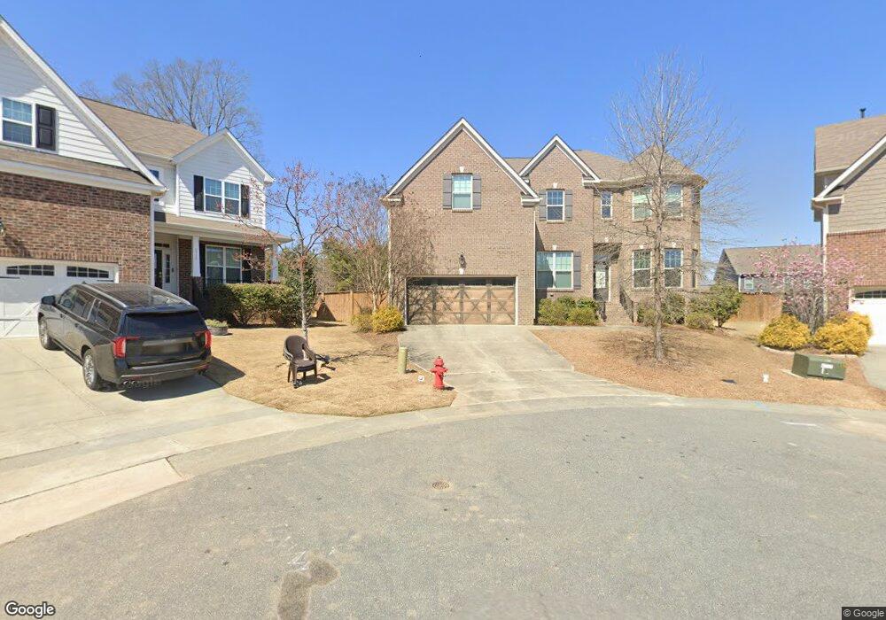
2718 Fort Fisher Trace Apex, NC 27502
Friendship NeighborhoodEstimated Value: $828,596 - $947,000
--
Bed
1
Bath
3,483
Sq Ft
$255/Sq Ft
Est. Value
About This Home
This home is located at 2718 Fort Fisher Trace, Apex, NC 27502 and is currently estimated at $886,899, approximately $254 per square foot. 2718 Fort Fisher Trace is a home with nearby schools including Apex Friendship Elementary, Apex Friendship Middle School, and Apex Friendship High School.
Ownership History
Date
Name
Owned For
Owner Type
Purchase Details
Closed on
Jan 24, 2015
Sold by
Lennar Carolinas Llc
Bought by
Narayanan Binu and Somaraj Kollamparambil Srutt
Current Estimated Value
Home Financials for this Owner
Home Financials are based on the most recent Mortgage that was taken out on this home.
Original Mortgage
$340,886
Outstanding Balance
$260,234
Interest Rate
3.75%
Mortgage Type
New Conventional
Estimated Equity
$626,665
Create a Home Valuation Report for This Property
The Home Valuation Report is an in-depth analysis detailing your home's value as well as a comparison with similar homes in the area
Home Values in the Area
Average Home Value in this Area
Purchase History
| Date | Buyer | Sale Price | Title Company |
|---|---|---|---|
| Narayanan Binu | $455,000 | None Available |
Source: Public Records
Mortgage History
| Date | Status | Borrower | Loan Amount |
|---|---|---|---|
| Open | Narayanan Binu | $340,886 |
Source: Public Records
Tax History Compared to Growth
Tax History
| Year | Tax Paid | Tax Assessment Tax Assessment Total Assessment is a certain percentage of the fair market value that is determined by local assessors to be the total taxable value of land and additions on the property. | Land | Improvement |
|---|---|---|---|---|
| 2025 | $6,874 | $785,046 | $140,000 | $645,046 |
| 2024 | $6,720 | $785,046 | $140,000 | $645,046 |
| 2023 | $5,196 | $471,867 | $107,000 | $364,867 |
| 2022 | $4,878 | $471,867 | $107,000 | $364,867 |
| 2021 | $4,691 | $471,867 | $107,000 | $364,867 |
| 2020 | $4,644 | $471,867 | $107,000 | $364,867 |
| 2019 | $5,142 | $450,962 | $118,000 | $332,962 |
| 2018 | $4,843 | $450,962 | $118,000 | $332,962 |
| 2017 | $4,507 | $450,962 | $118,000 | $332,962 |
| 2016 | $4,442 | $450,962 | $118,000 | $332,962 |
| 2015 | $3,495 | $94,000 | $94,000 | $0 |
| 2014 | $910 | $94,000 | $94,000 | $0 |
Source: Public Records
Map
Nearby Homes
- 2701 Sugar Mountain Way
- 2704 Bushy Lake Cove
- 0-0 Mount Zion Church Rd
- 0 Mount Zion Church Rd
- 2508 Whistling Quail Run
- 610 Cable Ct
- 616 Cable Ct
- 2751 Lake Waccamaw Trail
- 1956 Lazio Ln
- 614 Cable Ct
- 2048 Lazio Ln
- 2876 MacIntosh Woods Dr
- 1913 Stanlake Dr
- 2849 Dallas Valley Ln
- 1897 Lazio Ln
- 2805 Evans Rd
- 2908 Evans Rd
- 2928 Murray Ridge Trail
- 3112 Mavisbank Cir
- Elizabeth Plan at Friendship Village - Single-Family
- 2719 Fort Fisher Trace
- 2712 Fort Fisher Trace
- 2719 Bushy Lake Cove
- 2715 Fort Fisher Trace
- 2715 Bushy Lake Cove
- 2706 Fort Fisher Trace
- 2723 Bushy Lake Cove
- 1959 Baldhead Island Dr
- 1963 Baldhead Island Dr
- 1955 Baldhead Island Dr
- 2421 Mount Zion Church Rd
- 2709 Bushy Lake Cove
- 1967 Baldhead Island Dr
- 1951 Baldhead Island Dr
- 1971 Bald Head Island Dr
- 1971 Baldhead Island Dr
- 2711 Fort Fisher Trace
- 2724 Bushy Lake Cove
- 2705 Bushy Lake Cove
- 1918 Firenza Dr