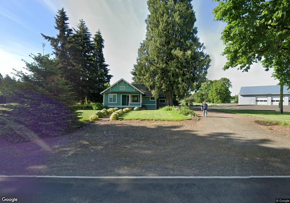
27196 W Ingram Island Rd Monroe, OR 97456
Estimated Value: $604,000 - $707,585
3
Beds
1
Bath
1,450
Sq Ft
$467/Sq Ft
Est. Value
About This Home
This home is located at 27196 W Ingram Island Rd, Monroe, OR 97456 and is currently estimated at $676,896, approximately $466 per square foot. 27196 W Ingram Island Rd is a home located in Benton County with nearby schools including Monroe Grade School and Monroe High School.
Ownership History
Date
Name
Owned For
Owner Type
Purchase Details
Closed on
Jan 9, 2007
Sold by
Gibson Scott W and Gibson Angela F
Bought by
Krot Paul and Krot Karen Y
Current Estimated Value
Home Financials for this Owner
Home Financials are based on the most recent Mortgage that was taken out on this home.
Original Mortgage
$200,000
Outstanding Balance
$118,920
Interest Rate
6.12%
Mortgage Type
Unknown
Estimated Equity
$557,976
Purchase Details
Closed on
Jul 21, 2000
Sold by
Lindsey Teddy A
Bought by
Gibson Scott W and Gibson Angela F
Home Financials for this Owner
Home Financials are based on the most recent Mortgage that was taken out on this home.
Original Mortgage
$147,250
Interest Rate
8.2%
Create a Home Valuation Report for This Property
The Home Valuation Report is an in-depth analysis detailing your home's value as well as a comparison with similar homes in the area
Home Values in the Area
Average Home Value in this Area
Purchase History
| Date | Buyer | Sale Price | Title Company |
|---|---|---|---|
| Krot Paul | $330,000 | First American Title | |
| Gibson Scott W | $155,000 | Western Pioneer Title Co |
Source: Public Records
Mortgage History
| Date | Status | Borrower | Loan Amount |
|---|---|---|---|
| Open | Krot Paul | $200,000 | |
| Previous Owner | Gibson Scott W | $147,250 |
Source: Public Records
Tax History Compared to Growth
Tax History
| Year | Tax Paid | Tax Assessment Tax Assessment Total Assessment is a certain percentage of the fair market value that is determined by local assessors to be the total taxable value of land and additions on the property. | Land | Improvement |
|---|---|---|---|---|
| 2024 | $2,707 | $207,352 | -- | -- |
| 2023 | $2,558 | $201,299 | $0 | $0 |
| 2022 | $2,492 | $195,680 | $0 | $0 |
| 2021 | $2,429 | $190,099 | $0 | $0 |
| 2020 | $2,464 | $184,679 | $0 | $0 |
| 2019 | $2,242 | $179,416 | $0 | $0 |
| 2018 | $2,431 | $174,307 | $0 | $0 |
| 2017 | $1,923 | $169,346 | $0 | $0 |
| 2016 | $1,854 | $164,530 | $0 | $0 |
| 2015 | $1,798 | $159,854 | $0 | $0 |
| 2014 | $947 | $83,908 | $0 | $0 |
| 2012 | -- | $79,321 | $0 | $0 |
Source: Public Records
Map
Nearby Homes
- 628 Commercial St
- 629 Commercial St
- 648 Commercial St
- 3 Orchard St
- 875 Shelby Way
- 194 Oak St
- 0 Oak St
- 580 S 10th St
- 991 Main St
- 0 8th Ave
- 710 N 8th St
- 26436 Coon Rd
- 26377 Cherry Creek Rd
- 24880 Orchard Tract Rd
- TA 352602 off Goracke Rd
- 0 Hwy 99 W
- 15511AA016 W Highway 99
- 15511AA017 W Highway 99
- 23741 Hwy 99
- 25676 Coon Rd
- 27203 W Ingram Island Rd
- 24707 Highway 99 W
- 27108 W Ingram Island Rd
- 24656 Losen Rd
- 27109 W Ingram Island Rd
- 24645 Highway 99 W
- 27105 W Ingram Island Rd
- 24623 Highway 99 W
- 24623 Highway 99 W
- 24623 Oregon 99w
- 24615 Losen Rd
- 24745 Highway 99 W
- 27276 W Ingram Island Rd
- 24618 Highway 99 W
- 24618 Highway 99 W
- 24618 Highway 99 W
- 24618 Highway 99 W
- 24794 Highway 99 W
- 24797 Highway 99 W
- 24800 Highway 99 W