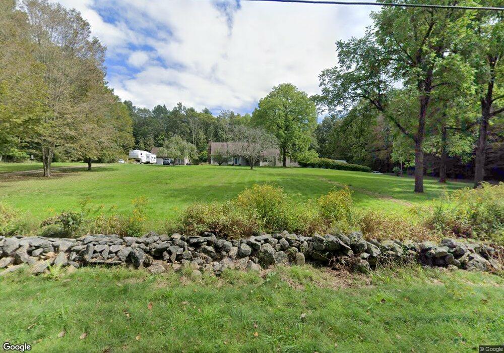
272 Barlow Cemetery Rd Woodstock, CT 06281
Estimated Value: $534,110 - $632,000
3
Beds
3
Baths
2,526
Sq Ft
$237/Sq Ft
Est. Value
About This Home
This home is located at 272 Barlow Cemetery Rd, Woodstock, CT 06281 and is currently estimated at $598,028, approximately $236 per square foot. 272 Barlow Cemetery Rd is a home located in Windham County with nearby schools including Woodstock Elementary School and Woodstock Middle School.
Ownership History
Date
Name
Owned For
Owner Type
Purchase Details
Closed on
Feb 25, 2008
Sold by
Gale Roger W and Gale Nancy M
Bought by
Fitzmaurice Sean and Gaumond Gwenn
Current Estimated Value
Home Financials for this Owner
Home Financials are based on the most recent Mortgage that was taken out on this home.
Original Mortgage
$313,500
Interest Rate
5.9%
Mortgage Type
Purchase Money Mortgage
Create a Home Valuation Report for This Property
The Home Valuation Report is an in-depth analysis detailing your home's value as well as a comparison with similar homes in the area
Home Values in the Area
Average Home Value in this Area
Purchase History
| Date | Buyer | Sale Price | Title Company |
|---|---|---|---|
| Fitzmaurice Sean | $330,000 | -- |
Source: Public Records
Mortgage History
| Date | Status | Borrower | Loan Amount |
|---|---|---|---|
| Open | Fitzmaurice Sean | $20,000 | |
| Open | Fitzmaurice Sean | $297,783 | |
| Closed | Fitzmaurice Sean | $313,500 |
Source: Public Records
Tax History Compared to Growth
Tax History
| Year | Tax Paid | Tax Assessment Tax Assessment Total Assessment is a certain percentage of the fair market value that is determined by local assessors to be the total taxable value of land and additions on the property. | Land | Improvement |
|---|---|---|---|---|
| 2025 | $6,427 | $263,300 | $49,100 | $214,200 |
| 2024 | $6,066 | $263,300 | $49,100 | $214,200 |
| 2023 | $5,901 | $263,300 | $49,100 | $214,200 |
| 2022 | $5,490 | $263,300 | $49,100 | $214,200 |
| 2021 | $5,562 | $218,100 | $49,100 | $169,000 |
| 2020 | $5,069 | $206,900 | $49,100 | $157,800 |
| 2019 | $5,069 | $206,900 | $49,100 | $157,800 |
| 2018 | $5,069 | $206,900 | $49,100 | $157,800 |
| 2017 | $5,028 | $206,900 | $49,100 | $157,800 |
| 2016 | $5,041 | $209,700 | $56,100 | $153,600 |
| 2015 | $4,899 | $209,700 | $56,100 | $153,600 |
| 2014 | $4,844 | $209,700 | $56,100 | $153,600 |
Source: Public Records
Map
Nearby Homes
- 402 Perrin Rd
- 60 Indian Spring Rd
- 145 Perrin Rd
- 30 Lyon Rd
- 0 Hemlock Dr
- 23 Little Bungee Hill Rd
- 86A County Rd
- 19 Hiawatha Heights
- 29 Crooked Trail Extension
- 80 Bungay Hill Rd
- 70 Laurel Hill Dr
- 4 Perrin Rd
- 56 Laurel Hill Dr
- 140 Ragged Hill Rd
- 10 Laurel Hill Dr
- 00 Route 171 Unit Lot 1
- Lot 4A Weeks Rd
- 381 Bungay Hill Rd
- 89 John Perry Rd
- 8 Nahaco Hill Ln
- 300 Barlow Cemetery Rd
- L12C Barlow Cemetery Rd
- L12B Barlow Cemetery Rd
- 53 Jeans Ct
- 49 Jeans Ct
- 249 Barlow Cemetery Rd
- 50 Jeans Ct
- 234 Barlow Cemetery Rd
- 289 Barlow Cemetery Rd
- 33 Jeans Ct
- 54 Jeans Ct
- 309 Barlow Cemetery Rd
- 231 Barlow Cemetery Rd
- 215 Barlow Cemetery Rd
- 239 Barlow Cemetery Rd
- 273 Barlow Cemetery Rd
- 21 Jeans Ct
- 299 Barlow Cemetery Rd