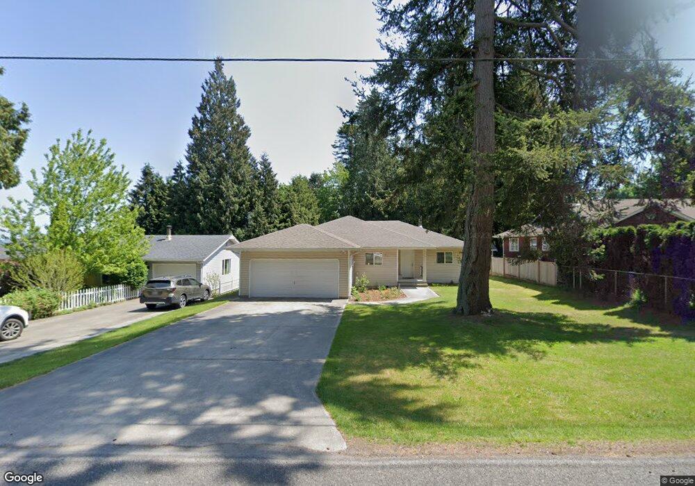
272 Boundary Bay Rd Point Roberts, WA 98281
Estimated Value: $464,000 - $557,000
3
Beds
2
Baths
1,541
Sq Ft
$321/Sq Ft
Est. Value
About This Home
This home is located at 272 Boundary Bay Rd, Point Roberts, WA 98281 and is currently estimated at $494,666, approximately $321 per square foot. 272 Boundary Bay Rd is a home located in Whatcom County with nearby schools including Point Roberts Primary School, Blaine Middle School, and Blaine High School.
Ownership History
Date
Name
Owned For
Owner Type
Purchase Details
Closed on
Sep 21, 2004
Sold by
Anderson Robert Hartley
Bought by
Clingan Warren J and Burkhart Leonard F
Current Estimated Value
Home Financials for this Owner
Home Financials are based on the most recent Mortgage that was taken out on this home.
Original Mortgage
$128,000
Outstanding Balance
$62,906
Interest Rate
5.76%
Mortgage Type
Purchase Money Mortgage
Estimated Equity
$431,760
Create a Home Valuation Report for This Property
The Home Valuation Report is an in-depth analysis detailing your home's value as well as a comparison with similar homes in the area
Home Values in the Area
Average Home Value in this Area
Purchase History
| Date | Buyer | Sale Price | Title Company |
|---|---|---|---|
| Clingan Warren J | $164,000 | Whatcom Land Title |
Source: Public Records
Mortgage History
| Date | Status | Borrower | Loan Amount |
|---|---|---|---|
| Open | Clingan Warren J | $128,000 |
Source: Public Records
Tax History Compared to Growth
Tax History
| Year | Tax Paid | Tax Assessment Tax Assessment Total Assessment is a certain percentage of the fair market value that is determined by local assessors to be the total taxable value of land and additions on the property. | Land | Improvement |
|---|---|---|---|---|
| 2024 | $3,013 | $371,969 | $102,383 | $269,586 |
| 2023 | $3,013 | $362,661 | $93,075 | $269,586 |
| 2022 | $2,559 | $331,197 | $85,000 | $246,197 |
| 2021 | $2,549 | $254,877 | $53,504 | $201,373 |
| 2020 | $2,537 | $235,994 | $49,540 | $186,454 |
| 2019 | $2,354 | $226,371 | $47,520 | $178,851 |
| 2018 | $2,240 | $203,505 | $42,720 | $160,785 |
| 2017 | $1,942 | $194,359 | $40,800 | $153,559 |
| 2016 | $2,077 | $190,548 | $40,000 | $150,548 |
| 2015 | $2,208 | $198,189 | $38,644 | $159,545 |
| 2014 | -- | $207,191 | $40,400 | $166,791 |
| 2013 | -- | $197,964 | $38,800 | $159,164 |
Source: Public Records
Map
Nearby Homes
- 251 Elizabeth Dr
- 302 Boundary Bay Rd
- Lot 35 Boundary Bay Rd
- 2138 Benson Rd
- 2145 Fir St
- 103 Goodman Rd
- 0 X Weasel Run
- 412 High Bluff Dr
- 0 Lot 7 Weasel Run Rd
- 6 Weasel Run Rd
- 0 3 73 Acres Derby Ave
- 500 Moose Trail
- Lot 2 Greenwood Dr
- 1931 Sanders Ct Unit 11
- 1976 Cedar Park Dr
- lot 14 Cedar Park Dr Unit 14
- 1871 Johnson Rd
- 0 6 39 Acres South Beach Rd
- 2045 Apa Rd
- 2149 Seabright Loop
- 276 Boundary Bay Rd
- 267 Elizabeth Dr
- 261 Elizabeth Dr
- 2193 Culp Ct
- 256 Boundary Bay Rd
- 286 Boundary Bay Rd
- 288 Boundary Bay Rd
- 2185 Culp Ct
- 276 Elizabeth Dr
- 285 Elizabeth Dr
- 258 Elizabeth Dr
- 246 Boundary Bay Rd
- 280 Elizabeth Dr
- 2186 Culp Court Rd
- 245 Elizabeth Dr
- 254 Elizabeth Dr
- 284 Elizabeth Dr
- 303 Madrona Place
- 282 Elizabeth Dr
- 250 Elizabeth Dr