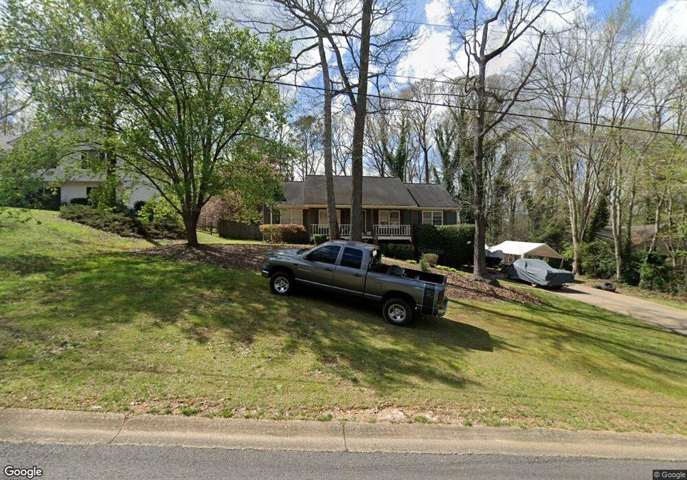
272 Cedar Mill Ln Unit 2 Woodstock, GA 30189
Sutallee NeighborhoodEstimated Value: $375,000 - $379,920
3
Beds
2
Baths
1,842
Sq Ft
$205/Sq Ft
Est. Value
About This Home
This home is located at 272 Cedar Mill Ln Unit 2, Woodstock, GA 30189 and is currently estimated at $377,460, approximately $204 per square foot. 272 Cedar Mill Ln Unit 2 is a home located in Cherokee County with nearby schools including Boston Elementary School, E. T. Booth Middle School, and Etowah High School.
Ownership History
Date
Name
Owned For
Owner Type
Purchase Details
Closed on
Feb 14, 2019
Sold by
Stumpf Kevin D
Bought by
Stumpf Kevin D and Stumpf April
Current Estimated Value
Home Financials for this Owner
Home Financials are based on the most recent Mortgage that was taken out on this home.
Original Mortgage
$155,000
Outstanding Balance
$136,273
Interest Rate
4.5%
Mortgage Type
New Conventional
Estimated Equity
$241,187
Purchase Details
Closed on
Oct 28, 1998
Sold by
Doyle Brendan P and Doyle Maura K
Bought by
Stumpf Kevin D
Home Financials for this Owner
Home Financials are based on the most recent Mortgage that was taken out on this home.
Original Mortgage
$104,918
Interest Rate
6.58%
Mortgage Type
FHA
Purchase Details
Closed on
Jun 15, 1993
Sold by
Watson W Marque and Watson Tonda M
Bought by
Doyle Brendan P and Doyle Maura K
Home Financials for this Owner
Home Financials are based on the most recent Mortgage that was taken out on this home.
Original Mortgage
$69,920
Interest Rate
7.42%
Create a Home Valuation Report for This Property
The Home Valuation Report is an in-depth analysis detailing your home's value as well as a comparison with similar homes in the area
Home Values in the Area
Average Home Value in this Area
Purchase History
| Date | Buyer | Sale Price | Title Company |
|---|---|---|---|
| Stumpf Kevin D | -- | -- | |
| Stumpf Kevin D | $107,500 | -- | |
| Doyle Brendan P | $87,400 | -- |
Source: Public Records
Mortgage History
| Date | Status | Borrower | Loan Amount |
|---|---|---|---|
| Open | Stumpf Kevin D | $155,000 | |
| Previous Owner | Stumpf Kevin D | $104,918 | |
| Previous Owner | Doyle Brendan P | $69,920 |
Source: Public Records
Tax History Compared to Growth
Tax History
| Year | Tax Paid | Tax Assessment Tax Assessment Total Assessment is a certain percentage of the fair market value that is determined by local assessors to be the total taxable value of land and additions on the property. | Land | Improvement |
|---|---|---|---|---|
| 2024 | $3,714 | $142,908 | $28,000 | $114,908 |
| 2023 | $3,618 | $139,228 | $27,200 | $112,028 |
| 2022 | $3,194 | $121,508 | $23,200 | $98,308 |
| 2021 | $2,762 | $97,308 | $19,440 | $77,868 |
| 2020 | $2,474 | $87,068 | $17,200 | $69,868 |
| 2019 | $2,240 | $78,840 | $15,400 | $63,440 |
| 2018 | $2,156 | $75,400 | $14,000 | $61,400 |
| 2017 | $2,017 | $175,000 | $13,200 | $56,800 |
| 2016 | $1,910 | $164,000 | $13,200 | $52,400 |
| 2015 | $1,808 | $153,700 | $13,200 | $48,280 |
| 2014 | $1,517 | $128,700 | $13,280 | $38,200 |
Source: Public Records
Map
Nearby Homes
- 0 Black Oak Trail Unit 10267626
- 0 Black Oak Trail Unit 7303191
- 306 N Briar Ridge
- 308 Mainsail Ln
- 204 Captains Quarters
- 124 Dockside Downs Dr
- 104 Rose Cottage Ln Unit 65
- 313 Maltibe Dr
- 146 Sunset Ln
- 7307 Carriage Creek Rd
- 7119 Big Woods Dr
- 507 Huntgate Rd
- 1001 Deer Hollow Dr
- 477 Victoria Rd
- 416 Ballymore Pass
- 112 Countryside Ct
- 923 Pine Cir
- 2006 Hawthorne Way
- 270 Cedar Mill Ln Unit 2
- 274 Cedar Mill Ln
- 276 Cedar Mill Ln
- 268 Cedar Mill Ln
- 253 Cedar Mill Ln Unit 2
- 255 Cedar Mill Ln
- 251 Cedar Mill Ln Unit 2
- 257 Cedar Mill Ln
- 266 Cedar Mill Ln Unit 2
- 278 Cedar Mill Ln
- 249 Cedar Mill Ln
- 259 Cedar Mill Ln Unit 2
- 508 Chestnut Ridge
- 264 Cedar Mill Ln
- 247 Cedar Mill Ln
- 509 Chestnut Ridge
- 280 Cedar Mill Ln Unit 3
- 261 Cedar Mill Ln
- 506 Chestnut Ridge
- 262 Cedar Mill Ln