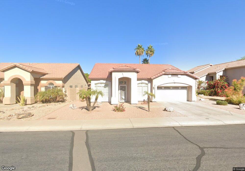
272 E Devon Dr Gilbert, AZ 85296
Heritage District NeighborhoodEstimated Value: $449,374 - $515,000
Studio
3
Baths
1,870
Sq Ft
$264/Sq Ft
Est. Value
About This Home
This home is located at 272 E Devon Dr, Gilbert, AZ 85296 and is currently estimated at $493,594, approximately $263 per square foot. 272 E Devon Dr is a home located in Maricopa County with nearby schools including Settlers Point Elementary School, Mesquite Junior High School, and Mesquite High School.
Ownership History
Date
Name
Owned For
Owner Type
Purchase Details
Closed on
Jan 25, 2019
Sold by
Shultz William A and Shultz Jolene V
Bought by
Shultz William A and Shultz Jolene V
Current Estimated Value
Purchase Details
Closed on
Jun 26, 1996
Sold by
Ditz Crane Builders Llc
Bought by
Shultz Ii William A and Shultz Jolene
Home Financials for this Owner
Home Financials are based on the most recent Mortgage that was taken out on this home.
Original Mortgage
$111,300
Outstanding Balance
$7,939
Interest Rate
8.09%
Mortgage Type
New Conventional
Estimated Equity
$485,655
Purchase Details
Closed on
Feb 26, 1996
Sold by
Parkview Investors I Llc
Bought by
Ditz Crane Inc
Purchase Details
Closed on
Feb 20, 1996
Sold by
Ditz Crane Inc
Bought by
Ditz Crane Builders Llc
Create a Home Valuation Report for This Property
The Home Valuation Report is an in-depth analysis detailing your home's value as well as a comparison with similar homes in the area
Home Values in the Area
Average Home Value in this Area
Purchase History
| Date | Buyer | Sale Price | Title Company |
|---|---|---|---|
| Shultz William A | -- | None Available | |
| Shultz Ii William A | $117,200 | Security Title Agency | |
| Ditz Crane Inc | $26,500 | Security Title Agency | |
| Ditz Crane Builders Llc | -- | Security Title Agency |
Source: Public Records
Mortgage History
| Date | Status | Borrower | Loan Amount |
|---|---|---|---|
| Open | Shultz Ii William A | $111,300 |
Source: Public Records
Tax History
| Year | Tax Paid | Tax Assessment Tax Assessment Total Assessment is a certain percentage of the fair market value that is determined by local assessors to be the total taxable value of land and additions on the property. | Land | Improvement |
|---|---|---|---|---|
| 2025 | $1,649 | $21,504 | -- | -- |
| 2024 | $1,596 | $20,480 | -- | -- |
| 2023 | $1,596 | $35,930 | $7,180 | $28,750 |
| 2022 | $1,547 | $27,370 | $5,470 | $21,900 |
| 2021 | $1,633 | $25,630 | $5,120 | $20,510 |
| 2020 | $1,607 | $23,760 | $4,750 | $19,010 |
| 2019 | $1,478 | $21,760 | $4,350 | $17,410 |
| 2018 | $1,434 | $20,260 | $4,050 | $16,210 |
| 2017 | $1,385 | $18,930 | $3,780 | $15,150 |
| 2016 | $1,428 | $18,180 | $3,630 | $14,550 |
| 2015 | $1,308 | $17,370 | $3,470 | $13,900 |
Source: Public Records
Map
Nearby Homes
- 313 E Sherri Dr
- 485 E Ranch Rd
- 558 E Devon Dr
- 434 E Sheffield Ave
- 4160 E Brisa Dr
- 4143 E Appaloosa Rd
- 389 E Arabian Dr
- 486 E Windsor Dr
- 549 E Sheffield Ave
- 670 E Kyle Dr Unit 3
- 221 E Appaloosa Ct
- 669 E Cathy Dr
- 591 E Sheffield Ave
- 681 E Ranch Rd Unit IV
- 104 E Palomino Dr
- 741 E Cantebria Dr
- 1051 S Honeysuckle Ln
- 1441 S La Arboleta Dr
- 79 W Gail Dr
- 629 E Orchid Ln
- 282 E Devon Dr
- 262 E Devon Dr
- 279 E Nunneley Rd
- 254 E Devon Dr
- 287 E Nunneley Rd
- 271 E Nunneley Rd
- 1082 S Cottonwood Ct
- 298 E Devon Dr
- 263 E Nunneley Rd
- 246 E Devon Dr
- 301 E Nunneley Rd
- 1087 S Cottonwood Ct
- 1088 S Cottonwood Ct
- 308 E Devon Dr
- 233 E Devon Dr
- 257 E Nunneley Rd
- 1086 S Ironwood Ct
- 1091 S Cottonwood Ct
- 240 E Devon Dr
- 309 E Nunneley Rd
Your Personal Tour Guide
Ask me questions while you tour the home.